TopoQuest Logo
Do you find TopoQuest useful?
Help keep TopoQuest running and adding new maps/features by donating!
Bitcoin:  19c7KJd3qBynnjoSw5npx9KScwjBe4ifkT
Litecoin:  LXs6TkuXGGXo1vDsWCkWVdjQX94eUKd6ui
Home View Maps Find Maps Find Places Resources & Links


Burro Peak, New Mexico Topographic Map

USGS Map Title: Burro Peak, NM
USGS Map MRC: 32108E4
DRG (GeoTIFF) Download: o32108e4.tif


Neighboring USGS Topographic Map Quads:


  Bullard Peak, NM  
32108F5
 

  Wind Mountain, NM  
32108F4
 

  Tyrone, NM  
32108F3
 

  Eagle Eye Peak, NM  
32108E5
 

  Burro Peak, NM  
32108E4
 

  White Signal, NM  
32108E3
 

  Gold Hill, NM  
32108D5
 

  C Bar Ranch, NM  
32108D4
 

  Werney Hill, NM  
32108D3


Map MRC Location:

N33°
W109°
N33°
W108°
H8 H7 H6 H5 H4 H3 H2 H1
G8 G7 G6 G5 G4 G3 G2 G1
F8 F7 F6 F5 F4 F3 F2 F1
E8 E7 E6 E5 E4 E3 E2 E1
D8 D7 D6 D5 D4 D3 D2 D1
C8 C7 C6 C5 C4 C3 C2 C1
B8 B7 B6 B5 B4 B3 B2 B1
A8 A7 A6 A5 A4 A3 A2 A1
N32°
W109°
N32°
W108°

Burro Peak, NM USGS 1:24K Topographic Map Preview:
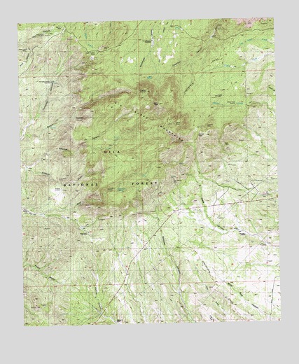
Burro Peak, NM USGS Topographic Map
Click on map above to begin viewing in our Map Viewer.

This topographic map contains these locations and features:
Feature Name Type Latitude Longitude GNIS ID View Map
00988 Water WellWellN32.5491°W108.4228°937558View Map
00989 Water WellWellN32.5598°W108.3977°921638View Map
Arrastre WindmillLocaleN32.5567°W108.4809°900200View Map
Austin Amazon MinesMineN32.6131°W108.4600°903463View Map
Burro Mountain HomesteadLocaleN32.6151°W108.4353°904241View Map
Burro PeakSummitN32.5906°W108.4328°904242View Map
Copeland MineMineN32.5815°W108.4098°905321View Map
Copeland TankReservoirN32.5769°W108.3915°936671View Map
Deadman Canyon Shafts and ProspectMineN32.6223°W108.4006°914945View Map
Ferguson MountainSummitN32.5956°W108.4381°906259View Map
Floyd Collins MineMineN32.5529°W108.3895°914959View Map
Goat Camp WindmillLocaleN32.5379°W108.4687°900213View Map
Gold Gulch PlacerMineN32.5476°W108.4970°914967View Map
Gold Gulch SpringSpringN32.5495°W108.4731°936680View Map
Gold Gulch WindmillLocaleN32.5209°W108.4687°936673View Map
Grapevine SpringSpringN32.5557°W108.4537°936676View Map
Hop Williams MineMineN32.5584°W108.4275°907079View Map
Indian HillSummitN32.5931°W108.4037°907210View Map
Jacks PeakSummitN32.5823°W108.4253°936871View Map
John Malone ShaftMineN32.5690°W108.4992°914828View Map
Knight Canyon TankReservoirN32.5184°W108.4806°936674View Map
KXKK-FM (Lordsburg)TowerN32.5826°W108.4253°938677View Map
McCauley RanchLocaleN32.5362°W108.3917°908494View Map
Merry Widow MineMineN32.5520°W108.3820°914845View Map
Merry Widow ShaftMineN32.5517°W108.3831°908576View Map
Mud SpringSpringN32.6014°W108.4355°936675View Map
Neglected MineMineN32.5448°W108.4425°909036View Map
Pine Canyon WindmillLocaleN32.6209°W108.4878°900218View Map
Red HillSummitN32.5731°W108.4012°936672View Map
Red Hill Turquoise MineMineN32.5717°W108.4006°910064View Map
Russel RanchLocaleN32.5431°W108.4098°910477View Map
Rustler CanyonValleyN32.5787°W108.4989°910480View Map
Rustler SpringSpringN32.5820°W108.4862°2038660View Map
S Big Burro Mountains Euxenite DepositMineN32.5598°W108.4095°914884View Map
Sawmill CanyonValleyN32.5656°W108.4951°910829View Map
Section Fifteen WindmillLocaleN32.5592°W108.3978°936670View Map
ShrineMineN32.6223°W108.4923°914907View Map
Silsby RanchLocaleN32.6190°W108.4234°911053View Map
Silver Dollar MineMineN32.6229°W108.4792°914890View Map
Silver Dollar MineMineN32.6145°W108.4964°911070View Map
Spar Hill MineMineN32.6229°W108.4789°911294View Map
Sprouse MineMineN32.5773°W108.4137°911347View Map
Summit DepositMineN32.5545°W108.4653°914905View Map
Sunset Gold FieldMineN32.5470°W108.4967°900253View Map
Tank Number OneReservoirN32.5034°W108.4492°936677View Map
Thompson Canyon WindmillLocaleN32.6006°W108.4848°900226View Map
Thompson WindmillLocaleN32.6006°W108.4848°936679View Map
Uncle Jimmy Thwaits MineMineN32.5487°W108.4623°914911View Map
Walking X RanchLocaleN32.5012°W108.4562°912145View Map
Walnut Creek WindmillLocaleN32.5898°W108.3953°899294View Map
Wild Irishman Number 5 ShaftsMineN32.5448°W108.4951°914939View Map

Note: Coordinates in the location and feature list above are referenced to NAD83 datum.


Copyright (C) 2008-2025 Ryan Niemi / Sunset Dynamics ... All Rights Reserved