TopoQuest Logo
Do you find TopoQuest useful?
Help keep TopoQuest running and adding new maps/features by donating!
Bitcoin:  19c7KJd3qBynnjoSw5npx9KScwjBe4ifkT
Litecoin:  LXs6TkuXGGXo1vDsWCkWVdjQX94eUKd6ui
Home View Maps Find Maps Find Places Resources & Links


Burrville, Utah Topographic Map

USGS Map Title: Burrville, UT
USGS Map MRC: 38111E7
DRG (GeoTIFF) Download: o38111e7.tif


Neighboring USGS Topographic Map Quads:


  Water Creek Canyon, UT  
38111F8
 

  Boobe Hole Reservoir, UT  
38111F7
 

  Mount Terrill, UT  
38111F6
 

  Koosharem, UT  
38111E8
 

  Burrville, UT  
38111E7
 

  Fish Lake, UT  
38111E6
 

  Greenwich, UT  
38111D8
 

  Abes Knoll, UT  
38111D7
 

  Loa, UT  
38111D6


Map MRC Location:

N39°
W112°
N39°
W111°
H8 H7 H6 H5 H4 H3 H2 H1
G8 G7 G6 G5 G4 G3 G2 G1
F8 F7 F6 F5 F4 F3 F2 F1
E8 E7 E6 E5 E4 E3 E2 E1
D8 D7 D6 D5 D4 D3 D2 D1
C8 C7 C6 C5 C4 C3 C2 C1
B8 B7 B6 B5 B4 B3 B2 B1
A8 A7 A6 A5 A4 A3 A2 A1
N38°
W112°
N38°
W111°

Burrville, UT USGS 1:24K Topographic Map Preview:
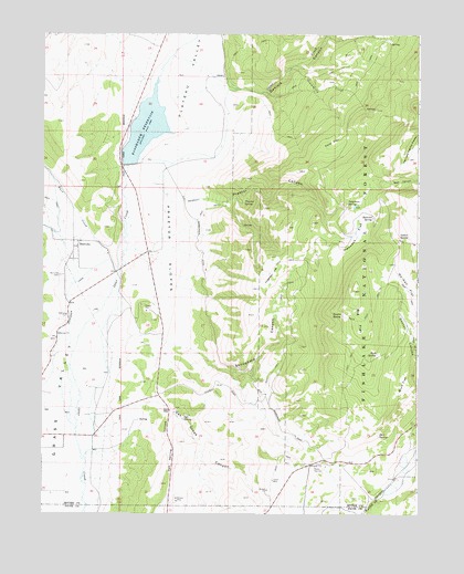
Burrville, UT USGS Topographic Map
Click on map above to begin viewing in our Map Viewer.

This topographic map contains these locations and features:
Feature Name Type Latitude Longitude GNIS ID View Map
Boobe Hole CreekStreamN38.6133°W111.8374°1439002View Map
Buck FlatFlatN38.5344°W111.7557°1439219View Map
Burr CreekStreamN38.5661°W111.8544°1439367View Map
BurrvillePopulated PlaceN38.5708°W111.8635°1439380View Map
Burrville CemeteryCemeteryN38.5621°W111.8695°1439381View Map
Daniels CanyonValleyN38.6114°W111.8138°1440255View Map
Deer SpringSpringN38.5207°W111.7635°1440397View Map
Gahew SpringSpringN38.5721°W111.7534°1441259View Map
Gooseberry CreekStreamN38.6153°W111.7946°1441373View Map
Hancock FlatFlatN38.5728°W111.7721°1441569View Map
Hancock SpringSpringN38.5774°W111.7653°1441575View Map
Koosharem DamDamN38.5908°W111.8474°1447724View Map
Koosharem ReservoirReservoirN38.6005°W111.8413°1442363View Map
Koosharem Reservoir Recreation SiteParkN38.6055°W111.8455°1448556View Map
Mill CreekStreamN38.5611°W111.8624°1443423View Map
Na-Gah FlatFlatN38.5597°W111.7507°1443757View Map
Oak Creek CanyonValleyN38.5269°W111.8527°1444018View Map
Oak SpringSpringN38.5249°W111.8280°1444033View Map
Oak Spring HollowValleyN38.5264°W111.8327°1444040View Map
Plateau ValleyValleyN38.5689°W111.8474°1444474View Map
Pole FlatFlatN38.5972°W111.7794°1444550View Map
Praetor CanyonValleyN38.5814°W111.8141°1444627View Map
Praetor SlopesSlopeN38.5678°W111.8330°1444628View Map
Praetor SpringSpringN38.5814°W111.8085°1444629View Map
Rock CanyonValleyN38.5872°W111.7655°1445044View Map
Rust SpringSpringN38.5420°W111.7639°1445212View Map
Skougaard CanyonValleyN38.5433°W111.8271°1445636View Map
Stag SpringSpringN38.5425°W111.7505°1446089View Map
Teeples SpringSpringN38.5521°W111.7753°1446371View Map
Torgerson FlatFlatN38.5630°W111.7994°1446656View Map
Torgerson SpringSpringN38.5804°W111.7739°1446657View Map

Note: Coordinates in the location and feature list above are referenced to NAD83 datum.


Copyright (C) 2008-2025 Ryan Niemi / Sunset Dynamics ... All Rights Reserved