TopoQuest Logo
Do you find TopoQuest useful?
Help keep TopoQuest running and adding new maps/features by donating!
Bitcoin:  19c7KJd3qBynnjoSw5npx9KScwjBe4ifkT
Litecoin:  LXs6TkuXGGXo1vDsWCkWVdjQX94eUKd6ui
Home View Maps Find Maps Find Places Resources & Links


Mount Terrill, Utah Topographic Map

USGS Map Title: Mount Terrill, UT
USGS Map MRC: 38111F6
DRG (GeoTIFF) Download: o38111f6.tif


Neighboring USGS Topographic Map Quads:


  Rex Reservoir, UT  
38111G7
 

  Gooseberry Creek, UT  
38111G6
 

  Yogo Creek, UT  
38111G5
 

  Boobe Hole Reservoir, UT  
38111F7
 

  Mount Terrill, UT  
38111F6
 

  Hilgard Mountain, UT  
38111F5
 

  Burrville, UT  
38111E7
 

  Fish Lake, UT  
38111E6
 

  Forsyth Reservoir, UT  
38111E5


Map MRC Location:

N39°
W112°
N39°
W111°
H8 H7 H6 H5 H4 H3 H2 H1
G8 G7 G6 G5 G4 G3 G2 G1
F8 F7 F6 F5 F4 F3 F2 F1
E8 E7 E6 E5 E4 E3 E2 E1
D8 D7 D6 D5 D4 D3 D2 D1
C8 C7 C6 C5 C4 C3 C2 C1
B8 B7 B6 B5 B4 B3 B2 B1
A8 A7 A6 A5 A4 A3 A2 A1
N38°
W112°
N38°
W111°

Mount Terrill, UT USGS 1:24K Topographic Map Preview:
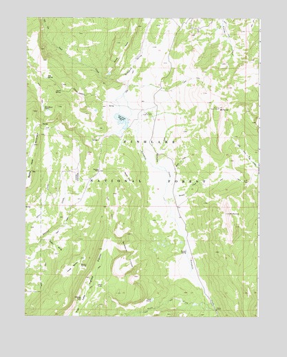
Mount Terrill, UT USGS Topographic Map
Click on map above to begin viewing in our Map Viewer.

This topographic map contains these locations and features:
Feature Name Type Latitude Longitude GNIS ID View Map
Boobe Hole MountainSummitN38.6966°W111.7435°1439003View Map
Broadhead LakesLakeN38.7128°W111.7409°1439145View Map
Bronco SpringSpringN38.6464°W111.7203°1439153View Map
Butterfield MeadowFlatN38.6833°W111.7227°1439395View Map
Cold SpringSpringN38.7248°W111.7389°1439866View Map
Daniels PassGapN38.6858°W111.7107°1440259View Map
Gottfredsen CreekStreamN38.6864°W111.6749°1441391View Map
Horse BenchBenchN38.6453°W111.7246°1441858View Map
Humphrey SpringStreamN38.7250°W111.7074°1441939View Map
Lake LouiseLakeN38.6320°W111.6821°1442986View Map
Lost Creek DamDamN38.7100°W111.7007°1447734View Map
Lost Creek ReservoirReservoirN38.7072°W111.6989°1447733View Map
Mount MarvineSummitN38.6683°W111.6410°1443212View Map
Mount TerrillSummitN38.7125°W111.6480°1446399View Map
Mount Terrill Guard StationLocaleN38.7097°W111.6830°1443632View Map
Neals FlatFlatN38.6830°W111.6957°1443771View Map
Petes HoleValleyN38.7258°W111.7055°1444317View Map
Richfield DivisionCivilN38.7026°W111.7430°1939411View Map
Sanford SpringStreamN38.6569°W111.7413°1445324View Map
Sawmill CreekStreamN38.6725°W111.6732°1445348View Map
Sevenmile CirquesBasinN38.6505°W111.6949°1445442View Map
Snow LakeLakeN38.6379°W111.7111°1445744View Map
Spirit SpringSpringN38.7189°W111.7313°1445965View Map
Tasha CreekStreamN38.6291°W111.6480°1446340View Map
Travois SpringSpringN38.6522°W111.6638°1446707View Map
U M PassGapN38.6819°W111.6341°1446825View Map
Whiskey KnollSummitN38.6322°W111.7199°1447231View Map
White CreekStreamN38.6828°W111.6732°1447245View Map

Note: Coordinates in the location and feature list above are referenced to NAD83 datum.


Copyright (C) 2008-2025 Ryan Niemi / Sunset Dynamics ... All Rights Reserved