TopoQuest Logo
Do you find TopoQuest useful?
Help keep TopoQuest running and adding new maps/features by donating!
Bitcoin:  19c7KJd3qBynnjoSw5npx9KScwjBe4ifkT
Litecoin:  LXs6TkuXGGXo1vDsWCkWVdjQX94eUKd6ui
Home View Maps Find Maps Find Places Resources & Links


Cactus Reservoir, Colorado Topographic Map

USGS Map Title: Cactus Reservoir, CO
USGS Map MRC: 40108B6
DRG (GeoTIFF) Download: o40108b6.tif


Neighboring USGS Topographic Map Quads:


  Lazy Y Point, CO  
40108C7
 

  Skull Creek, CO  
40108C6
 

  M F Mountain, CO  
40108C5
 

  Rangely NE, CO  
40108B7
 

  Cactus Reservoir, CO  
40108B6
 

  Divide Creek, CO  
40108B5
 

  Rangely, CO  
40108A7
 

  Gillam Draw, CO  
40108A6
 

  Calamity Ridge, CO  
40108A5


Map MRC Location:

N41°
W109°
N41°
W108°
H8 H7 H6 H5 H4 H3 H2 H1
G8 G7 G6 G5 G4 G3 G2 G1
F8 F7 F6 F5 F4 F3 F2 F1
E8 E7 E6 E5 E4 E3 E2 E1
D8 D7 D6 D5 D4 D3 D2 D1
C8 C7 C6 C5 C4 C3 C2 C1
B8 B7 B6 B5 B4 B3 B2 B1
A8 A7 A6 A5 A4 A3 A2 A1
N40°
W109°
N40°
W108°

Cactus Reservoir, CO USGS 1:24K Topographic Map Preview:
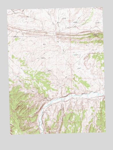
Cactus Reservoir, CO USGS Topographic Map
Click on map above to begin viewing in our Map Viewer.

This topographic map contains these locations and features:
Feature Name Type Latitude Longitude GNIS ID View Map
Box Elder CreekStreamN40.2266°W108.6840°170930View Map
Box Elder Reservoir Number 2ReservoirN40.2344°W108.6326°171575View Map
Box Elder Reservoir Number 3ReservoirN40.2359°W108.6587°171574View Map
Box Elder Reservoir Number 4ReservoirN40.2399°W108.6730°171573View Map
Cactus ReservoirReservoirN40.1896°W108.6564°171568View Map
Coal Ridge DamDamN40.2125°W108.6462°171564View Map
Darwin ReservoirReservoirN40.2144°W108.7051°171572View Map
Desperado MineMineN40.1719°W108.7354°1735330View Map
Fletcher GulchValleyN40.1589°W108.6383°171579View Map
Hatch FlatsFlatN40.1972°W108.6576°171567View Map
Jones TwistStreamN40.2464°W108.7298°170925View Map
Miller CreekStreamN40.2266°W108.6870°170928View Map
Prairie Dog ReservoirReservoirN40.2031°W108.6650°171571View Map
Priest DrawValleyN40.1589°W108.6545°171580View Map
Quinn DrawValleyN40.1596°W108.6712°171581View Map
Raven Park DamDamN40.1828°W108.7396°171565View Map
Red WashStreamN40.1605°W108.6879°170826View Map
Red Wash Reservoir Number 2ReservoirN40.2009°W108.7076°171570View Map
Red Wash Reservoir Number 3ReservoirN40.1878°W108.6996°171569View Map
Rock Wall DrawValleyN40.2465°W108.7411°170827View Map
Scullion GulchValleyN40.1567°W108.6986°171563View Map
Skull CreekStreamN40.2258°W108.6898°170929View Map
Skull Creek ReservoirReservoirN40.2354°W108.6860°171576View Map
Spring CreekStreamN40.1586°W108.6823°171577View Map
Staley-Gordon MineMineN40.1600°W108.7048°171566View Map
Villard Flats ReservoirReservoirN40.2062°W108.6254°171594View Map
Yanks GulchValleyN40.1352°W108.6421°171578View Map

Note: Coordinates in the location and feature list above are referenced to NAD83 datum.


Copyright (C) 2008-2025 Ryan Niemi / Sunset Dynamics ... All Rights Reserved