TopoQuest Logo
Do you find TopoQuest useful?
Help keep TopoQuest running and adding new maps/features by donating!
Bitcoin:  19c7KJd3qBynnjoSw5npx9KScwjBe4ifkT
Litecoin:  LXs6TkuXGGXo1vDsWCkWVdjQX94eUKd6ui
Home View Maps Find Maps Find Places Resources & Links


Caledonia, Ohio Topographic Map

USGS Map Title: Caledonia, OH
USGS Map MRC: 40082F8
DRG (GeoTIFF) Download: o40082f8.tif


Neighboring USGS Topographic Map Quads:


  Oceola, OH  
40083G1
 

  Bucyrus, OH  
40082G8
 

  North Robinson, OH  
40082G7
 

  Monnett, OH  
40083F1
 

  Caledonia, OH  
40082F8
 

  Galion, OH  
40082F7
 

  Marion East, OH  
40083E1
 

  Denmark, OH  
40082E8
 

  Mount Gilead, OH  
40082E7


Map MRC Location:

N41°
W83°
N41°
W82°
H8 H7 H6 H5 H4 H3 H2 H1
G8 G7 G6 G5 G4 G3 G2 G1
F8 F7 F6 F5 F4 F3 F2 F1
E8 E7 E6 E5 E4 E3 E2 E1
D8 D7 D6 D5 D4 D3 D2 D1
C8 C7 C6 C5 C4 C3 C2 C1
B8 B7 B6 B5 B4 B3 B2 B1
A8 A7 A6 A5 A4 A3 A2 A1
N40°
W83°
N40°
W82°

Caledonia, OH USGS 1:24K Topographic Map Preview:
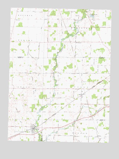
Caledonia, OH USGS Topographic Map
Click on map above to begin viewing in our Map Viewer.

This topographic map contains these locations and features:
Feature Name Type Latitude Longitude GNIS ID View Map
Albright School (historical)SchoolN40.7401°W82.9055°1055720View Map
Brucklacher CemeteryCemeteryN40.6889°W82.9480°1038395View Map
Bunker Hill School (historical)SchoolN40.7470°W82.9788°1055728View Map
CaledoniaPopulated PlaceN40.6364°W82.9691°1056754View Map
Caledonia CemeteryCemeteryN40.6328°W82.9585°1071752View Map
Caledonia Elementary SchoolSchoolN40.6409°W82.9685°1060592View Map
Caledonia GraveyardCemeteryN40.6385°W82.9666°1071753View Map
Caledonia Memorial United Methodist ChurchChurchN40.6353°W82.9694°1074907View Map
Caledonia Police DepartmentBuildingN40.6369°W82.9686°2732525View Map
Church of Christ in CaledoniaChurchN40.6387°W82.9685°1074908View Map
ClimaxPopulated PlaceN40.6306°W82.8880°1039187View Map
Climx Post Office (historical)Post OfficeN40.6306°W82.8874°2038898View Map
Clyde ChurchChurchN40.6892°W82.9394°1039204View Map
Cohan School (historical)SchoolN40.6362°W82.9427°1080689View Map
Coulter CemeteryCemeteryN40.7332°W82.9241°1039394View Map
Craner School (historical)SchoolN40.7123°W82.8780°1055734View Map
Douce School (historical)SchoolN40.6528°W82.9085°1049600View Map
First Consolidated Fire DistrictBuildingN40.6370°W82.9706°2549627View Map
Flat RunStreamN40.6259°W82.9596°1066003View Map
Hipscher School (historical)SchoolN40.6520°W82.9949°1049594View Map
Hog Swamp School (historical)SchoolN40.7184°W82.9496°1055751View Map
Huntly School (historical)SchoolN40.7184°W82.9844°1055752View Map
Lee School (historical)SchoolN40.6578°W82.9671°1049595View Map
Maple Grove School (historical)SchoolN40.6898°W82.9435°1049599View Map
MartelPopulated PlaceN40.6689°W82.9102°1061477View Map
Martel United Methodist ChurchChurchN40.6717°W82.9096°1074909View Map
Mellott CemeteryCemeteryN40.6528°W82.9527°1960535View Map
Miller CemeteryCemeteryN40.6770°W82.9599°1043361View Map
Monnett ChapelChurchN40.7392°W82.9932°1043438View Map
Monnett Chapel CemeteryCemeteryN40.7392°W82.9924°1963187View Map
Mud RunStreamN40.6559°W82.9591°1066104View Map
Mud RunStreamN40.6601°W82.8810°1066105View Map
Neff CemeteryCemeteryN40.6895°W82.9196°1960537View Map
New WinchesterPopulated PlaceN40.7189°W82.9191°1065143View Map
New Winchester Golf CourseLocaleN40.7287°W82.9174°1055762View Map
New Winchester Post Office (historical)Post OfficeN40.7195°W82.9194°1966933View Map
Noblet DrainStreamN40.6573°W82.8991°1066110View Map
North Canaan School (historical)SchoolN40.6303°W82.9174°1080688View Map
Remer CemeteryCemeteryN40.7437°W82.9155°1044941View Map
Rice CemeteryCemeteryN40.6270°W82.9513°1963224View Map
Rush CemeteryCemeteryN40.6582°W82.9792°1045271View Map
Saint Johns ChurchChurchN40.7439°W82.9160°1045532View Map
School Number 8 (historical)SchoolN40.6898°W82.9744°1049596View Map
Sixteen CemeteryCemeteryN40.7048°W82.9107°1046313View Map
Sixteen ChurchChurchN40.6895°W82.9199°1046315View Map
Sixteen School (historical)SchoolN40.6895°W82.9099°1049601View Map
Stoltz CemeteryCemeteryN40.7462°W82.9646°1046706View Map
Stringtown (historical)Populated PlaceN40.6745°W82.9485°1049598View Map
Stringtown School (historical)SchoolN40.6678°W82.9485°1049597View Map
Sugar Grove LakeReservoirN40.7417°W82.8949°1079336View Map
Sugar Grove Lake DamDamN40.7417°W82.8949°1079335View Map
Thorn RunStreamN40.6264°W82.9524°1066234View Map
Township of TullyCivilN40.6753°W82.9084°1086587View Map
Village of CaledoniaCivilN40.6363°W82.9694°2397526View Map
Whetstone Elementary SchoolSchoolN40.7398°W82.9169°1055806View Map
Whetstone Township Fire Department Station 1BuildingN40.7192°W82.9188°2550464View Map

Note: Coordinates in the location and feature list above are referenced to NAD83 datum.


Copyright (C) 2008-2025 Ryan Niemi / Sunset Dynamics ... All Rights Reserved