TopoQuest Logo
Do you find TopoQuest useful?
Help keep TopoQuest running and adding new maps/features by donating!
Bitcoin:  19c7KJd3qBynnjoSw5npx9KScwjBe4ifkT
Litecoin:  LXs6TkuXGGXo1vDsWCkWVdjQX94eUKd6ui
Home View Maps Find Maps Find Places Resources & Links


Monnett, Ohio Topographic Map

USGS Map Title: Monnett, OH
USGS Map MRC: 40083F1
DRG (GeoTIFF) Download: o40083f1.tif


Neighboring USGS Topographic Map Quads:


  Nevada, OH  
40083G2
 

  Oceola, OH  
40083G1
 

  Bucyrus, OH  
40082G8
 

  Morral, OH  
40083F2
 

  Monnett, OH  
40083F1
 

  Caledonia, OH  
40082F8
 

  Marion West, OH  
40083E2
 

  Marion East, OH  
40083E1
 

  Denmark, OH  
40082E8


Map MRC Location:

N41°
W84°
N41°
W83°
H8 H7 H6 H5 H4 H3 H2 H1
G8 G7 G6 G5 G4 G3 G2 G1
F8 F7 F6 F5 F4 F3 F2 F1
E8 E7 E6 E5 E4 E3 E2 E1
D8 D7 D6 D5 D4 D3 D2 D1
C8 C7 C6 C5 C4 C3 C2 C1
B8 B7 B6 B5 B4 B3 B2 B1
A8 A7 A6 A5 A4 A3 A2 A1
N40°
W84°
N40°
W83°

Monnett, OH USGS 1:24K Topographic Map Preview:
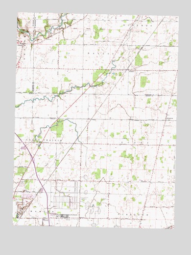
Monnett, OH USGS Topographic Map
Click on map above to begin viewing in our Map Viewer.

This topographic map contains these locations and features:
Feature Name Type Latitude Longitude GNIS ID View Map
Burtsfield CemeteryCemeteryN40.6688°W83.1146°1960527View Map
Dallas Township Fire DepartmentBuildingN40.7174°W83.0384°2550088View Map
Drake CemeteryCemeteryN40.7162°W83.1249°1730704View Map
Grandview EstatesPopulated PlaceN40.6438°W83.0838°2771056View Map
KirkpatrickPopulated PlaceN40.6887°W83.0085°1064949View Map
Kirkpatrick CemeteryCemeteryN40.6854°W83.0092°1042302View Map
Kirkpatrick Post Office (historical)Post OfficeN40.6889°W83.0082°2035955View Map
Likens CemeteryCemeteryN40.6295°W83.0864°1042564View Map
Likens ChurchChurchN40.6303°W83.0730°1072229View Map
MonnettPopulated PlaceN40.7176°W83.0399°1065045View Map
Monnett Post Office (historical)Post OfficeN40.7181°W83.0402°1966932View Map
River Valley EstatesPopulated PlaceN40.6272°W83.0989°2513773View Map
TobiasPopulated PlaceN40.6884°W83.0663°1063061View Map
Tobias Post Office (historical)Post OfficeN40.6889°W83.0666°2035973View Map
Township of DallasCivilN40.7274°W83.0505°1085936View Map
Township of ScottCivilN40.6740°W83.0155°1086586View Map
White CemeteryCemeteryN40.7350°W83.1019°1047868View Map
WyandotPopulated PlaceN40.7314°W83.1196°1048162View Map

Note: Coordinates in the location and feature list above are referenced to NAD83 datum.


Copyright (C) 2008-2025 Ryan Niemi / Sunset Dynamics ... All Rights Reserved