TopoQuest Logo
Do you find TopoQuest useful?
Help keep TopoQuest running and adding new maps/features by donating!
Bitcoin:  19c7KJd3qBynnjoSw5npx9KScwjBe4ifkT
Litecoin:  LXs6TkuXGGXo1vDsWCkWVdjQX94eUKd6ui
Home View Maps Find Maps Find Places Resources & Links


Callaghan, Virginia Topographic Map

USGS Map Title: Callaghan, VA
USGS Map MRC: 37080G1
DRG (GeoTIFF) Download: o37080g1.tif


Neighboring USGS Topographic Map Quads:


  Alvon, WV  
37080H2
 

  Rucker Gap, VA  
37080H1
 

  Falling Spring, VA  
37079H8
 

  Jerrys Run, VA  
37080G2
 

  Callaghan, VA  
37080G1
 

  Covington, VA  
37079G8
 

  Alleghany, VA  
37080F2
 

  Jordan Mines, VA  
37080F1
 

  Strom, VA  
37079F8


Map MRC Location:

N38°
W81°
N38°
W80°
H8 H7 H6 H5 H4 H3 H2 H1
G8 G7 G6 G5 G4 G3 G2 G1
F8 F7 F6 F5 F4 F3 F2 F1
E8 E7 E6 E5 E4 E3 E2 E1
D8 D7 D6 D5 D4 D3 D2 D1
C8 C7 C6 C5 C4 C3 C2 C1
B8 B7 B6 B5 B4 B3 B2 B1
A8 A7 A6 A5 A4 A3 A2 A1
N37°
W81°
N37°
W80°

Callaghan, VA USGS 1:24K Topographic Map Preview:
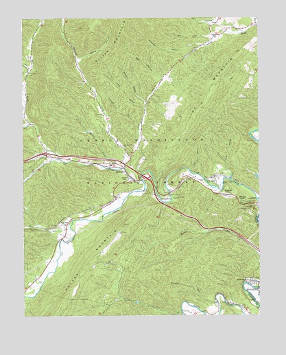
Callaghan, VA USGS Topographic Map
Click on map above to begin viewing in our Map Viewer.

This topographic map contains these locations and features:
Feature Name Type Latitude Longitude GNIS ID View Map
Alleghany CountyCivilN37.7878°W80.0062°1673675View Map
Anderson HollowValleyN37.8749°W80.0206°1481316View Map
Bear HollowValleyN37.8493°W80.0516°1481520View Map
Bennets RunStreamN37.7554°W80.0226°1481625View Map
Big LickStreamN37.8679°W80.0231°1481748View Map
Big RunStreamN37.8304°W80.1198°1481780View Map
CallaghanPopulated PlaceN37.8121°W80.0742°1492692View Map
Callaghan Census Designated PlaceCensusN37.8112°W80.0871°2584819View Map
Callaghan Elementary SchoolSchoolN37.8132°W80.0782°1673681View Map
Cook HollowValleyN37.8371°W80.0604°1482687View Map
Cove RunStreamN37.8101°W80.0614°1482745View Map
Covington DistrictCivilN37.8046°W80.0582°1927581View Map
Dry BranchStreamN37.8715°W80.0001°1483105View Map
Dunlap BeachBeachN37.7979°W80.0506°1483175View Map
Dunlap Volunteer Fire and Rescue SubstationBuildingN37.8142°W80.0817°2075669View Map
Fletcher ChapelChurchN37.8071°W80.0692°1483460View Map
Ford HollowValleyN37.8115°W80.0179°1483475View Map
Goff HollowValleyN37.8727°W80.0241°1483685View Map
Helmintoller CemeteryCemeteryN37.7848°W80.0745°1484019View Map
Hoke CemeteryCemeteryN37.8590°W80.1228°1484150View Map
Hoke ChapelChurchN37.8521°W80.1212°1484151View Map
Humpback Bridge WaysideParkN37.7998°W80.0459°1484274View Map
Humpback Covered BridgeBridgeN37.8004°W80.0470°1673692View Map
Industrial School and Farm for Homeless BoysSchoolN37.8071°W80.0237°1690069View Map
Interchange 10CrossingN37.8082°W80.0595°1673696View Map
Interchange 7CrossingN37.8182°W80.1126°1673695View Map
Johns RunStreamN37.7521°W80.0417°1495764View Map
Johnsons CreekStreamN37.8115°W80.0714°1484486View Map
Johnsons Creek ChurchChurchN37.8212°W80.0723°1484487View Map
Johnsons Creek ChurchChurchN37.8343°W80.0820°1484488View Map
Jones HollowValleyN37.8538°W80.1217°1484503View Map
Kittenger HollowValleyN37.8636°W80.0294°1484623View Map
Laurel BranchStreamN37.7501°W80.0476°1484681View Map
Lick MountainSummitN37.8371°W80.0309°1484823View Map
Lukes MountainSummitN37.7946°W80.0067°1485130View Map
Moss RunStreamN37.7868°W80.1001°1485565View Map
Moss RunPopulated PlaceN37.7885°W80.1017°1493313View Map
Moss Run Baptist ChurchChurchN37.7882°W80.1031°1673707View Map
Mud TunnelTunnelN37.8018°W80.0587°1485733View Map
Oakwood ForestPopulated PlaceN37.7979°W80.0081°1493369View Map
Ogle CreekStreamN37.8065°W80.0626°1485951View Map
Pond Suck HollowValleyN37.8410°W80.1247°1486331View Map
Sawmill HollowValleyN37.8396°W80.0597°1486956View Map
South Covington ChurchChurchN37.7646°W80.0003°1487390View Map
South Fork Ogle CreekStreamN37.8193°W80.1098°1487404View Map
Spring BranchStreamN37.8576°W80.0962°1487448View Map
StonewallPopulated PlaceN37.8082°W80.0676°1488561View Map
Straight RunStreamN37.8304°W80.0631°1487659View Map
Thorny BranchStreamN37.8115°W80.0714°1487895View Map
Westvaco Number Two Flyash LagoonReservoirN37.8051°W80.0031°1489109View Map
Westvaco Number Two Flyash Lagoon DamDamN37.8051°W80.0031°1489108View Map
Westwood PlacePopulated PlaceN37.8007°W80.0164°1493788View Map

Note: Coordinates in the location and feature list above are referenced to NAD83 datum.


Copyright (C) 2008-2024 Ryan Niemi / Sunset Dynamics ... All Rights Reserved