TopoQuest Logo
Do you find TopoQuest useful?
Help keep TopoQuest running and adding new maps/features by donating!
Bitcoin:  19c7KJd3qBynnjoSw5npx9KScwjBe4ifkT
Litecoin:  LXs6TkuXGGXo1vDsWCkWVdjQX94eUKd6ui
Home View Maps Find Maps Find Places Resources & Links


Rucker Gap, Virginia Topographic Map

USGS Map Title: Rucker Gap, VA
USGS Map MRC: 37080H1
DRG (GeoTIFF) Download: o37080h1.tif


Neighboring USGS Topographic Map Quads:


  Denmar, WV  
38080A2
 

  Lake Sherwood, WV  
38080A1
 

  Mountain Grove, VA  
38079A8
 

  Alvon, WV  
37080H2
 

  Rucker Gap, VA  
37080H1
 

  Falling Spring, VA  
37079H8
 

  Jerrys Run, VA  
37080G2
 

  Callaghan, VA  
37080G1
 

  Covington, VA  
37079G8


Map MRC Location:

N38°
W81°
N38°
W80°
H8 H7 H6 H5 H4 H3 H2 H1
G8 G7 G6 G5 G4 G3 G2 G1
F8 F7 F6 F5 F4 F3 F2 F1
E8 E7 E6 E5 E4 E3 E2 E1
D8 D7 D6 D5 D4 D3 D2 D1
C8 C7 C6 C5 C4 C3 C2 C1
B8 B7 B6 B5 B4 B3 B2 B1
A8 A7 A6 A5 A4 A3 A2 A1
N37°
W81°
N37°
W80°

Rucker Gap, VA USGS 1:24K Topographic Map Preview:
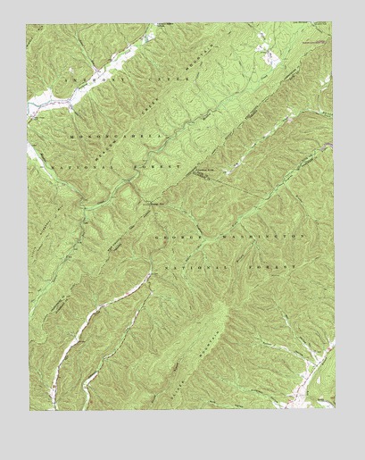
Rucker Gap, VA USGS Topographic Map
Click on map above to begin viewing in our Map Viewer.

This topographic map contains these locations and features:
Feature Name Type Latitude Longitude GNIS ID View Map
Allegheny Mountain TrailTrailN37.9765°W80.0245°1550090View Map
Allegheny Mountain TrailTrailN37.9651°W80.0403°1481240View Map
Big Lick DraftValleyN37.9704°W80.0050°1481750View Map
Brushy LickStreamN37.9479°W80.0201°1502779View Map
Chestnut KnobSummitN37.9518°W80.0565°1499251View Map
Coles RunStreamN37.9835°W80.0948°1550768View Map
Diley TrailTrailN37.9885°W80.0203°1550924View Map
Falling Spring DistrictCivilN37.8848°W80.0400°1927315View Map
Hickory LickStreamN37.9376°W80.0370°1484067View Map
Jackson TrailTrailN37.9129°W80.0078°1484393View Map
Lake Sherwood TrailTrailN37.9976°W80.0048°1551683View Map
Laurel RunStreamN37.9407°W80.1012°1551738View Map
May HollowValleyN37.8911°W80.0064°1485234View Map
Oliver MountainSummitN37.9048°W80.0445°1485975View Map
Oliver Mountain TrailTrailN37.9196°W80.0167°1485976View Map
Pond Lick RunStreamN37.9968°W80.0762°1552537View Map
Robins RunStreamN37.9301°W80.0520°1486683View Map
Rucker GapGapN37.9415°W80.0745°1486806View Map
Rucker HollowValleyN37.8894°W80.0103°1486807View Map
Watts Chapel CemeteryCemeteryN37.9698°W80.1217°1553393View Map

Note: Coordinates in the location and feature list above are referenced to NAD83 datum.


Copyright (C) 2008-2025 Ryan Niemi / Sunset Dynamics ... All Rights Reserved