TopoQuest Logo
Do you find TopoQuest useful?
Help keep TopoQuest running and adding new maps/features by donating!
Bitcoin:  19c7KJd3qBynnjoSw5npx9KScwjBe4ifkT
Litecoin:  LXs6TkuXGGXo1vDsWCkWVdjQX94eUKd6ui
Home View Maps Find Maps Find Places Resources & Links


Callisburg, Texas Topographic Map

USGS Map Title: Callisburg, TX
USGS Map MRC: 33097F1
DRG (GeoTIFF) Download: o33097f1.tif


Neighboring USGS Topographic Map Quads:


  Thackerville, OK  
33097G2
 

  Horseshoe Bend, TX  
33097G1
 

  Dexter, TX  
33096G8
 

  Gainesville North, TX  
33097F2
 

  Callisburg, TX  
33097F1
 

  Whitesboro, TX  
33096F8
 

  Gainesville South, TX  
33097E2
 

  Woodbine, TX  
33097E1
 

  Collinsville, TX  
33096E8


Map MRC Location:

N34°
W98°
N34°
W97°
H8 H7 H6 H5 H4 H3 H2 H1
G8 G7 G6 G5 G4 G3 G2 G1
F8 F7 F6 F5 F4 F3 F2 F1
E8 E7 E6 E5 E4 E3 E2 E1
D8 D7 D6 D5 D4 D3 D2 D1
C8 C7 C6 C5 C4 C3 C2 C1
B8 B7 B6 B5 B4 B3 B2 B1
A8 A7 A6 A5 A4 A3 A2 A1
N33°
W98°
N33°
W97°

Callisburg, TX USGS 1:24K Topographic Map Preview:
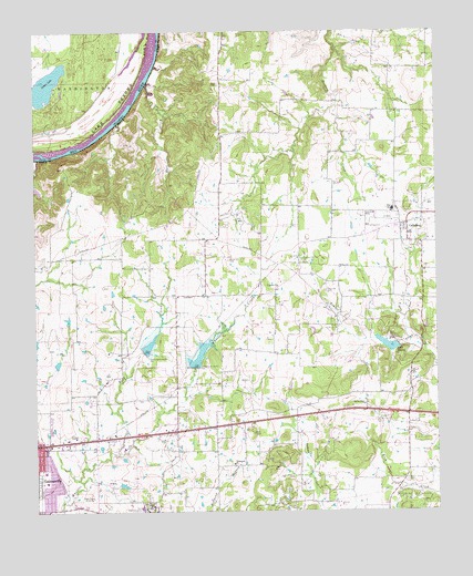
Callisburg, TX USGS Topographic Map
Click on map above to begin viewing in our Map Viewer.

This topographic map contains these locations and features:
Feature Name Type Latitude Longitude GNIS ID View Map
CallisburgPopulated PlaceN33.6979°W97.0089°1353567View Map
Callisburg CemeteryCemeteryN33.7021°W97.0222°1353568View Map
Callisburg City HallBuildingN33.6991°W97.0104°2753865View Map
Callisburg Oil FieldOilfieldN33.6837°W97.0106°1353569View Map
Callisburg Volunteer Fire DepartmentBuildingN33.6994°W97.0114°2551744View Map
Camp SweeneyLocaleN33.6701°W97.0136°1353678View Map
Center Hill CemeteryCemeteryN33.6909°W97.0642°1354195View Map
City of CallisburgCivilN33.6987°W97.0159°2409964View Map
Custer CityPopulated PlaceN33.6829°W97.0500°1379623View Map
Fairview CemeteryCemeteryN33.6318°W97.1245°1357183View Map
Gainesville State School for GirlsSchoolN33.6259°W97.0906°1373792View Map
House of Prayer Assembly of God ChurchChurchN33.6259°W97.1231°2017542View Map
KGAF-AM (Gainesville)TowerN33.6284°W97.1072°1387849View Map
Lake DealeyReservoirN33.6684°W97.0154°1355783View Map
Lake Dealey DamDamN33.6684°W97.0120°1855306View Map
Leeper LakeLakeN33.7362°W97.1219°1094565View Map
Mass CreekStreamN33.7365°W97.0895°1362263View Map
Nelson Grove CemeteryCemeteryN33.6332°W97.0097°1363666View Map
Oak RidgePopulated PlaceN33.6482°W97.0383°1377756View Map
Oak Ridge Police DepartmentBuildingN33.6490°W97.0405°2739111View Map
Oak Ridge Volunteer Fire DepartmentBuildingN33.6486°W97.0403°2551745View Map
Rock CreekStreamN33.6404°W97.1008°1366641View Map
Soil Conservation Service Site 11b DamDamN33.6668°W97.0936°1855302View Map
Soil Conservation Service Site 11b ReservoirReservoirN33.6668°W97.0936°1855303View Map
Soil Conservation Service Site 12 DamDamN33.6634°W97.0753°1855304View Map
Soil Conservation Service Site 12 ReservoirReservoirN33.6634°W97.0753°1855305View Map
Spring Grove ChurchChurchN33.6529°W97.0228°1369003View Map
Town of Oak RidgeCivilN33.6481°W97.0385°2413064View Map
Union Hill CemeteryCemeteryN33.6823°W97.0345°1370461View Map

Note: Coordinates in the location and feature list above are referenced to NAD83 datum.


Copyright (C) 2008-2025 Ryan Niemi / Sunset Dynamics ... All Rights Reserved