TopoQuest Logo
Do you find TopoQuest useful?
Help keep TopoQuest running and adding new maps/features by donating!
Bitcoin:  19c7KJd3qBynnjoSw5npx9KScwjBe4ifkT
Litecoin:  LXs6TkuXGGXo1vDsWCkWVdjQX94eUKd6ui
Home View Maps Find Maps Find Places Resources & Links


Adams Grove, Virginia Topographic Map

USGS Map Title: Adams Grove, VA
USGS Map MRC: 36077F4
DRG (GeoTIFF) Download: o36077f4.tif


Neighboring USGS Topographic Map Quads:


  Purdy, VA  
36077G5
 

  Jarratt, VA  
36077G4
 

  Yale, VA  
36077G3
 

  Emporia, VA  
36077F5
 

  Adams Grove, VA  
36077F4
 

  Drewryville, VA  
36077F3
 

  Skippers, VA  
36077E5
 

  Claresville, VA  
36077E4
 

  Margarettsville, NC  
36077E3


Map MRC Location:

N37°
W78°
N37°
W77°
H8 H7 H6 H5 H4 H3 H2 H1
G8 G7 G6 G5 G4 G3 G2 G1
F8 F7 F6 F5 F4 F3 F2 F1
E8 E7 E6 E5 E4 E3 E2 E1
D8 D7 D6 D5 D4 D3 D2 D1
C8 C7 C6 C5 C4 C3 C2 C1
B8 B7 B6 B5 B4 B3 B2 B1
A8 A7 A6 A5 A4 A3 A2 A1
N36°
W78°
N36°
W77°

Adams Grove, VA USGS 1:24K Topographic Map Preview:
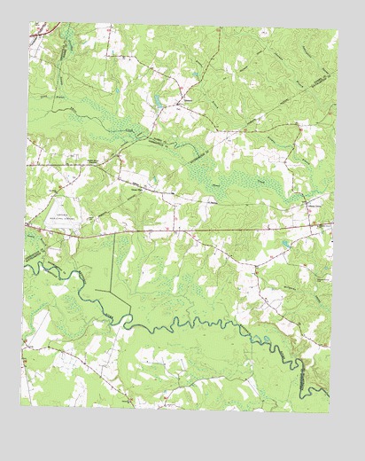
Adams Grove, VA USGS Topographic Map
Click on map above to begin viewing in our Map Viewer.

This topographic map contains these locations and features:
Feature Name Type Latitude Longitude GNIS ID View Map
Adams GrovePopulated PlaceN36.6932°W77.3853°1477062View Map
Big BranchStreamN36.6627°W77.4544°1738972View Map
Browns BranchStreamN36.6976°W77.3819°1463917View Map
Caney BranchStreamN36.6715°W77.4922°1464405View Map
Claresville ChurchChurchN36.6271°W77.4553°1464934View Map
Emporia Country ClubLocaleN36.7496°W77.4969°1500974View Map
Emporia-Greensville Regional AirportAirportN36.6830°W77.4836°1498661View Map
Faison School (historical)SchoolN36.6393°W77.4750°1500980View Map
Faisons Mobile Home ParkPopulated PlaceN36.7076°W77.4611°1500979View Map
Friendship Church of God in ChristChurchN36.7465°W77.4941°1500983View Map
Green PlainPopulated PlaceN36.6968°W77.4519°1477371View Map
GrizzardPopulated PlaceN36.7265°W77.4375°1477378View Map
Grizzard School (historical)SchoolN36.7274°W77.4378°1690202View Map
Harrell PondReservoirN36.7251°W77.4472°1490963View Map
Holly Square School (historical)SchoolN36.6815°W77.4322°1738995View Map
J B Harrell DamDamN36.7235°W77.4447°1490962View Map
James River JunctionPopulated PlaceN36.7038°W77.4728°1493134View Map
Newsom Grove School (historical)SchoolN36.7182°W77.3905°1739010View Map
Oak Grove Baptist ChurchChurchN36.6943°W77.4866°1471704View Map
Otterdam SwampStreamN36.7265°W77.4853°1471971View Map
Pleasant Grove CemeteryCemeteryN36.6690°W77.3800°1472466View Map
Pleasant Grove ChurchChurchN36.6854°W77.3811°1472470View Map
Uriah BranchStreamN36.7240°W77.4786°1476128View Map

Note: Coordinates in the location and feature list above are referenced to NAD83 datum.


Copyright (C) 2008-2025 Ryan Niemi / Sunset Dynamics ... All Rights Reserved