TopoQuest Logo
Do you find TopoQuest useful?
Help keep TopoQuest running and adding new maps/features by donating!
Bitcoin:  19c7KJd3qBynnjoSw5npx9KScwjBe4ifkT
Litecoin:  LXs6TkuXGGXo1vDsWCkWVdjQX94eUKd6ui
Home View Maps Find Maps Find Places Resources & Links


Jarratt, Virginia Topographic Map

USGS Map Title: Jarratt, VA
USGS Map MRC: 36077G4
DRG (GeoTIFF) Download: o36077g4.tif


Neighboring USGS Topographic Map Quads:


  Cherry Hill, VA  
36077H5
 

  Stony Creek, VA  
36077H4
 

  Sussex, VA  
36077H3
 

  Purdy, VA  
36077G5
 

  Jarratt, VA  
36077G4
 

  Yale, VA  
36077G3
 

  Emporia, VA  
36077F5
 

  Adams Grove, VA  
36077F4
 

  Drewryville, VA  
36077F3


Map MRC Location:

N37°
W78°
N37°
W77°
H8 H7 H6 H5 H4 H3 H2 H1
G8 G7 G6 G5 G4 G3 G2 G1
F8 F7 F6 F5 F4 F3 F2 F1
E8 E7 E6 E5 E4 E3 E2 E1
D8 D7 D6 D5 D4 D3 D2 D1
C8 C7 C6 C5 C4 C3 C2 C1
B8 B7 B6 B5 B4 B3 B2 B1
A8 A7 A6 A5 A4 A3 A2 A1
N36°
W78°
N36°
W77°

Jarratt, VA USGS 1:24K Topographic Map Preview:
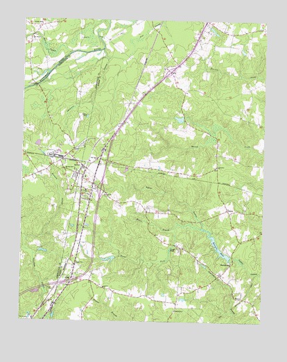
Jarratt, VA USGS Topographic Map
Click on map above to begin viewing in our Map Viewer.

This topographic map contains these locations and features:
Feature Name Type Latitude Longitude GNIS ID View Map
Bailys PondReservoirN36.8348°W77.4667°1462692View Map
Bethlehem ChurchChurchN36.7546°W77.4194°1463226View Map
Centenary United Methodist ChurchChurchN36.8110°W77.4711°1500967View Map
Chapel Hill ChurchChurchN36.7738°W77.4711°1464743View Map
Chetocric SwampStreamN36.8629°W77.4583°1464838View Map
Creath DamDamN36.8335°W77.4164°1490934View Map
Creath PondReservoirN36.8341°W77.4187°1490935View Map
Creath School (historical)SchoolN36.8338°W77.4164°1690196View Map
First Baptist ChurchChurchN36.8676°W77.4955°1466577View Map
Greensville Correctional CenterLocaleN36.7996°W77.4836°1500988View Map
Greensville Correctional Center UnitBuildingN36.7969°W77.4829°2767096View Map
Grigg Family CemeteryCemeteryN36.7971°W77.4841°1690170View Map
Harrells DamDamN36.7761°W77.3920°1490932View Map
Harrells MillPopulated PlaceN36.7749°W77.3914°1495658View Map
Harrells PondReservoirN36.7812°W77.3977°1467768View Map
Harris SwampStreamN36.8615°W77.4753°1467785View Map
Hasadiah ChurchChurchN36.8024°W77.4572°1467811View Map
Hassidiah CemeteryCemeteryN36.8029°W77.4572°1690205View Map
HenryPopulated PlaceN36.7968°W77.3928°1477408View Map
Henry DistrictCivilN36.7918°W77.3949°1927340View Map
Hickory SwampStreamN36.7840°W77.4972°1467991View Map
High Hill ChurchChurchN36.8171°W77.4611°1468008View Map
High Hills CemeteryCemeteryN36.8176°W77.4603°1690208View Map
Holy Trinity Episcopal Church (historical)ChurchN36.8174°W77.4728°1500995View Map
Horne DamDamN36.7768°W77.4514°1490942View Map
Horne PondReservoirN36.7758°W77.4539°1490943View Map
Howie BranchStreamN36.7890°W77.4200°1468337View Map
Interchange 17CrossingN36.7668°W77.4736°1690216View Map
Interchange 20CrossingN36.8046°W77.4589°1690217View Map
Interchange 24CrossingN36.8538°W77.4244°1690218View Map
JarrattPopulated PlaceN36.8143°W77.4683°1495754View Map
Jarratt Post OfficePost OfficeN36.8148°W77.4696°1690221View Map
Jarratt School (historical)SchoolN36.8096°W77.4669°1690222View Map
Jarratt Volunteer Fire DepartmentBuildingN36.8192°W77.4751°2086226View Map
Jefferson Elementary SchoolSchoolN36.8041°W77.4668°1468661View Map
Jerusalem CemeteryCemeteryN36.8138°W77.3994°1690223View Map
Jerusalem ChurchChurchN36.8146°W77.3989°1468701View Map
Lebanon ChurchChurchN36.7640°W77.4569°1469239View Map
Little MillPopulated PlaceN36.8726°W77.4908°1495847View Map
Loco School (historical)SchoolN36.8724°W77.3769°1690228View Map
Magnums Mobile Home ParkPopulated PlaceN36.8110°W77.4900°1501009View Map
MasonPopulated PlaceN36.7596°W77.3853°1495907View Map
Morning Star ChurchChurchN36.8126°W77.4772°1470741View Map
Otterdam Mobile Home ParkPopulated PlaceN36.7543°W77.4855°1501016View Map
OwensPopulated PlaceN36.8538°W77.4244°1496054View Map
Pine View GreenhousesBuildingN36.7575°W77.4244°2677808View Map
Saint Johns ChurchChurchN36.7674°W77.4736°1473759View Map
Smith BridgeBridgeN36.8479°W77.4933°1474721View Map
South Fork Poplar SwampStreamN36.7890°W77.4072°1474862View Map
Town of JarrattCivilN36.8160°W77.4689°2391245View Map

Note: Coordinates in the location and feature list above are referenced to NAD83 datum.


Copyright (C) 2008-2024 Ryan Niemi / Sunset Dynamics ... All Rights Reserved