TopoQuest Logo
Do you find TopoQuest useful?
Help keep TopoQuest running and adding new maps/features by donating!
Bitcoin:  19c7KJd3qBynnjoSw5npx9KScwjBe4ifkT
Litecoin:  LXs6TkuXGGXo1vDsWCkWVdjQX94eUKd6ui
Home View Maps Find Maps Find Places Resources & Links


Windham, Pennsylvania Topographic Map

USGS Map Title: Windham, PA
USGS Map MRC: 41076H3
DRG (GeoTIFF) Download: o41076h3.tif


Neighboring USGS Topographic Map Quads:


  Barton, NY  
42076A4
 

  Owego, NY  
42076A3
 

  Apalachin, NY  
42076A2
 

  Litchfield, PA  
41076H4
 

  Windham, PA  
41076H3
 

  Little Meadows, PA  
41076H2
 

  Towanda, PA  
41076G4
 

  Rome, PA  
41076G3
 

  Le Raysville, PA  
41076G2


Map MRC Location:

N42°
W77°
N42°
W76°
H8 H7 H6 H5 H4 H3 H2 H1
G8 G7 G6 G5 G4 G3 G2 G1
F8 F7 F6 F5 F4 F3 F2 F1
E8 E7 E6 E5 E4 E3 E2 E1
D8 D7 D6 D5 D4 D3 D2 D1
C8 C7 C6 C5 C4 C3 C2 C1
B8 B7 B6 B5 B4 B3 B2 B1
A8 A7 A6 A5 A4 A3 A2 A1
N41°
W77°
N41°
W76°

Windham, PA USGS 1:24K Topographic Map Preview:
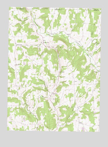
Windham, PA USGS Topographic Map
Click on map above to begin viewing in our Map Viewer.

This topographic map contains these locations and features:
Feature Name Type Latitude Longitude GNIS ID View Map
Babcock Hill CemeteryCemeteryN41.9851°W76.2725°2776401View Map
Babcock RunStreamN41.9670°W76.2610°969835View Map
Bixby CornerPopulated PlaceN41.9420°W76.3613°1203106View Map
Briggs HollowValleyN41.9964°W76.3435°969915View Map
Cold BrookStreamN41.9726°W76.3127°970021View Map
Jillson CemeteryCemeteryN41.9172°W76.2587°1178078View Map
Lake BoninReservoirN41.8769°W76.2718°1212693View Map
Lake NadineLakeN41.9103°W76.3292°1193000View Map
Little Falls CreekStreamN41.9945°W76.3444°1179541View Map
North OrwellPopulated PlaceN41.9126°W76.3147°1204303View Map
North Orwell CemeteryCemeteryN41.9080°W76.3152°1182612View Map
OrwellPopulated PlaceN41.8840°W76.2772°1204336View Map
Orwell CemeteryCemeteryN41.8760°W76.2786°1183057View Map
Orwell Valley CemeteryCemeteryN41.8810°W76.3045°1183058View Map
Osborne Hill CemeteryCemeteryN41.9954°W76.3709°2776474View Map
Owl HollowPopulated PlaceN41.9823°W76.3385°1204344View Map
Prince Hollow RunStreamN41.9576°W76.2716°1184418View Map
Ransom School (historical)SchoolN41.8809°W76.3052°1197340View Map
Rogers / Dickerson CemeteryCemeteryN41.9542°W76.2628°2776484View Map
Rogers Family CemeteryCemeteryN41.9446°W76.2584°2776483View Map
Roswell Russell Farm CemeteryCemeteryN41.9142°W76.3149°2776487View Map
Russell RunStreamN41.9704°W76.2952°970553View Map
RussellvillePopulated PlaceN41.9084°W76.3172°1202113View Map
Spring RunStreamN41.9854°W76.3555°1188267View Map
State Game Lands Number 219ParkN41.9623°W76.2549°1193444View Map
Township of WindhamCivilN41.9601°W76.3213°1216006View Map
Trout BrookStreamN41.9131°W76.3130°1189829View Map
Trout StreamStreamN41.8837°W76.3058°1189872View Map
Tyrrel School (historical)SchoolN41.9179°W76.2841°1197339View Map
TyrrellPopulated PlaceN41.9254°W76.2838°1204845View Map
Tyrrell Hill CemeteryCemeteryN41.9308°W76.2865°2776510View Map
Union Valley ChurchChurchN41.8934°W76.3422°1190182View Map
West Branch Parks CreekStreamN41.9312°W76.3599°1190922View Map
West WarrenPopulated PlaceN41.9359°W76.2513°1204932View Map
WindhamPopulated PlaceN41.9717°W76.2913°1204966View Map
Windham / Valley Home CemeteryCemeteryN41.9731°W76.3170°1191576View Map
Windham Ambulance AssociationBuildingN41.9645°W76.3284°2722265View Map
Windham CenterPopulated PlaceN41.9645°W76.3263°1204967View Map
Windham SchoolSchoolN41.9667°W76.3263°1191577View Map
Windham SummitPopulated PlaceN41.9612°W76.3641°1204968View Map
Windham Summit CemeteryCemeteryN41.9632°W76.3640°2776449View Map
Windham Township Volunteer Fire Company Station 19BuildingN41.9369°W76.3039°2653258View Map

Note: Coordinates in the location and feature list above are referenced to NAD83 datum.


Copyright (C) 2008-2025 Ryan Niemi / Sunset Dynamics ... All Rights Reserved