TopoQuest Logo
Do you find TopoQuest useful?
Help keep TopoQuest running and adding new maps/features by donating!
Bitcoin:  19c7KJd3qBynnjoSw5npx9KScwjBe4ifkT
Litecoin:  LXs6TkuXGGXo1vDsWCkWVdjQX94eUKd6ui
Home View Maps Find Maps Find Places Resources & Links


Armada, Michigan Topographic Map

USGS Map Title: Armada, MI
USGS Map MRC: 42082G8
DRG (GeoTIFF) Download: o42082g8.tif


Neighboring USGS Topographic Map Quads:


  Almont, MI  
42083H1
 

  Allenton, MI  
42082H8
 

  Memphis, MI  
42082H7
 

  Romeo, MI  
42083G1
 

  Armada, MI  
42082G8
 

  Richmond, MI  
42082G7
 

  Utica, MI  
42083F1
 

  Waldenburg, MI  
42082F8
 

  New Haven, MI  
42082F7


Map MRC Location:

N43°
W83°
N43°
W82°
H8 H7 H6 H5 H4 H3 H2 H1
G8 G7 G6 G5 G4 G3 G2 G1
F8 F7 F6 F5 F4 F3 F2 F1
E8 E7 E6 E5 E4 E3 E2 E1
D8 D7 D6 D5 D4 D3 D2 D1
C8 C7 C6 C5 C4 C3 C2 C1
B8 B7 B6 B5 B4 B3 B2 B1
A8 A7 A6 A5 A4 A3 A2 A1
N42°
W83°
N42°
W82°

Armada, MI USGS 1:24K Topographic Map Preview:
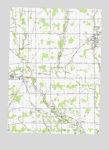
Armada, MI USGS Topographic Map
Click on map above to begin viewing in our Map Viewer.

This topographic map contains these locations and features:
Feature Name Type Latitude Longitude GNIS ID View Map
Apel DrainStreamN42.8581°W82.9919°620162View Map
ArmadaPopulated PlaceN42.8442°W82.8844°620222View Map
Armada and Ray DrainStreamN42.7945°W82.8810°620223View Map
Armada Area High SchoolSchoolN42.8506°W82.8806°2343332View Map
Armada Community ChurchChurchN42.8444°W82.8823°2648113View Map
Armada Emergency Medical ServicesBuildingN42.8508°W82.8828°2662054View Map
Armada Fire DepartmentBuildingN42.8508°W82.8828°2648112View Map
Armada Free Public LibraryBuildingN42.8421°W82.8830°2648111View Map
Armada Middle SchoolSchoolN42.8506°W82.8829°2343333View Map
Armada Police DepartmentBuildingN42.8450°W82.8831°2648110View Map
Armada Post OfficePost OfficeN42.8450°W82.8830°2648106View Map
Armada Station (historical)LocaleN42.8369°W82.8908°2648114View Map
Armada Township Fire DepartmentBuildingN42.8508°W82.8828°2620111View Map
Armada United Methodist ChurchChurchN42.8439°W82.8822°2648109View Map
Bruce and Armada CemeteryCemeteryN42.8486°W82.9821°622119View Map
Calvary Baptist ChurchChurchN42.8500°W82.8844°2648108View Map
Camp RotaryLocaleN42.7642°W82.9244°622625View Map
Cascade LakeLakeN42.7945°W82.9630°1618793View Map
Congregational United ChurchChurchN42.8422°W82.8842°2648107View Map
Dodge Airport (historical)AirportN42.7720°W82.9539°1624123View Map
East Pond CreekStreamN42.8061°W82.9705°625246View Map
Faith Freewill Baptist ChurchChurchN42.7709°W82.9630°1618796View Map
Farley DrainStreamN42.8200°W82.9760°625827View Map
Hadley CemeteryCemeteryN42.8289°W82.9291°627583View Map
Knust DrainStreamN42.7909°W82.9480°629832View Map
Kriewall StripAirportN42.8359°W82.9690°1624124View Map
Lee CemeteryCemeteryN42.7670°W82.9166°630249View Map
Little Zion ChurchChurchN42.7620°W82.9616°630829View Map
Macomb Academy of Arts and ScienceSchoolN42.8461°W82.8830°2345324View Map
Mahaffy DrainStreamN42.8267°W82.9877°631328View Map
Newland DrainStreamN42.8353°W82.9802°1624779View Map
Orville C Krause Later Elementary SchoolSchoolN42.8507°W82.8785°2344329View Map
Our Saviour Lutheran SchoolSchoolN42.8433°W82.8933°2648105View Map
Our Saviour's Lutheran ChurchChurchN42.8433°W82.8933°2648104View Map
Pine Valley Golf CourseLocaleN42.7936°W82.9583°2648101View Map
Powell CemeteryCemeteryN42.7814°W82.9946°635373View Map
Priest DrainStreamN42.7631°W82.8996°635453View Map
Procter CemeteryCemeteryN42.8042°W82.9749°635471View Map
Ray CenterPopulated PlaceN42.7617°W82.9013°635677View Map
Ray Center Post Office (historical)Post OfficeN42.7617°W82.9014°2648096View Map
Ray Township District School Number One Historical MarkerParkN42.7697°W82.9284°2647814View Map
Ray Township Fire and RescueBuildingN42.7611°W82.9256°2619913View Map
Ray Township Fire DepartmentBuildingN42.7611°W82.9257°2648100View Map
Ray Township LibraryBuildingN42.7696°W82.9287°2648099View Map
Ray Township ParkParkN42.7684°W82.9319°1618795View Map
Religious Society Church Historical MarkerParkN42.7700°W82.9286°2647815View Map
Romeo Golf ClubLocaleN42.8000°W82.9889°2648644View Map
Romeo State AirportAirportN42.7970°W82.9768°1624125View Map
Saint John's Lutheran ChurchChurchN42.7593°W82.8821°2648098View Map
Township of ArmadaCivilN42.8502°W82.9231°1625850View Map
Township of RayCivilN42.7613°W82.9199°1626955View Map
Village of ArmadaCivilN42.8424°W82.8828°2397987View Map
Wilson DrainCanalN42.8714°W82.9710°1616570View Map
Wolcott Mill MetroparkParkN42.7684°W82.8971°1618794View Map
Wolcott MillsPopulated PlaceN42.7689°W82.9269°1616678View Map
Woodbeck DrainStreamN42.8392°W82.8874°1616734View Map
Wyman DrainStreamN42.7870°W82.9508°1616859View Map

Note: Coordinates in the location and feature list above are referenced to NAD83 datum.


Copyright (C) 2008-2025 Ryan Niemi / Sunset Dynamics ... All Rights Reserved