TopoQuest Logo
Do you find TopoQuest useful?
Help keep TopoQuest running and adding new maps/features by donating!
Bitcoin:  19c7KJd3qBynnjoSw5npx9KScwjBe4ifkT
Litecoin:  LXs6TkuXGGXo1vDsWCkWVdjQX94eUKd6ui
Home View Maps Find Maps Find Places Resources & Links


Allenton, Michigan Topographic Map

USGS Map Title: Allenton, MI
USGS Map MRC: 42082H8
DRG (GeoTIFF) Download: o42082h8.tif


Neighboring USGS Topographic Map Quads:


  Imlay City, MI  
43083A1
 

  Capac, MI  
43082A8
 

  Brockway, MI  
43082A7
 

  Almont, MI  
42083H1
 

  Allenton, MI  
42082H8
 

  Memphis, MI  
42082H7
 

  Romeo, MI  
42083G1
 

  Armada, MI  
42082G8
 

  Richmond, MI  
42082G7


Map MRC Location:

N43°
W83°
N43°
W82°
H8 H7 H6 H5 H4 H3 H2 H1
G8 G7 G6 G5 G4 G3 G2 G1
F8 F7 F6 F5 F4 F3 F2 F1
E8 E7 E6 E5 E4 E3 E2 E1
D8 D7 D6 D5 D4 D3 D2 D1
C8 C7 C6 C5 C4 C3 C2 C1
B8 B7 B6 B5 B4 B3 B2 B1
A8 A7 A6 A5 A4 A3 A2 A1
N42°
W83°
N42°
W82°

Allenton, MI USGS 1:24K Topographic Map Preview:
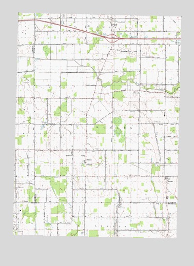
Allenton, MI USGS Topographic Map
Click on map above to begin viewing in our Map Viewer.

This topographic map contains these locations and features:
Feature Name Type Latitude Longitude GNIS ID View Map
AllentonPopulated PlaceN42.9195°W82.9455°1624348View Map
Allenton Post OfficePost OfficeN42.9175°W82.9453°2582204View Map
Almont CampLocaleN42.9381°W82.9755°1624349View Map
Almont Society of the New ChurchChurchN42.9378°W82.9755°1624309View Map
Almont Society of the New Church Historical MarkerParkN42.9375°W82.9755°2581670View Map
Belle River Post Office (historical)Post OfficeN42.9578°W82.9056°2581587View Map
Berlin Oil FieldOilfieldN42.8995°W82.9458°1624387View Map
Berlin Township Fire DepartmentBuildingN42.9153°W82.9451°2620053View Map
BervillePopulated PlaceN42.9084°W82.8830°1624388View Map
Berville Post Office (historical)Post OfficeN42.9083°W82.8831°2581586View Map
Berville Station (historical)LocaleN42.9083°W82.8833°2582228View Map
Capac CemeteryCemeteryN42.9942°W82.9274°1624441View Map
Capac DrainCanalN42.9972°W82.9283°1624442View Map
Capac Rest AreaLocaleN42.9928°W82.9583°2581603View Map
East Berlin CemeteryCemeteryN42.9400°W82.8958°1624501View Map
Interchange 176CrossingN42.9867°W82.9278°2581621View Map
LestervillePopulated PlaceN42.9578°W82.9055°1624676View Map
McKay DitchCanalN42.8900°W82.9883°631933View Map
Rose Hill CemeteryCemeteryN42.8922°W82.9191°636199View Map
Saint Johns Catholic ChurchChurchN42.9200°W82.9472°1624308View Map
Scotch Settlement CemeteryCemeteryN42.9014°W82.9991°637457View Map
Smith's Station (historical)LocaleN42.9164°W82.9453°2582203View Map
Townline DrainCanalN42.8759°W82.9816°1615007View Map
Township of BerlinCivilN42.9392°W82.9260°1625925View Map
West Berlin CemeteryCemeteryN42.9225°W82.9561°2581625View Map
West Berlin ChurchChurchN42.9206°W82.9558°1625010View Map

Note: Coordinates in the location and feature list above are referenced to NAD83 datum.


Copyright (C) 2008-2025 Ryan Niemi / Sunset Dynamics ... All Rights Reserved