TopoQuest Logo
Do you find TopoQuest useful?
Help keep TopoQuest running and adding new maps/features by donating!
Bitcoin:  19c7KJd3qBynnjoSw5npx9KScwjBe4ifkT
Litecoin:  LXs6TkuXGGXo1vDsWCkWVdjQX94eUKd6ui
Home View Maps Find Maps Find Places Resources & Links


Camp Hill, Mississippi Topographic Map

USGS Map Title: Camp Hill, MS
USGS Map MRC: 34089H1
DRG (GeoTIFF) Download: o34089h1.tif


Neighboring USGS Topographic Map Quads:


  Grand Junction, TN  
35089A2
 

  Saulsbury, TN  
35089A1
 

  Middleton, TN  
35088A8
 

  Canaan, MS  
34089H2
 

  Camp Hill, MS  
34089H1
 

  Walnut, MS  
34088H8
 

  Ashland, MS  
34089G2
 

  Whitten Town, MS  
34089G1
 

  Falkner, MS  
34088G8


Map MRC Location:

N35°
W90°
N35°
W89°
H8 H7 H6 H5 H4 H3 H2 H1
G8 G7 G6 G5 G4 G3 G2 G1
F8 F7 F6 F5 F4 F3 F2 F1
E8 E7 E6 E5 E4 E3 E2 E1
D8 D7 D6 D5 D4 D3 D2 D1
C8 C7 C6 C5 C4 C3 C2 C1
B8 B7 B6 B5 B4 B3 B2 B1
A8 A7 A6 A5 A4 A3 A2 A1
N34°
W90°
N34°
W89°

Camp Hill, MS USGS 1:24K Topographic Map Preview:
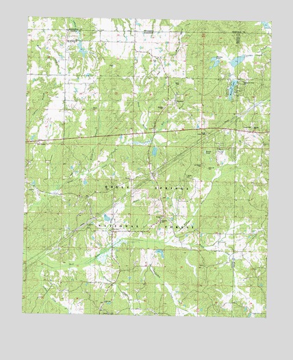
Camp Hill, MS USGS Topographic Map
Click on map above to begin viewing in our Map Viewer.

This topographic map contains these locations and features:
Feature Name Type Latitude Longitude GNIS ID View Map
Bakers PondLakeN34.9444°W89.0329°692442View Map
Benton Lookout TowerTowerN34.9523°W89.0328°704502View Map
Black JackPopulated PlaceN34.8770°W89.0848°704503View Map
Black Jack CemeteryCemeteryN34.8801°W89.0834°705874View Map
Black Jack ChurchChurchN34.8801°W89.0820°692629View Map
BrodyPopulated PlaceN34.9320°W89.0701°692712View Map
Bryant CemeteryCemeteryN34.9729°W89.0462°692737View Map
Camp HillLocaleN34.9537°W89.0098°692816View Map
Camp Hill CemeteryCemeteryN34.9373°W89.0306°692817View Map
Goose CreekStreamN34.9056°W89.0512°693327View Map
HamiltonPopulated PlaceN34.9168°W89.0540°705881View Map
Hamilton CemeteryCemeteryN34.9143°W89.0545°704513View Map
Hamilton ChurchChurchN34.9165°W89.0542°693405View Map
Heathville (historical)LocaleN34.9376°W89.0040°704668View Map
Hensley and Glover CemeteryCemeteryN34.9734°W89.0139°693305View Map
Hensley PondReservoirN34.9838°W89.0295°693451View Map
Hines CemeteryCemeteryN34.9820°W89.0576°693486View Map
Hines SchoolSchoolN34.9906°W89.0731°693487View Map
Hood BranchStreamN34.9484°W89.0615°693520View Map
HopewellPopulated PlaceN34.9681°W89.0481°693521View Map
Hopewell CemeteryCemeteryN34.9626°W89.0545°704517View Map
Hopewell Presbyterian ChurchChurchN34.9654°W89.0487°705883View Map
Indian CreekStreamN34.8962°W89.1148°693585View Map
Marlow ChurchChurchN34.9531°W89.0084°693874View Map
Marlowe CemeteryCemeteryN34.9548°W89.0087°704675View Map
McKee CemeteryCemeteryN34.9337°W89.0420°704524View Map
Medlock CemeteryCemeteryN34.9120°W89.0923°705888View Map
Medlock ChurchChurchN34.9123°W89.0909°693941View Map
Mill BranchStreamN34.9493°W89.0595°693969View Map
Miller BranchStreamN34.8995°W89.0865°694003View Map
Mount Bethel ChurchChurchN34.9898°W89.0998°694050View Map
Mount Pleasant CemeteryCemeteryN34.9390°W89.0348°694092View Map
New Barden (historical)LocaleN34.9618°W89.0267°704527View Map
New CanaanPopulated PlaceN34.9476°W89.1178°694157View Map
Oak Grove SchoolSchoolN34.9120°W89.0015°694234View Map
Sourwood CreekStreamN34.8981°W89.0878°694839View Map
Turkey CreekStreamN34.9065°W89.0620°695024View Map
Walnut LakeReservoirN34.9714°W89.0196°704546View Map
Wesley BranchStreamN34.9340°W89.0945°695119View Map
Wesley CemeteryCemeteryN34.9615°W89.0901°695120View Map
Wesley Chapel (historical)ChurchN34.9612°W89.0903°705899View Map
Zion ChapelChurchN34.9106°W89.0790°695235View Map
Zion Chapel CemeteryCemeteryN34.9106°W89.0795°705900View Map

Note: Coordinates in the location and feature list above are referenced to NAD83 datum.


Copyright (C) 2008-2025 Ryan Niemi / Sunset Dynamics ... All Rights Reserved