TopoQuest Logo
Do you find TopoQuest useful?
Help keep TopoQuest running and adding new maps/features by donating!
Bitcoin:  19c7KJd3qBynnjoSw5npx9KScwjBe4ifkT
Litecoin:  LXs6TkuXGGXo1vDsWCkWVdjQX94eUKd6ui
Home View Maps Find Maps Find Places Resources & Links


Tigerton, Wisconsin Topographic Map

USGS Map Title: Tigerton, WI
USGS Map MRC: 44089F1
DRG (GeoTIFF) Download: o44089f1.tif


Neighboring USGS Topographic Map Quads:


  Wittenberg, WI  
44089G2
 

  Shepley, WI  
44089G1
 

  Bowler, WI  
44088G8
 

  Tigerton NW, WI  
44089F2
 

  Tigerton, WI  
44089F1
 

  Marion, WI  
44088F8
 

  Iola, WI  
44089E2
 

  Big Falls, WI  
44089E1
 

  Symco, WI  
44088E8


Map MRC Location:

N45°
W90°
N45°
W89°
H8 H7 H6 H5 H4 H3 H2 H1
G8 G7 G6 G5 G4 G3 G2 G1
F8 F7 F6 F5 F4 F3 F2 F1
E8 E7 E6 E5 E4 E3 E2 E1
D8 D7 D6 D5 D4 D3 D2 D1
C8 C7 C6 C5 C4 C3 C2 C1
B8 B7 B6 B5 B4 B3 B2 B1
A8 A7 A6 A5 A4 A3 A2 A1
N44°
W90°
N44°
W89°

Tigerton, WI USGS 1:24K Topographic Map Preview:
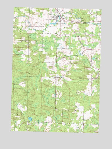
Tigerton, WI USGS Topographic Map
Click on map above to begin viewing in our Map Viewer.

This topographic map contains these locations and features:
Feature Name Type Latitude Longitude GNIS ID View Map
Beetle CreekStreamN44.7411°W89.1082°1561502View Map
Jones CreekStreamN44.6286°W89.1187°1567266View Map
Kersten LakeLakeN44.7000°W89.0097°1567428View Map
Kerstens GreenhouseBuildingN44.7192°W89.0219°2723756View Map
Lower Tigerton PondReservoirN44.7416°W89.0587°1578566View Map
Mud LakeLakeN44.6376°W89.0975°1569926View Map
Mud Lake Bog State Natural AreaParkN44.6378°W89.0982°2061760View Map
Split RockPopulated PlaceN44.7050°W89.0259°1574566View Map
Split Rock CreekStreamN44.7036°W89.0287°1577393View Map
Steinke CreekStreamN44.7280°W89.1021°1574850View Map
Tiger CreekStreamN44.7422°W89.0607°1575447View Map
TigertonPopulated PlaceN44.7408°W89.0632°1575448View Map
Tigerton Area Ambulance ServiceBuildingN44.7466°W89.0625°2698363View Map
Tigerton DellsRapidsN44.7378°W89.0284°1575449View Map
Tigerton Elementary SchoolSchoolN44.7405°W89.0669°2713313View Map
Tigerton Middle and High SchoolSchoolN44.7392°W89.0579°2713393View Map
Tigerton Police DepartmentBuildingN44.7412°W89.0622°2759973View Map
Tigerton Volunteer Fire DepartmentBuildingN44.7412°W89.0624°2696931View Map
Town of FairbanksCivilN44.7232°W89.0420°1583183View Map
Town of WyomingCivilN44.6357°W89.0422°1584491View Map
Upper Tigerton PondReservoirN44.7338°W89.0665°1578568View Map
Village of TigertonCivilN44.7409°W89.0465°1584279View Map

Note: Coordinates in the location and feature list above are referenced to NAD83 datum.


Copyright (C) 2008-2025 Ryan Niemi / Sunset Dynamics ... All Rights Reserved