TopoQuest Logo
Do you find TopoQuest useful?
Help keep TopoQuest running and adding new maps/features by donating!
Bitcoin:  19c7KJd3qBynnjoSw5npx9KScwjBe4ifkT
Litecoin:  LXs6TkuXGGXo1vDsWCkWVdjQX94eUKd6ui
Home View Maps Find Maps Find Places Resources & Links


Cartwright, Texas Topographic Map

USGS Map Title: Cartwright, TX
USGS Map MRC: 32095G3
DRG (GeoTIFF) Download: o32095g3.tif


Neighboring USGS Topographic Map Quads:


  Pleasant Grove, TX  
32095H4
 

  Winnsboro, TX  
32095H3
 

  Newsome, TX  
32095H2
 

  Quitman, TX  
32095G4
 

  Cartwright, TX  
32095G3
 

  Rhonesboro, TX  
32095G2
 

  Mineola, TX  
32095F4
 

  Hainesville, TX  
32095F3
 

  Shady Grove, TX  
32095F2


Map MRC Location:

N33°
W96°
N33°
W95°
H8 H7 H6 H5 H4 H3 H2 H1
G8 G7 G6 G5 G4 G3 G2 G1
F8 F7 F6 F5 F4 F3 F2 F1
E8 E7 E6 E5 E4 E3 E2 E1
D8 D7 D6 D5 D4 D3 D2 D1
C8 C7 C6 C5 C4 C3 C2 C1
B8 B7 B6 B5 B4 B3 B2 B1
A8 A7 A6 A5 A4 A3 A2 A1
N32°
W96°
N32°
W95°

Cartwright, TX USGS 1:24K Topographic Map Preview:
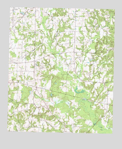
Cartwright, TX USGS Topographic Map
Click on map above to begin viewing in our Map Viewer.

This topographic map contains these locations and features:
Feature Name Type Latitude Longitude GNIS ID View Map
Big Woods Spring Lake DamDamN32.8251°W95.2502°1856118View Map
Buck CreekStreamN32.7762°W95.2891°1372785View Map
Burleson BranchStreamN32.8176°W95.3183°1372837View Map
CartwrightPopulated PlaceN32.8721°W95.3713°1380827View Map
Chicken CreekStreamN32.8371°W95.3280°1373079View Map
Cooper BranchStreamN32.8712°W95.3380°1373201View Map
Crones PondReservoirN32.7875°W95.3236°1373286View Map
East PointPopulated PlaceN32.8312°W95.2977°1380844View Map
Ebenezer ChurchChurchN32.8174°W95.3444°1373580View Map
Grinnel LakeLakeN32.7562°W95.2644°1373933View Map
Homebrew BranchStreamN32.8676°W95.2549°1374125View Map
Indian CreekStreamN32.8590°W95.3355°1374213View Map
Jarred BranchStreamN32.8365°W95.3263°1374271View Map
Liberty ChurchChurchN32.7999°W95.3644°1374519View Map
Little HopePopulated PlaceN32.7796°W95.2569°1380875View Map
Lone Grove SchoolSchoolN32.8185°W95.3655°1374684View Map
Long LakeLakeN32.7837°W95.2830°1374709View Map
Mansell CreekStreamN32.7601°W95.2711°1374791View Map
Midway LakeReservoirN32.8692°W95.3600°1374923View Map
Midway Lake DamDamN32.8701°W95.3586°1856098View Map
Mill CreekStreamN32.8576°W95.2583°1374952View Map
Murphy BranchStreamN32.7754°W95.2763°1375070View Map
Oak GrovePopulated PlaceN32.8215°W95.3449°1380894View Map
Pleasantville Branch LibraryBuildingN32.7562°W95.2730°2014790View Map
Rogers BranchStreamN32.7504°W95.2524°1375815View Map
Round LakeLakeN32.7599°W95.2698°1375842View Map
Sand Springs BranchStreamN32.7985°W95.2630°1375991View Map
Scenic Woods Regional LibraryBuildingN32.7607°W95.3008°2014762View Map
Shady Grove ChurchChurchN32.8571°W95.2724°1376075View Map
Slough Bridge BranchStreamN32.7610°W95.2766°1376145View Map
Smith Branch LibraryBuildingN32.7737°W95.3686°2014770View Map
StoutPopulated PlaceN32.8721°W95.2966°1380930View Map
Stout CreekStreamN32.8032°W95.2927°1376313View Map
Tarkill LakeLakeN32.7540°W95.2619°1376392View Map
Turkey CreekStreamN32.8535°W95.3322°1376519View Map
Turkey CreekStreamN32.8179°W95.2874°1376528View Map
Tuttle Branch LibraryBuildingN32.7812°W95.3083°2014739View Map
Way Lake Oil FieldOilfieldN32.8643°W95.3599°1376663View Map
Young Branch LibraryBuildingN32.8074°W95.3330°2014758View Map

Note: Coordinates in the location and feature list above are referenced to NAD83 datum.


Copyright (C) 2008-2025 Ryan Niemi / Sunset Dynamics ... All Rights Reserved