TopoQuest Logo
Do you find TopoQuest useful?
Help keep TopoQuest running and adding new maps/features by donating!
Bitcoin:  19c7KJd3qBynnjoSw5npx9KScwjBe4ifkT
Litecoin:  LXs6TkuXGGXo1vDsWCkWVdjQX94eUKd6ui
Home View Maps Find Maps Find Places Resources & Links


Quitman, Texas Topographic Map

USGS Map Title: Quitman, TX
USGS Map MRC: 32095G4
DRG (GeoTIFF) Download: o32095g4.tif


Neighboring USGS Topographic Map Quads:


  Yantis, TX  
32095H5
 

  Pleasant Grove, TX  
32095H4
 

  Winnsboro, TX  
32095H3
 

  Calvary, TX  
32095G5
 

  Quitman, TX  
32095G4
 

  Cartwright, TX  
32095G3
 

  Golden, TX  
32095F5
 

  Mineola, TX  
32095F4
 

  Hainesville, TX  
32095F3


Map MRC Location:

N33°
W96°
N33°
W95°
H8 H7 H6 H5 H4 H3 H2 H1
G8 G7 G6 G5 G4 G3 G2 G1
F8 F7 F6 F5 F4 F3 F2 F1
E8 E7 E6 E5 E4 E3 E2 E1
D8 D7 D6 D5 D4 D3 D2 D1
C8 C7 C6 C5 C4 C3 C2 C1
B8 B7 B6 B5 B4 B3 B2 B1
A8 A7 A6 A5 A4 A3 A2 A1
N32°
W96°
N32°
W95°

Quitman, TX USGS 1:24K Topographic Map Preview:
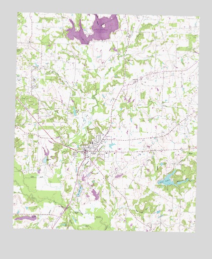
Quitman, TX USGS Topographic Map
Click on map above to begin viewing in our Map Viewer.

This topographic map contains these locations and features:
Feature Name Type Latitude Longitude GNIS ID View Map
Alba - Golden Alternative SchoolSchoolN32.7960°W95.4316°2009296View Map
Aley Wine LakeLakeN32.7624°W95.4649°1372267View Map
Andrews LakeReservoirN32.7901°W95.4790°1862872View Map
Brushy CreekStreamN32.8573°W95.4522°1372772View Map
Brushy LakeLakeN32.7528°W95.4511°1372777View Map
Cana SchoolSchoolN32.8576°W95.4913°1372903View Map
Caney CreekStreamN32.7987°W95.4636°1372918View Map
Carter CreekStreamN32.8518°W95.4269°1372962View Map
Chinquapin BranchStreamN32.7862°W95.3897°1373091View Map
City of QuitmanCivilN32.7951°W95.4442°2411510View Map
Cloverhill ChurchChurchN32.8623°W95.4227°1373143View Map
Coats Oil FieldOilfieldN32.8412°W95.4069°1373150View Map
Crystal Lake DamDamN32.7885°W95.4802°1862871View Map
Dry CreekStreamN32.7649°W95.4669°1373470View Map
Duck Pond BranchStreamN32.7632°W95.4177°1373493View Map
East Texas Medical CenterHospitalN32.7970°W95.4441°2718902View Map
First Baptist ChurchChurchN32.7979°W95.4500°2024872View Map
Forest HillPopulated PlaceN32.8365°W95.4180°1380854View Map
Forkview LakeReservoirN32.7934°W95.4780°1862870View Map
Forkview Lake DamDamN32.7918°W95.4786°1862869View Map
George SloughLakeN32.7809°W95.4839°1373826View Map
Glade BranchStreamN32.8665°W95.4422°1373842View Map
Graveyard BranchStreamN32.7521°W95.4361°1373900View Map
Greens LakeReservoirN32.8175°W95.4594°1373921View Map
Greens Lake DamDamN32.8168°W95.4586°1856128View Map
Hannah LakeLakeN32.7610°W95.4563°1373990View Map
Harris LakeReservoirN32.7818°W95.4282°1856109View Map
Harris Lake B DamDamN32.7801°W95.4302°1856108View Map
Herrin LakeReservoirN32.7531°W95.4653°1374044View Map
Ima Hogg MuseumBuildingN32.7912°W95.4532°2632174View Map
Ingram CemeteryCemeteryN32.8262°W95.4341°1374224View Map
Lake LydiaReservoirN32.7801°W95.3949°1374766View Map
Lake Lydia DamDamN32.7785°W95.4002°1856112View Map
Lake QuitmanReservoirN32.8666°W95.4461°1856111View Map
Lake TimadoReservoirN32.7568°W95.4819°1856107View Map
Lake Timado DamDamN32.7568°W95.4819°1856106View Map
Little Dry CreekStreamN32.8132°W95.4466°1374576View Map
Merigale-Paul Oil FieldOilfieldN32.8018°W95.4044°1374884View Map
Muddy CreekStreamN32.8351°W95.4427°1375052View Map
Muddy Creek ChurchChurchN32.8490°W95.4247°1375053View Map
Myrtle Springs BranchStreamN32.8262°W95.4463°1375088View Map
Myrtle Springs ChurchChurchN32.8426°W95.4855°1375089View Map
New Wells Dam Number 1DamN32.7701°W95.4536°1856100View Map
New Wells LakeReservoirN32.7732°W95.4550°1856101View Map
Peyton CemeteryCemeteryN32.8168°W95.4611°1375433View Map
Price CemeteryCemeteryN32.8573°W95.4647°1375564View Map
QuitmanPopulated PlaceN32.7960°W95.4511°1375601View Map
Quitman City HallBuildingN32.7961°W95.4486°2753895View Map
Quitman Club LakeReservoirN32.7793°W95.3848°1375602View Map
Quitman Club Lake DamDamN32.7785°W95.3869°1856114View Map
Quitman DivisionCivilN32.8467°W95.4604°1939117View Map
Quitman Elementary SchoolSchoolN32.7960°W95.4380°2009261View Map
Quitman Fire DepartmentBuildingN32.7961°W95.4484°2655279View Map
Quitman High SchoolSchoolN32.7960°W95.4316°2009262View Map
Quitman Junior High SchoolSchoolN32.7960°W95.4316°2009263View Map
Quitman Oil FieldOilfieldN32.8337°W95.4886°1375604View Map
Quitman Police DepartmentBuildingN32.7935°W95.4515°2751139View Map
Quitman Post OfficePost OfficeN32.7967°W95.4491°2731843View Map
Salt BranchStreamN32.7707°W95.4938°1375927View Map
Shield LakeReservoirN32.7893°W95.3993°1376096View Map
Shiloh BranchStreamN32.7774°W95.4038°1376098View Map
Shiloh CemeteryCemeteryN32.7971°W95.4050°1376101View Map
Shiloh ChurchChurchN32.7912°W95.4086°1376103View Map
Stinson Home- Honeymoon Cottage MuseumBuildingN32.7915°W95.4519°2014360View Map
The Church of Jesus Christ of Latter Day SaintsChurchN32.7754°W95.4488°2024879View Map
Turman BranchStreamN32.7651°W95.4705°1376535View Map
Vinson Branch LibraryBuildingN32.7854°W95.4230°2014744View Map
Wells Dam Number 4DamN32.7668°W95.4419°1856102View Map
Wells Dam Number 5DamN32.7718°W95.4402°1856104View Map
Wells LakeLakeN32.7563°W95.4582°1376677View Map
Wells Lake Number 2ReservoirN32.7801°W95.4524°1863753View Map
Wells Lake Number 2 DamDamN32.7801°W95.4536°1863752View Map
Wells Lake Number 4ReservoirN32.7668°W95.4419°1856103View Map
Wells Lake Number 5ReservoirN32.7718°W95.4402°1856105View Map
West University Branch LibraryBuildingN32.8037°W95.4377°2014753View Map
Wood CountyCivilN32.7864°W95.3821°1384035View Map
Wood County Alternative SchoolSchoolN32.7960°W95.4316°2009298View Map
Wood County Constable's Office Precinct 1BuildingN32.7928°W95.4537°2751525View Map
Wood County Dam Number 1DamN32.8585°W95.4502°1856110View Map
Wood County JailBuildingN32.7931°W95.4536°2738685View Map
Wood County Sheriff's OfficeBuildingN32.7931°W95.4539°2751236View Map

Note: Coordinates in the location and feature list above are referenced to NAD83 datum.


Copyright (C) 2008-2025 Ryan Niemi / Sunset Dynamics ... All Rights Reserved