TopoQuest Logo
Do you find TopoQuest useful?
Help keep TopoQuest running and adding new maps/features by donating!
Bitcoin:  19c7KJd3qBynnjoSw5npx9KScwjBe4ifkT
Litecoin:  LXs6TkuXGGXo1vDsWCkWVdjQX94eUKd6ui
Home View Maps Find Maps Find Places Resources & Links


Centralia, Texas Topographic Map

USGS Map Title: Centralia, TX
USGS Map MRC: 31095C1
DRG (GeoTIFF) Download: o31095c1.tif


Neighboring USGS Topographic Map Quads:


  Ratcliff, TX  
31095D2
 

  Kennard NE, TX  
31095D1
 

  Wells, TX  
31094D8
 

  Kennard, TX  
31095C2
 

  Centralia, TX  
31095C1
 

  Wells SW, TX  
31094C8
 

  Pennington, TX  
31095B2
 

  Crecy, TX  
31095B1
 

  Apple Springs, TX  
31094B8


Map MRC Location:

N32°
W96°
N32°
W95°
H8 H7 H6 H5 H4 H3 H2 H1
G8 G7 G6 G5 G4 G3 G2 G1
F8 F7 F6 F5 F4 F3 F2 F1
E8 E7 E6 E5 E4 E3 E2 E1
D8 D7 D6 D5 D4 D3 D2 D1
C8 C7 C6 C5 C4 C3 C2 C1
B8 B7 B6 B5 B4 B3 B2 B1
A8 A7 A6 A5 A4 A3 A2 A1
N31°
W96°
N31°
W95°

Centralia, TX USGS 1:24K Topographic Map Preview:
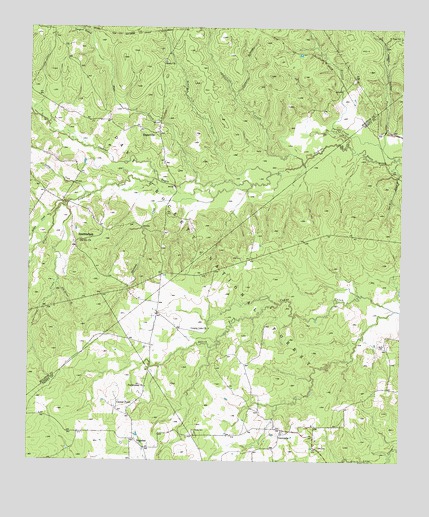
Centralia, TX USGS Topographic Map
Click on map above to begin viewing in our Map Viewer.

This topographic map contains these locations and features:
Feature Name Type Latitude Longitude GNIS ID View Map
4 - C National Recreation Hiking TrailTrailN31.3421°W95.1033°2032979View Map
Armstrong CreekStreamN31.3313°W95.0816°1381336View Map
Brown Lee Hill (historical)SummitN31.3227°W95.0791°1383233View Map
Brushy CreekStreamN31.3330°W95.0441°1381535View Map
Burke CemeteryCemeteryN31.2838°W95.0077°1381556View Map
Calvary CemeteryCemeteryN31.2588°W95.0691°1381567View Map
Center PointLocaleN31.2649°W95.0949°1381616View Map
Center PointPopulated PlaceN31.2632°W95.0916°2034853View Map
CentraliaPopulated PlaceN31.2580°W95.0399°1381623View Map
Centralia Post OfficePost OfficeN31.2594°W95.0397°2731679View Map
Colbert Branch SchoolSchoolN31.3249°W95.1166°1383247View Map
Copperas BranchStreamN31.3557°W95.0560°1381697View Map
County Line ChurchChurchN31.2885°W95.0641°1381708View Map
Davy Crockett National ForestForestN31.2971°W95.1021°1383230View Map
Dickey CreekStreamN31.3274°W95.1063°1381762View Map
Enon CemeteryCemeteryN31.3660°W95.0805°1383248View Map
Enon ChurchChurchN31.3655°W95.0791°1381845View Map
Enon School (historical)SchoolN31.3652°W95.0805°1383249View Map
Garrison CreekStreamN31.3296°W95.0505°1381905View Map
Hager CreekStreamN31.3313°W95.0691°1383101View Map
Hager CreekStreamN31.3232°W95.1127°1381957View Map
HagervillePopulated PlaceN31.3446°W95.0813°1381958View Map
Hagerville Baptist Church (historical)ChurchN31.3449°W95.0819°1383253View Map
Hagerville Post Office (historical)Post OfficeN31.3449°W95.0819°1385460View Map
Hagerville SchoolSchoolN31.3449°W95.0816°1383250View Map
Helton CreekStreamN31.3221°W95.1166°1381989View Map
Indian CreekStreamN31.3366°W95.0335°1382062View Map
Ivie Baptist Church CemeteryCemeteryN31.3143°W95.1085°1383246View Map
Lundy Post Office (historical)Post OfficeN31.3321°W95.1152°1385459View Map
Lundy School (historical)SchoolN31.3357°W95.1238°1383254View Map
Mount Pisgah CemeteryCemeteryN31.3730°W95.0008°1382345View Map
NogalusPopulated PlaceN31.2555°W95.0883°1382400View Map
Old Ivy Baptist ChurchChurchN31.3141°W95.1074°1382424View Map
Pentecostal ChurchChurchN31.2716°W95.0855°1382478View Map
Pile Driver CreekStreamN31.3013°W95.1158°1382501View Map
Rice CemeteryCemeteryN31.3085°W95.0538°1383558View Map
StubblefieldPopulated PlaceN31.3143°W95.1099°1388221View Map
Stubblefield Baptist Church (historical)ChurchN31.3132°W95.1102°1383245View Map
Stubblefield School (historical)SchoolN31.3180°W95.1113°1383234View Map
Sugar MoundsSummitN31.3355°W95.0999°1383343View Map
Tanyard BranchStreamN31.3730°W95.1047°1383196View Map
Tar Kiln BranchStreamN31.3368°W95.0013°1382846View Map
Tullos CemeteryCemeteryN31.2544°W95.0280°1382887View Map
Woodman of the World Lodge (historical)BuildingN31.3449°W95.0819°1383251View Map

Note: Coordinates in the location and feature list above are referenced to NAD83 datum.


Copyright (C) 2008-2025 Ryan Niemi / Sunset Dynamics ... All Rights Reserved