TopoQuest Logo
Do you find TopoQuest useful?
Help keep TopoQuest running and adding new maps/features by donating!
Bitcoin:  19c7KJd3qBynnjoSw5npx9KScwjBe4ifkT
Litecoin:  LXs6TkuXGGXo1vDsWCkWVdjQX94eUKd6ui
Home View Maps Find Maps Find Places Resources & Links


Ratcliff, Texas Topographic Map

USGS Map Title: Ratcliff, TX
USGS Map MRC: 31095D2
DRG (GeoTIFF) Download: o31095d2.tif


Neighboring USGS Topographic Map Quads:


  Augusta, TX  
31095E3
 

  Weches, TX  
31095E2
 

  Forest, TX  
31095E1
 

  Crockett NE, TX  
31095D3
 

  Ratcliff, TX  
31095D2
 

  Kennard NE, TX  
31095D1
 

  Berea, TX  
31095C3
 

  Kennard, TX  
31095C2
 

  Centralia, TX  
31095C1


Map MRC Location:

N32°
W96°
N32°
W95°
H8 H7 H6 H5 H4 H3 H2 H1
G8 G7 G6 G5 G4 G3 G2 G1
F8 F7 F6 F5 F4 F3 F2 F1
E8 E7 E6 E5 E4 E3 E2 E1
D8 D7 D6 D5 D4 D3 D2 D1
C8 C7 C6 C5 C4 C3 C2 C1
B8 B7 B6 B5 B4 B3 B2 B1
A8 A7 A6 A5 A4 A3 A2 A1
N31°
W96°
N31°
W95°

Ratcliff, TX USGS 1:24K Topographic Map Preview:
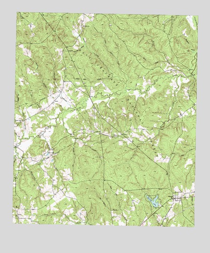
Ratcliff, TX USGS Topographic Map
Click on map above to begin viewing in our Map Viewer.

This topographic map contains these locations and features:
Feature Name Type Latitude Longitude GNIS ID View Map
Adeline SpringsSpringN31.4291°W95.1791°1383288View Map
Beaver CreekStreamN31.4560°W95.1722°1381378View Map
Bethel CemeteryCemeteryN31.4293°W95.2030°1381401View Map
Bethel ChurchChurchN31.4299°W95.1908°1381403View Map
Bethel Methodist ChurchChurchN31.4330°W95.2497°1383295View Map
Blue LakeLakeN31.4671°W95.1272°1383287View Map
Boatwright CreekStreamN31.4168°W95.2477°1381470View Map
Brent CemeteryCemeteryN31.4180°W95.1869°1383301View Map
Brown CreekStreamN31.4285°W95.2302°1381521View Map
BurrantownPopulated PlaceN31.4927°W95.2049°1381557View Map
Camp Four (historical)LocaleN31.4571°W95.1774°1383278View Map
Cedar Point ChurchChurchN31.4352°W95.2458°1381612View Map
CenterLocaleN31.3802°W95.2466°1381613View Map
Center HillPopulated PlaceN31.3802°W95.2472°1383339View Map
Center Hill Methodist ChurchChurchN31.3796°W95.2466°1383285View Map
Center Ridge School (historical)SchoolN31.3838°W95.2372°1383300View Map
Chinguapin BranchStreamN31.4443°W95.2119°1381631View Map
Conner CemeteryCemeteryN31.4388°W95.1399°1381689View Map
Cook LakeLakeN31.4163°W95.2271°1381692View Map
Copperas Spring School (historical)SchoolN31.4777°W95.2169°1383303View Map
Copperas Springs BranchStreamN31.4810°W95.2019°1381699View Map
Copperas Springs Missionary Baptist ChurchChurchN31.4768°W95.2172°1383304View Map
CreathPopulated PlaceN31.4480°W95.2233°1381713View Map
Creath Post Office (historical)Post OfficeN31.4474°W95.2227°1385467View Map
Cross Roads School (historical)SchoolN31.3985°W95.2247°1383291View Map
Gin BranchStreamN31.4377°W95.2213°1381915View Map
Gum CreekStreamN31.4252°W95.2458°1383099View Map
Harrison TownPopulated PlaceN31.4013°W95.2230°1383340View Map
Joe BranchStreamN31.4260°W95.2077°1382081View Map
Johnson CreekStreamN31.4474°W95.2483°1383116View Map
Kennard Mills (historical)LocaleN31.3860°W95.1494°1383283View Map
Little Beaver CreekStreamN31.4593°W95.1738°1382161View Map
Lone Star Private SchoolSchoolN31.4330°W95.2497°1383296View Map
Merkel CreekStreamN31.4724°W95.1455°1382276View Map
Mill School (historical)SchoolN31.3905°W95.1485°1383281View Map
Moffit Creath CemeteryCemeteryN31.4421°W95.2302°1383293View Map
Old CemeteryCemeteryN31.3963°W95.1374°1383279View Map
Old CemeteryCemeteryN31.4202°W95.2236°1383297View Map
Old Patton CemeteryCemeteryN31.4488°W95.1966°1383305View Map
Old Zion CemeteryCemeteryN31.4155°W95.1894°1382436View Map
Old Zion CreekStreamN31.4430°W95.2088°1382437View Map
Parker BranchStreamN31.4257°W95.2441°1383145View Map
Parker Private School (historical)SchoolN31.4371°W95.2416°1383294View Map
Patton Family GravesCemeteryN31.4146°W95.2419°1383302View Map
Pigeon Roost BranchStreamN31.4632°W95.1830°1382499View Map
Pond CampLocaleN31.4938°W95.1736°1383609View Map
RatcliffPopulated PlaceN31.3916°W95.1397°1382593View Map
Ratcliff Baptist ChurchChurchN31.3916°W95.1394°1383280View Map
Ratcliff DamDamN31.3868°W95.1519°1860723View Map
Ratcliff Depot (historical)BuildingN31.3857°W95.1438°1383282View Map
Ratcliff LakeReservoirN31.3896°W95.1532°1382594View Map
Ratcliff Lake Recreation SiteLocaleN31.3843°W95.1535°1383761View Map
Ratcliff Lake TrailTrailN31.3902°W95.1533°2033252View Map
Ratcliff Post OfficePost OfficeN31.3920°W95.1390°2731692View Map
Red Lick FordCrossingN31.4646°W95.1288°1383299View Map
Rosy BayouStreamN31.4210°W95.2488°1383170View Map
Rye Spring BranchStreamN31.3843°W95.1752°1382670View Map
Sikes CreekStreamN31.4221°W95.1252°1382760View Map
Smith CreekStreamN31.4960°W95.2444°1383014View Map
Sulphur Springs School Number 4 (historical)SchoolN31.4752°W95.1505°1383284View Map
TadmorPopulated PlaceN31.4291°W95.1758°1382840View Map
Tadmor ChurchChurchN31.4288°W95.1822°1382841View Map
Tadmor SchoolSchoolN31.4302°W95.1838°1383298View Map
Tadmor School (historical)SchoolN31.4280°W95.1811°1383286View Map
Vaughn Family GravesCemeteryN31.4241°W95.1669°1383290View Map
W.D. McKinney Cotton Gin (historical)BuildingN31.4468°W95.1263°1383306View Map
Wallace SpringsSpringN31.4282°W95.1738°1383289View Map
Walnut CreekStreamN31.4749°W95.1269°1383206View Map
Walnut Creek CampLocaleN31.4818°W95.1469°1383762View Map
Whiteley CreekStreamN31.4638°W95.1380°1382958View Map
Wilcox BranchStreamN31.4499°W95.2169°1382961View Map
Wilcox Branch and Chinquapin MergeBendN31.4499°W95.2174°1383292View Map
Windbush BranchStreamN31.4780°W95.1258°1382983View Map

Note: Coordinates in the location and feature list above are referenced to NAD83 datum.


Copyright (C) 2008-2025 Ryan Niemi / Sunset Dynamics ... All Rights Reserved