TopoQuest Logo
Do you find TopoQuest useful?
Help keep TopoQuest running and adding new maps/features by donating!
Bitcoin:  19c7KJd3qBynnjoSw5npx9KScwjBe4ifkT
Litecoin:  LXs6TkuXGGXo1vDsWCkWVdjQX94eUKd6ui
Home View Maps Find Maps Find Places Resources & Links


Cox Flat, Oregon Topographic Map

USGS Map Title: Cox Flat, OR
USGS Map MRC: 42120C5
DRG (GeoTIFF) Download: o42120c5.tif


Neighboring USGS Topographic Map Quads:


  Coleman Point, OR  
42120D6
 

  Shoestring Butte, OR  
42120D5
 

  Clover Flat, OR  
42120D4
 

  Cougar Peak, OR  
42120C6
 

  Cox Flat, OR  
42120C5
 

  Big Baldy, OR  
42120C4
 

  Drews Reservoir, OR  
42120B6
 

  Drews Gap, OR  
42120B5
 

  Lakeview Airport, OR  
42120B4


Map MRC Location:

N43°
W121°
N43°
W120°
H8 H7 H6 H5 H4 H3 H2 H1
G8 G7 G6 G5 G4 G3 G2 G1
F8 F7 F6 F5 F4 F3 F2 F1
E8 E7 E6 E5 E4 E3 E2 E1
D8 D7 D6 D5 D4 D3 D2 D1
C8 C7 C6 C5 C4 C3 C2 C1
B8 B7 B6 B5 B4 B3 B2 B1
A8 A7 A6 A5 A4 A3 A2 A1
N42°
W121°
N42°
W120°

Cox Flat, OR USGS 1:24K Topographic Map Preview:
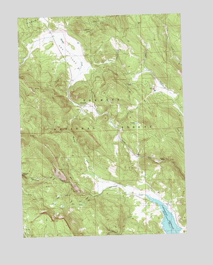
Cox Flat, OR USGS Topographic Map
Click on map above to begin viewing in our Map Viewer.

This topographic map contains these locations and features:
Feature Name Type Latitude Longitude GNIS ID View Map
Boggs SpringSpringN42.3697°W120.5341°1138380View Map
Cold CreekStreamN42.2768°W120.5869°1139911View Map
Cottonwood Creek TrailheadLocaleN42.2731°W120.5674°2548760View Map
Cottonwood ReservoirReservoirN42.2562°W120.5145°1140191View Map
Cottonwood Reservoir County ParkParkN42.2534°W120.5072°2022187View Map
Cougar SpringsSpringN42.3154°W120.6205°1155827View Map
Cox FlatFlatN42.3538°W120.5889°1140300View Map
Garrett PlaceLocaleN42.2954°W120.5380°1142582View Map
Helphenstein CreekStreamN42.2685°W120.5277°1143471View Map
Hunters SpringSpringN42.2921°W120.5164°1143948View Map
Irishmans CampgroundLocaleN42.3718°W120.5647°1144110View Map
Lucky Lass MineMineN42.3357°W120.5405°1145663View Map
Mesman CreekStreamN42.2782°W120.5516°1146113View Map
Paradise LakeLakeN42.3131°W120.5369°1147418View Map
Snake SpringSpringN42.3721°W120.5150°1153765View Map
Thomas Creek Campground (historical)LocaleN42.3254°W120.5747°1151077View Map
Tom Young CreekStreamN42.2732°W120.5719°1151319View Map
White King MineMineN42.3327°W120.5219°1152237View Map

Note: Coordinates in the location and feature list above are referenced to NAD83 datum.


Copyright (C) 2008-2025 Ryan Niemi / Sunset Dynamics ... All Rights Reserved