TopoQuest Logo
Do you find TopoQuest useful?
Help keep TopoQuest running and adding new maps/features by donating!
Bitcoin:  19c7KJd3qBynnjoSw5npx9KScwjBe4ifkT
Litecoin:  LXs6TkuXGGXo1vDsWCkWVdjQX94eUKd6ui
Home View Maps Find Maps Find Places Resources & Links


Dissen, Missouri Topographic Map

USGS Map Title: Dissen, MO
USGS Map MRC: 38091E3
DRG (GeoTIFF) Download: o38091e3.tif


Neighboring USGS Topographic Map Quads:


  Hermann, MO  
38091F4
 

  Berger, MO  
38091F3
 

  Treloar, MO  
38091F2
 

  Swiss, MO  
38091E4
 

  Dissen, MO  
38091E3
 

  New Haven, MO  
38091E2
 

  Rosebud, MO  
38091D4
 

  Gerald, MO  
38091D3
 

  Leslie, MO  
38091D2


Map MRC Location:

N39°
W92°
N39°
W91°
H8 H7 H6 H5 H4 H3 H2 H1
G8 G7 G6 G5 G4 G3 G2 G1
F8 F7 F6 F5 F4 F3 F2 F1
E8 E7 E6 E5 E4 E3 E2 E1
D8 D7 D6 D5 D4 D3 D2 D1
C8 C7 C6 C5 C4 C3 C2 C1
B8 B7 B6 B5 B4 B3 B2 B1
A8 A7 A6 A5 A4 A3 A2 A1
N38°
W92°
N38°
W91°

Dissen, MO USGS 1:24K Topographic Map Preview:
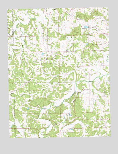
Dissen, MO USGS Topographic Map
Click on map above to begin viewing in our Map Viewer.

This topographic map contains these locations and features:
Feature Name Type Latitude Longitude GNIS ID View Map
Adventist Church (historical)ChurchN38.5689°W91.3343°730566View Map
Ben J Koch LakeReservoirN38.5285°W91.3514°764629View Map
Big BranchStreamN38.5536°W91.2920°714142View Map
Cedar ForkStreamN38.5342°W91.3077°731552View Map
Cedar Grove SchoolSchoolN38.5306°W91.3410°747942View Map
Chester Mayer LakeReservoirN38.5076°W91.2982°764627View Map
Dahl CemeteryCemeteryN38.5912°W91.3729°716634View Map
DetmoldPopulated PlaceN38.5428°W91.2904°731561View Map
Detmold CemeteryCemeteryN38.5386°W91.2935°2702120View Map
Detmold SchoolSchoolN38.5350°W91.2843°747945View Map
DissenPopulated PlaceN38.5598°W91.2760°716915View Map
Ebenezer Stone Church CemeteryCemeteryN38.5115°W91.3185°2702121View Map
Ebenezer United Church of ChristChurchN38.5120°W91.3188°727132View Map
Etlah KnobsRangeN38.6147°W91.2742°717637View Map
Excelsior SchoolSchoolN38.5717°W91.2843°747944View Map
Fork CreekStreamN38.6067°W91.3643°729491View Map
Good Hope SchoolSchoolN38.5792°W91.3446°747941View Map
Grant SchoolSchoolN38.6134°W91.3007°747943View Map
Helling CemeteryCemeteryN38.5712°W91.3204°719350View Map
Kaiser HillSummitN38.6006°W91.2924°720466View Map
Koch Lake DamDamN38.5284°W91.3502°764628View Map
Kohl CityPopulated PlaceN38.5984°W91.3646°731598View Map
Kohlbush CemeteryCemeteryN38.5742°W91.3332°720687View Map
Laschke Lake DamDamN38.5900°W91.2768°764624View Map
Lyon SchoolSchoolN38.6209°W91.3446°747940View Map
Maria Vista RetreatChurchN38.6120°W91.2535°721862View Map
Meyer Lake DamDamN38.5084°W91.2985°764626View Map
Meyers CemeteryCemeteryN38.5839°W91.3049°739967View Map
New Haven - Berger Fire Protection District Station 3BuildingN38.5439°W91.3717°2621617View Map
Prairie ForkStreamN38.5528°W91.2721°724846View Map
R-2 SchoolSchoolN38.5759°W91.2815°725034View Map
Roadside LakeReservoirN38.6064°W91.2787°725371View Map
Roadside Lake DamDamN38.6067°W91.2768°764884View Map
Sellenriek DamDamN38.5817°W91.3318°764885View Map
Senate Grove (historical)Populated PlaceN38.5756°W91.3279°740073View Map
Senate Grove ChurchChurchN38.5962°W91.3274°726199View Map
Stony HillPopulated PlaceN38.5428°W91.3738°727147View Map
Stony Hill ChurchChurchN38.5459°W91.3679°730567View Map
Strubberg Lake DamDamN38.5234°W91.3018°764625View Map
Township of BoeufCivilN38.6129°W91.2781°766643View Map

Note: Coordinates in the location and feature list above are referenced to NAD83 datum.


Copyright (C) 2008-2025 Ryan Niemi / Sunset Dynamics ... All Rights Reserved