TopoQuest Logo
Do you find TopoQuest useful?
Help keep TopoQuest running and adding new maps/features by donating!
Bitcoin:  19c7KJd3qBynnjoSw5npx9KScwjBe4ifkT
Litecoin:  LXs6TkuXGGXo1vDsWCkWVdjQX94eUKd6ui
Home View Maps Find Maps Find Places Resources & Links


Dublin, Kentucky Topographic Map

USGS Map Title: Dublin, KY
USGS Map MRC: 36088F7
DRG (GeoTIFF) Download: o36088f7.tif


Neighboring USGS Topographic Map Quads:


  Milburn, KY  
36088G8
 

  Fancy Farm, KY  
36088G7
 

  Hickory, KY  
36088G6
 

  Clinton, KY  
36088F8
 

  Dublin, KY  
36088F7
 

  Mayfield, KY  
36088F6
 

  Crutchfield, KY  
36088E8
 

  Water Valley, KY  
36088E7
 

  Cuba, KY  
36088E6


Map MRC Location:

N37°
W89°
N37°
W88°
H8 H7 H6 H5 H4 H3 H2 H1
G8 G7 G6 G5 G4 G3 G2 G1
F8 F7 F6 F5 F4 F3 F2 F1
E8 E7 E6 E5 E4 E3 E2 E1
D8 D7 D6 D5 D4 D3 D2 D1
C8 C7 C6 C5 C4 C3 C2 C1
B8 B7 B6 B5 B4 B3 B2 B1
A8 A7 A6 A5 A4 A3 A2 A1
N36°
W89°
N36°
W88°

Dublin, KY USGS 1:24K Topographic Map Preview:
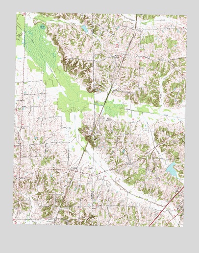
Dublin, KY USGS Topographic Map
Click on map above to begin viewing in our Map Viewer.

This topographic map contains these locations and features:
Feature Name Type Latitude Longitude GNIS ID View Map
BaltimorePopulated PlaceN36.6876°W88.8059°507446View Map
Baltimore ChurchChurchN36.6759°W88.8170°486308View Map
Brush CreekStreamN36.6984°W88.8323°488070View Map
Cane CreekStreamN36.6926°W88.7814°488770View Map
Clapp CreekStreamN36.6912°W88.7687°489525View Map
Clark CemeteryCemeteryN36.6326°W88.8701°489532View Map
DublinPopulated PlaceN36.7253°W88.8023°491246View Map
Dublin CemeteryCemeteryN36.7234°W88.8106°2775606View Map
Fancy Farm DivisionCivilN36.7451°W88.7670°1936996View Map
FulghamPopulated PlaceN36.6528°W88.8703°492602View Map
Fulgham Fire DepartmentBuildingN36.6525°W88.8729°2637274View Map
HolifieldPopulated PlaceN36.6617°W88.7892°494391View Map
Hopkins CemeteryCemeteryN36.6366°W88.8042°2775622View Map
Jackson Chapel ChurchChurchN36.6282°W88.8444°495116View Map
Lain-Scholes CemeteryCemeteryN36.6817°W88.7682°2775604View Map
Little Joe CreekStreamN36.7384°W88.8687°496772View Map
Little Obion CemeteryCemeteryN36.6583°W88.7760°2775595View Map
Little Obion ChurchChurchN36.6584°W88.7764°496819View Map
Mason CemeteryCemeteryN36.7222°W88.8183°2775605View Map
McClure ChapelChurchN36.6587°W88.8195°497792View Map
Mount Olive CemeteryCemeteryN36.7196°W88.7591°2775609View Map
Mount Olive ChurchChurchN36.7195°W88.7595°498789View Map
Murphy PondLakeN36.7415°W88.8555°499115View Map
New Bethel ChurchChurchN36.6339°W88.8712°499280View Map
NicholsPopulated PlaceN36.6937°W88.8698°508703View Map
Obion CemeteryCemeteryN36.6753°W88.7589°2775603View Map
Obion ChurchChurchN36.6753°W88.7587°499764View Map
Old Wingo - Greer CemeteryCemeteryN36.6482°W88.7522°2775597View Map
Pleasant Valley CemeteryCemeteryN36.6981°W88.8691°2775592View Map
Pleasant Valley ChurchChurchN36.6976°W88.8689°500924View Map
Price CemeteryCemeteryN36.6978°W88.7606°501317View Map
Salem CemeteryCemeteryN36.6825°W88.8702°2775593View Map
Salem ChurchChurchN36.6822°W88.8693°502776View Map
Watts StationLocaleN36.6587°W88.8281°506299View Map
Wingo Rural Fire Department Station 2 DublinBuildingN36.7249°W88.8032°2637205View Map

Note: Coordinates in the location and feature list above are referenced to NAD83 datum.


Copyright (C) 2008-2024 Ryan Niemi / Sunset Dynamics ... All Rights Reserved