TopoQuest Logo
Do you find TopoQuest useful?
Help keep TopoQuest running and adding new maps/features by donating!
Bitcoin:  19c7KJd3qBynnjoSw5npx9KScwjBe4ifkT
Litecoin:  LXs6TkuXGGXo1vDsWCkWVdjQX94eUKd6ui
Home View Maps Find Maps Find Places Resources & Links


Fall Creek, Wisconsin Topographic Map

USGS Map Title: Fall Creek, WI
USGS Map MRC: 44091G3
DRG (GeoTIFF) Download: o44091g3.tif


Neighboring USGS Topographic Map Quads:


  Chippewa Falls, WI  
44091H4
 

  Lake Wissota, WI  
44091H3
 

  Cadott, WI  
44091H2
 

  Eau Claire East, WI  
44091G4
 

  Fall Creek, WI  
44091G3
 

  Lake Eau Claire West, WI  
44091G2
 

  Cleghorn, WI  
44091F4
 

  Brackett, WI  
44091F3
 

  Augusta West, WI  
44091F2


Map MRC Location:

N45°
W92°
N45°
W91°
H8 H7 H6 H5 H4 H3 H2 H1
G8 G7 G6 G5 G4 G3 G2 G1
F8 F7 F6 F5 F4 F3 F2 F1
E8 E7 E6 E5 E4 E3 E2 E1
D8 D7 D6 D5 D4 D3 D2 D1
C8 C7 C6 C5 C4 C3 C2 C1
B8 B7 B6 B5 B4 B3 B2 B1
A8 A7 A6 A5 A4 A3 A2 A1
N44°
W92°
N44°
W91°

Fall Creek, WI USGS 1:24K Topographic Map Preview:
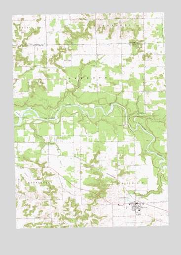
Fall Creek, WI USGS Topographic Map
Click on map above to begin viewing in our Map Viewer.

This topographic map contains these locations and features:
Feature Name Type Latitude Longitude GNIS ID View Map
Beaver CreekStreamN44.8088°W91.2713°1561449View Map
Big FallsFallsN44.8208°W91.2943°1561718View Map
Bluff School (historical)SchoolN44.8714°W91.2852°1578385View Map
Bourman School (historical)SchoolN44.8447°W91.3677°1578421View Map
Connell's OrchardLocaleN44.8731°W91.2786°2611787View Map
Countryside Manor Mobile Home ParkPopulated PlaceN44.7903°W91.3733°2555277View Map
Culbert School (historical)SchoolN44.8647°W91.3468°1578387View Map
Deinhammer CreekStreamN44.8155°W91.2824°1563867View Map
Fall CreekPopulated PlaceN44.7636°W91.2771°1564839View Map
Fall CreekStreamN44.7836°W91.2554°1564841View Map
Fall Creek Area Fire DistrictBuildingN44.7623°W91.2697°2697771View Map
Fall Creek Elementary SchoolSchoolN44.7589°W91.2729°2715857View Map
Fall Creek High SchoolSchoolN44.7589°W91.2729°1846664View Map
Fall Creek Middle SchoolSchoolN44.7590°W91.2729°2715690View Map
Fall Creek Police DepartmentBuildingN44.7623°W91.2697°2759523View Map
Fall Creek PondReservoirN44.7667°W91.2823°1564842View Map
Fall Creek ValleyValleyN44.7812°W91.2552°1846665View Map
Hager FarmLocaleN44.8561°W91.2958°2711438View Map
Hillyview School (historical)SchoolN44.7555°W91.3465°1578429View Map
J and J Tree FarmLocaleN44.7678°W91.3283°2727431View Map
Knudston FarmsLocaleN44.7517°W91.2750°2727425View Map
Ninemile CreekStreamN44.8130°W91.3682°1570298View Map
Ninemile CreekStreamN44.8213°W91.3363°1570299View Map
Oakview School (historical)SchoolN44.7883°W91.2904°1578435View Map
Pumpkin ValleyValleyN44.8134°W91.3579°1571973View Map
Saint Bridgets CemeteryCemeteryN44.8447°W91.3060°1572874View Map
Saint Bridgets ChurchChurchN44.8513°W91.3052°1572875View Map
Seymour Central SchoolSchoolN44.8477°W91.3268°1573935View Map
Seymour Town HallBuildingN44.8450°W91.3554°1578440View Map
Springfield Prairie School (historical)SchoolN44.8505°W91.2968°1578442View Map
Sweet Pine FarmLocaleN44.8386°W91.2658°2727435View Map
Top of the Hill FarmLocaleN44.8731°W91.3144°2711497View Map
Town of SeymourCivilN44.8355°W91.3382°1584127View Map
Trinity CemeteryCemeteryN44.7672°W91.2757°1575616View Map
Village of Fall CreekCivilN44.7639°W91.2783°1583188View Map
Vogler Flour Mill DamDamN44.7683°W91.2802°1791678View Map
Washington School (historical)SchoolN44.8005°W91.3468°1578447View Map
WCFW-FM (Chippewa Falls)TowerN44.8716°W91.2865°1582585View Map

Note: Coordinates in the location and feature list above are referenced to NAD83 datum.


Copyright (C) 2008-2025 Ryan Niemi / Sunset Dynamics ... All Rights Reserved