TopoQuest Logo
Do you find TopoQuest useful?
Help keep TopoQuest running and adding new maps/features by donating!
Bitcoin:  19c7KJd3qBynnjoSw5npx9KScwjBe4ifkT
Litecoin:  LXs6TkuXGGXo1vDsWCkWVdjQX94eUKd6ui
Home View Maps Find Maps Find Places Resources & Links


Augusta West, Wisconsin Topographic Map

USGS Map Title: Augusta West, WI
USGS Map MRC: 44091F2
DRG (GeoTIFF) Download: o44091f2.tif


Neighboring USGS Topographic Map Quads:


  Fall Creek, WI  
44091G3
 

  Lake Eau Claire West, WI  
44091G2
 

  Lake Eau Claire East, WI  
44091G1
 

  Brackett, WI  
44091F3
 

  Augusta West, WI  
44091F2
 

  Augusta East, WI  
44091F1
 

  Strum SE, WI  
44091E3
 

  Osseo, WI  
44091E2
 

  Price, WI  
44091E1


Map MRC Location:

N45°
W92°
N45°
W91°
H8 H7 H6 H5 H4 H3 H2 H1
G8 G7 G6 G5 G4 G3 G2 G1
F8 F7 F6 F5 F4 F3 F2 F1
E8 E7 E6 E5 E4 E3 E2 E1
D8 D7 D6 D5 D4 D3 D2 D1
C8 C7 C6 C5 C4 C3 C2 C1
B8 B7 B6 B5 B4 B3 B2 B1
A8 A7 A6 A5 A4 A3 A2 A1
N44°
W92°
N44°
W91°

Augusta West, WI USGS 1:24K Topographic Map Preview:
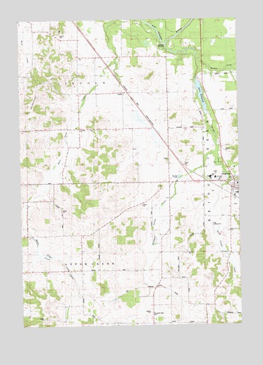
Augusta West, WI USGS Topographic Map
Click on map above to begin viewing in our Map Viewer.

This topographic map contains these locations and features:
Feature Name Type Latitude Longitude GNIS ID View Map
Augusta - Bridge Creek Township Fire DepartmentBuildingN44.6802°W91.1337°2697787View Map
Augusta Elementary SchoolSchoolN44.6851°W91.1387°1846619View Map
Augusta High SchoolSchoolN44.6853°W91.1410°1846620View Map
Augusta Mennonite SchoolSchoolN44.7424°W91.1390°2715795View Map
Augusta Middle SchoolSchoolN44.6852°W91.1410°2715729View Map
Beargrass School (historical)SchoolN44.7058°W91.2163°1846624View Map
Bears Grass DairyLocaleN44.7106°W91.2117°2727275View Map
Bills School (historical)SchoolN44.6258°W91.1454°1846628View Map
Bridge CreekStreamN44.7400°W91.1668°1562195View Map
Browns CreekStreamN44.7336°W91.1488°1562271View Map
Brune FarmsLocaleN44.7142°W91.1272°2727276View Map
Buse FarmsLocaleN44.7317°W91.1664°2727279View Map
Dells Lake DamDamN44.7255°W91.1496°1791732View Map
Dells MillpondReservoirN44.7188°W91.1459°1563886View Map
First Trestle CreekStreamN44.6833°W91.1304°1846674View Map
Gabler FarmsLocaleN44.6939°W91.1839°2727277View Map
Grace Evangelical Lutheran ChurchChurchN44.6852°W91.1277°1846677View Map
Grace Lutheran ChurchChurchN44.6852°W91.1277°1846679View Map
Grandpa's Farm Airport (historical)AirportN44.7019°W91.1340°2444145View Map
Harstad County ParkParkN44.7375°W91.1696°1566102View Map
Lincoln CemeteryCemeteryN44.7436°W91.2268°1568069View Map
Lincoln Valley School (historical)SchoolN44.7344°W91.2107°1846704View Map
Martinson FarmsLocaleN44.6744°W91.1881°2727280View Map
Mayo FarmsLocaleN44.6986°W91.1294°2727281View Map
Moldenhauer HillSummitN44.7272°W91.2257°1569639View Map
Osborn FarmsLocaleN44.7414°W91.2400°2727433View Map
Plain View SchoolSchoolN44.6540°W91.1388°1846733View Map
RodellPopulated PlaceN44.7200°W91.1882°1572523View Map
Rugotzke FarmLocaleN44.7014°W91.2367°2727428View Map
Russell Corners School (historical)SchoolN44.6836°W91.1649°1846749View Map
Saint Anthonys Roman Catholic ChurchChurchN44.6797°W91.1290°1846750View Map
Saint Peter CemeteryCemeteryN44.7050°W91.2076°1846761View Map
Saint Peters ChurchChurchN44.7047°W91.2157°1573536View Map
Scott ValleyValleyN44.6546°W91.2423°1573850View Map
Scott Valley School (historical)SchoolN44.6616°W91.2313°1846765View Map
Sieg Landing Strip (historical)AirportN44.6644°W91.1404°1846770View Map
Skyglo FarmsLocaleN44.6269°W91.1606°2727282View Map
Thompson Valley CemeteryCemeteryN44.6300°W91.1765°1575391View Map
Thompson Valley CreekStreamN44.6958°W91.1377°1846776View Map
Thompson Valley CreekStreamN44.6952°W91.1385°1575393View Map
Thompson Valley School (historical)SchoolN44.6455°W91.1707°1846777View Map
Town of Otter CreekCivilN44.6402°W91.2257°1583882View Map
West Lawn CemeteryCemeteryN44.6844°W91.1338°1846786View Map
Wildlands Charter SchoolSchoolN44.6852°W91.1410°2715701View Map

Note: Coordinates in the location and feature list above are referenced to NAD83 datum.


Copyright (C) 2008-2025 Ryan Niemi / Sunset Dynamics ... All Rights Reserved