TopoQuest Logo
Do you find TopoQuest useful?
Help keep TopoQuest running and adding new maps/features by donating!
Bitcoin:  19c7KJd3qBynnjoSw5npx9KScwjBe4ifkT
Litecoin:  LXs6TkuXGGXo1vDsWCkWVdjQX94eUKd6ui
Home View Maps Find Maps Find Places Resources & Links


Fruitdale, Alabama Topographic Map

USGS Map Title: Fruitdale, AL
USGS Map MRC: 31088C4
DRG (GeoTIFF) Download: o31088c4.tif


Neighboring USGS Topographic Map Quads:


  Knobtown, MS  
31088D5
 

  State Line, MS  
31088D4
 

  Chatom, AL  
31088D3
 

  Clark, MS  
31088C5
 

  Fruitdale, AL  
31088C4
 

  Vinegar Bend, AL  
31088C3
 

  Leakesville, MS  
31088B5
 

  Rounsaville, MS  
31088B4
 

  Deer Park, AL  
31088B3


Map MRC Location:

N32°
W89°
N32°
W88°
H8 H7 H6 H5 H4 H3 H2 H1
G8 G7 G6 G5 G4 G3 G2 G1
F8 F7 F6 F5 F4 F3 F2 F1
E8 E7 E6 E5 E4 E3 E2 E1
D8 D7 D6 D5 D4 D3 D2 D1
C8 C7 C6 C5 C4 C3 C2 C1
B8 B7 B6 B5 B4 B3 B2 B1
A8 A7 A6 A5 A4 A3 A2 A1
N31°
W89°
N31°
W88°

Fruitdale, AL USGS 1:24K Topographic Map Preview:
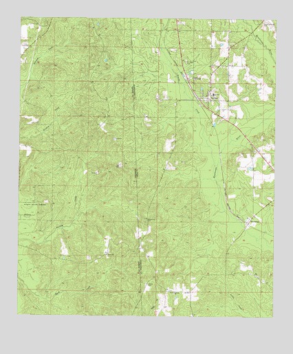
Fruitdale, AL USGS Topographic Map
Click on map above to begin viewing in our Map Viewer.

This topographic map contains these locations and features:
Feature Name Type Latitude Longitude GNIS ID View Map
Brushy CreekStreamN31.3091°W88.4040°115059View Map
Church of the BrethrenChurchN31.3502°W88.4156°116116View Map
EpworthPopulated PlaceN31.2607°W88.4242°138892View Map
Epworth CemeteryCemeteryN31.2602°W88.4236°157560View Map
Epworth United Methodist ChurchChurchN31.2605°W88.4233°118016View Map
Epworth Volunteer Fire DepartmentBuildingN31.2604°W88.4160°2331047View Map
EscatawpaPopulated PlaceN31.2896°W88.3872°118025View Map
Escatawpa Baptist ChurchChurchN31.2918°W88.3881°157561View Map
Escatawpa CemeteryCemeteryN31.2921°W88.3878°157562View Map
FruitdalePopulated PlaceN31.3427°W88.4078°118737View Map
Fruitdale - Yellowpine Volunteer Fire DepartmentBuildingN31.3413°W88.4115°2331097View Map
Fruitdale Baptist ChurchChurchN31.3388°W88.4082°2580467View Map
Fruitdale CemeteryCemeteryN31.3566°W88.4189°118738View Map
Fruitdale Census Designated PlaceCensusN31.3429°W88.4108°2628591View Map
Fruitdale High SchoolSchoolN31.3440°W88.4054°138907View Map
Fruitdale Post OfficePost OfficeN31.3418°W88.4119°166949View Map
Grimes CemeteryCemeteryN31.2638°W88.4361°119419View Map
Kurtz State ForestParkN31.2955°W88.4911°693672View Map
Macedonia Baptist Church (historical)ChurchN31.2902°W88.4370°138770View Map
Macedonia CemeteryCemeteryN31.2907°W88.4370°122143View Map
South Oak Grove CemeteryCemeteryN31.3738°W88.3806°127132View Map
Union Chapel ChurchChurchN31.3446°W88.4072°138839View Map
Westside School (historical)SchoolN31.2630°W88.4295°138849View Map
Williams CemeteryCemeteryN31.2760°W88.4575°679703View Map

Note: Coordinates in the location and feature list above are referenced to NAD83 datum.


Copyright (C) 2008-2024 Ryan Niemi / Sunset Dynamics ... All Rights Reserved