TopoQuest Logo
Do you find TopoQuest useful?
Help keep TopoQuest running and adding new maps/features by donating!
Bitcoin:  19c7KJd3qBynnjoSw5npx9KScwjBe4ifkT
Litecoin:  LXs6TkuXGGXo1vDsWCkWVdjQX94eUKd6ui
Home View Maps Find Maps Find Places Resources & Links


Stewart, Minnesota Topographic Map

USGS Map Title: Stewart, MN
USGS Map MRC: 44094F4
DRG (GeoTIFF) Download: o44094f4.tif


Neighboring USGS Topographic Map Quads:


  Lake Allie, MN  
44094G5
 

  Heatwole, MN  
44094G4
 

  Biscay, MN  
44094G3
 

  Buffalo Lake, MN  
44094F5
 

  Stewart, MN  
44094F4
 

  Brownton, MN  
44094F3
 

  Gibbon, MN  
44094E5
 

  Winthrop SW, MN  
44094E4
 

  Winthrop, MN  
44094E3


Map MRC Location:

N45°
W95°
N45°
W94°
H8 H7 H6 H5 H4 H3 H2 H1
G8 G7 G6 G5 G4 G3 G2 G1
F8 F7 F6 F5 F4 F3 F2 F1
E8 E7 E6 E5 E4 E3 E2 E1
D8 D7 D6 D5 D4 D3 D2 D1
C8 C7 C6 C5 C4 C3 C2 C1
B8 B7 B6 B5 B4 B3 B2 B1
A8 A7 A6 A5 A4 A3 A2 A1
N44°
W95°
N44°
W94°

Stewart, MN USGS 1:24K Topographic Map Preview:
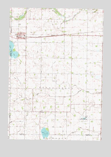
Stewart, MN USGS Topographic Map
Click on map above to begin viewing in our Map Viewer.

This topographic map contains these locations and features:
Feature Name Type Latitude Longitude GNIS ID View Map
City of StewartCivilN44.7235°W94.4869°2395966View Map
County Ditch Number SixtyfourCanalN44.7314°W94.4414°1817755View Map
County Ditch Number ThirtynineCanalN44.6780°W94.4355°1817756View Map
Draeger CemeteryCemeteryN44.6819°W94.3883°2065268View Map
FernandoPopulated PlaceN44.6516°W94.4578°643613View Map
Fernando Post Office (historical)Post OfficeN44.6517°W94.4575°2065374View Map
Glencoe Regional Health Services CenterHospitalN44.7247°W94.4856°2065206View Map
Halls LakebedFlatN44.6986°W94.4892°1817752View Map
Judicial Ditch Number FifteenCanalN44.6422°W94.4797°1817754View Map
Judicial Ditch Number SeventeenCanalN44.6311°W94.4272°1817753View Map
Kujas LakeLakeN44.6460°W94.4000°646273View Map
Kujas Lake State Wildlife Management AreaParkN44.6458°W94.3975°1817747View Map
Nutter LakebedFlatN44.6964°W94.4358°1817748View Map
Remus Trailer LotsPopulated PlaceN44.7247°W94.4856°2065211View Map
Round Grove CemeteryCemeteryN44.7167°W94.4944°2065267View Map
Round Grove LakeReservoirN44.7016°W94.4982°1776160View Map
Round Grove LakeLakeN44.7099°W94.4964°650316View Map
Round Grove Lake DamDamN44.7016°W94.4986°1776159View Map
Saint Boniface CemeteryCemeteryN44.7097°W94.4772°650533View Map
Saint Matthew ChurchChurchN44.6519°W94.4578°1817749View Map
Saint Matthew's CemeteryCemeteryN44.6522°W94.4583°2065266View Map
Showburg LakebedFlatN44.6805°W94.4864°1817751View Map
StewartLocaleN44.7233°W94.4867°2065212View Map
StewartPopulated PlaceN44.7247°W94.4858°652633View Map
Stewart Fire DepartmentBuildingN44.7243°W94.4877°2065207View Map
Stewart Police DepartmentBuildingN44.7241°W94.4876°2065208View Map
Stewart Post OfficePost OfficeN44.7247°W94.4856°2065210View Map
Stewart Village HallBuildingN44.7247°W94.4856°2065209View Map
Township of Round GroveCivilN44.6737°W94.4370°665477View Map
Twin LakebedFlatN44.6652°W94.4822°1817750View Map
Ward LakeLakeN44.6313°W94.4510°653774View Map

Note: Coordinates in the location and feature list above are referenced to NAD83 datum.


Copyright (C) 2008-2025 Ryan Niemi / Sunset Dynamics ... All Rights Reserved