TopoQuest Logo
Do you find TopoQuest useful?
Help keep TopoQuest running and adding new maps/features by donating!
Bitcoin:  19c7KJd3qBynnjoSw5npx9KScwjBe4ifkT
Litecoin:  LXs6TkuXGGXo1vDsWCkWVdjQX94eUKd6ui
Home View Maps Find Maps Find Places Resources & Links


Harmon Butte, Montana Topographic Map

USGS Map Title: Harmon Butte, MT
USGS Map MRC: 46104B6
DRG (GeoTIFF) Download: o46104b6.tif


Neighboring USGS Topographic Map Quads:


  Bracket Butte SE, MT  
46104C7
 

  T G Creek, MT  
46104C6
 

  Little Pine Creek, MT  
46104C5
 

  Nelson Butte, MT  
46104B7
 

  Harmon Butte, MT  
46104B6
 

  Seven-up Butte, MT  
46104B5
 

  Skunk Creek, MT  
46104A7
 

  Piney Butte SW, MT  
46104A6
 

  Piney Butte, MT  
46104A5


Map MRC Location:

N47°
W105°
N47°
W104°
H8 H7 H6 H5 H4 H3 H2 H1
G8 G7 G6 G5 G4 G3 G2 G1
F8 F7 F6 F5 F4 F3 F2 F1
E8 E7 E6 E5 E4 E3 E2 E1
D8 D7 D6 D5 D4 D3 D2 D1
C8 C7 C6 C5 C4 C3 C2 C1
B8 B7 B6 B5 B4 B3 B2 B1
A8 A7 A6 A5 A4 A3 A2 A1
N46°
W105°
N46°
W104°

Harmon Butte, MT USGS 1:24K Topographic Map Preview:
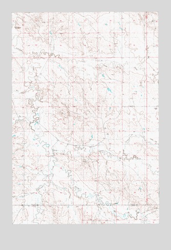
Harmon Butte, MT USGS Topographic Map
Click on map above to begin viewing in our Map Viewer.

This topographic map contains these locations and features:
Feature Name Type Latitude Longitude GNIS ID View Map
05N56E02BB__01 WellWellN46.2208°W104.6755°814644View Map
05N56E04BCB_01 WellWellN46.2181°W104.7144°814634View Map
05N56E08BA__01 WellWellN46.2056°W104.7311°814583View Map
05N56E17DD__01 WellWellN46.1808°W104.7219°814449View Map
05N56E22DABB01 WellWellN46.1719°W104.6827°814373View Map
05N56E22DB__01 WellWellN46.1736°W104.6852°814393View Map
05N56E22DC__01 WellWellN46.1694°W104.6825°814364View Map
05N56E24ABBB01 WellWellN46.1783°W104.6455°814429View Map
05N56E24ADAD01 WellWellN46.1744°W104.6366°814398View Map
05N56E31DAD_01 WellWellN46.1431°W104.7422°814208View Map
05N56E32CBB_01 WellWellN46.1458°W104.7380°814222View Map
05N56E36BAB_01 WellWellN46.1500°W104.6519°814250View Map
05N57E18BAAB01 WellWellN46.1522°W104.6275°814265View Map
7-UP Sea DamDamN46.2050°W104.6305°797490View Map
Ash CreekStreamN46.1844°W104.7372°768365View Map
Harmon ButteSummitN46.2411°W104.7447°799267View Map
Lame Jones CreekStreamN46.2222°W104.7402°773200View Map
Lone Tree CreekStreamN46.1425°W104.7263°799261View Map
MacKenzie (historical)Populated PlaceN46.1572°W104.7133°1688628View Map
MacKenzie Post Office (historical)Post OfficeN46.1572°W104.7133°1688679View Map
McLean (historical)LocaleN46.1608°W104.7130°1688631View Map
Mile CreekStreamN46.2050°W104.7352°774203View Map
Milk CreekStreamN46.1647°W104.7175°774211View Map
South Fork Milk CreekStreamN46.1642°W104.6536°776850View Map
Spring CreekStreamN46.1597°W104.7200°777011View Map

Note: Coordinates in the location and feature list above are referenced to NAD83 datum.


Copyright (C) 2008-2025 Ryan Niemi / Sunset Dynamics ... All Rights Reserved