TopoQuest Logo
Do you find TopoQuest useful?
Help keep TopoQuest running and adding new maps/features by donating!
Bitcoin:  19c7KJd3qBynnjoSw5npx9KScwjBe4ifkT
Litecoin:  LXs6TkuXGGXo1vDsWCkWVdjQX94eUKd6ui
Home View Maps Find Maps Find Places Resources & Links


Hatchet Mountain Pass, California Topographic Map

USGS Map Title: Hatchet Mountain Pass, CA
USGS Map MRC: 40121G7
DRG (GeoTIFF) Download: o40121g7.tif


Neighboring USGS Topographic Map Quads:


  Roaring Creek, CA  
40121H8
 

  Chalk Mountain, CA  
40121H7
 

  Burney, CA  
40121H6
 

  Montgomery Creek, CA  
40121G8
 

  Hatchet Mountain Pass, CA  
40121G7
 

  Burney Mountain West, CA  
40121G6
 

  Whitmore, CA  
40121F8
 

  Miller Mountain, CA  
40121F7
 

  Jacks Backbone, CA  
40121F6


Map MRC Location:

N41°
W122°
N41°
W121°
H8 H7 H6 H5 H4 H3 H2 H1
G8 G7 G6 G5 G4 G3 G2 G1
F8 F7 F6 F5 F4 F3 F2 F1
E8 E7 E6 E5 E4 E3 E2 E1
D8 D7 D6 D5 D4 D3 D2 D1
C8 C7 C6 C5 C4 C3 C2 C1
B8 B7 B6 B5 B4 B3 B2 B1
A8 A7 A6 A5 A4 A3 A2 A1
N40°
W122°
N40°
W121°

Hatchet Mountain Pass, CA USGS 1:24K Topographic Map Preview:
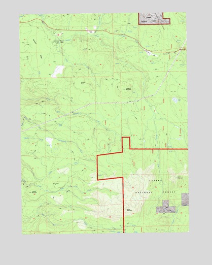
Hatchet Mountain Pass, CA USGS Topographic Map
Click on map above to begin viewing in our Map Viewer.

This topographic map contains these locations and features:
Feature Name Type Latitude Longitude GNIS ID View Map
Carberry CreekStreamN40.8626°W121.8169°2627950View Map
Carberry FlatFlatN40.8515°W121.7783°257967View Map
Carberry MountainSummitN40.8315°W121.7975°1658218View Map
Fauries PeakSummitN40.8352°W121.8305°1658527View Map
Fuller FlatFlatN40.8654°W121.8283°260444View Map
Fuller MountainSummitN40.8552°W121.8250°260447View Map
Goat CreekStreamN40.8599°W121.8455°260618View Map
Green MountainSummitN40.7804°W121.7592°260860View Map
Hatchet Mountain PassGapN40.8524°W121.7669°261152View Map
Indian SpringSpringN40.8121°W121.8449°261763View Map
KIBC-FM (Burney)TowerN40.8746°W121.7719°1662819View Map
KNCA-FM (Burney)TowerN40.8749°W121.7714°1662818View Map
Little Hatchet CreekStreamN40.8627°W121.8247°262628View Map
Lookout MountainSummitN40.7735°W121.8683°262901View Map
Moose CampLocaleN40.8590°W121.8469°263809View Map
Sanders RidgeRidgeN40.8521°W121.8617°265816View Map
Snow MountainSummitN40.7632°W121.7972°267324View Map
Terry LakeLakeN40.8250°W121.7603°268157View Map
The RimCliffN40.8240°W121.8661°268208View Map

Note: Coordinates in the location and feature list above are referenced to NAD83 datum.


Copyright (C) 2008-2024 Ryan Niemi / Sunset Dynamics ... All Rights Reserved