TopoQuest Logo
Do you find TopoQuest useful?
Help keep TopoQuest running and adding new maps/features by donating!
Bitcoin:  19c7KJd3qBynnjoSw5npx9KScwjBe4ifkT
Litecoin:  LXs6TkuXGGXo1vDsWCkWVdjQX94eUKd6ui
Home View Maps Find Maps Find Places Resources & Links


Holland, Virginia Topographic Map

USGS Map Title: Holland, VA
USGS Map MRC: 36076F7
DRG (GeoTIFF) Download: o36076f7.tif


Neighboring USGS Topographic Map Quads:


  Sedley, VA  
36076G8
 

  Zuni, VA  
36076G7
 

  Windsor, VA  
36076G6
 

  Franklin, VA  
36076F8
 

  Holland, VA  
36076F7
 

  Buckhorn, VA  
36076F6
 

  Riverdale, VA  
36076E8
 

  Gates, NC  
36076E7
 

  Whaleyville, VA  
36076E6


Map MRC Location:

N37°
W77°
N37°
W76°
H8 H7 H6 H5 H4 H3 H2 H1
G8 G7 G6 G5 G4 G3 G2 G1
F8 F7 F6 F5 F4 F3 F2 F1
E8 E7 E6 E5 E4 E3 E2 E1
D8 D7 D6 D5 D4 D3 D2 D1
C8 C7 C6 C5 C4 C3 C2 C1
B8 B7 B6 B5 B4 B3 B2 B1
A8 A7 A6 A5 A4 A3 A2 A1
N36°
W77°
N36°
W76°

Holland, VA USGS 1:24K Topographic Map Preview:
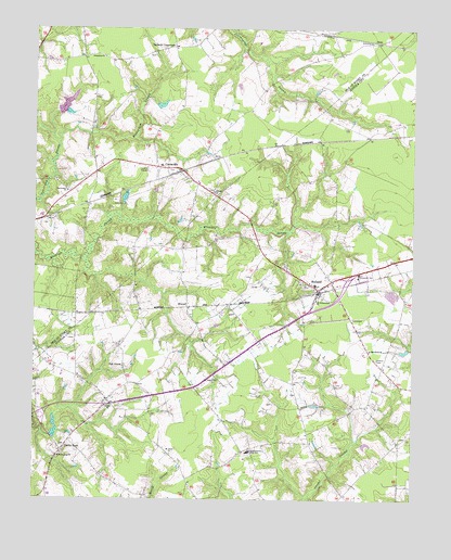
Holland, VA USGS Topographic Map
Click on map above to begin viewing in our Map Viewer.

This topographic map contains these locations and features:
Feature Name Type Latitude Longitude GNIS ID View Map
Alemar DamDamN36.7302°W76.8347°1490128View Map
Alemar PondReservoirN36.7298°W76.8330°1490129View Map
Ballards CrossroadsLocaleN36.7457°W76.8286°1493841View Map
Beales CornerPopulated PlaceN36.6502°W76.8491°1707307View Map
Beaver Dam CemeteryCemeteryN36.7076°W76.8641°1739976View Map
Beaverdam ChurchChurchN36.7068°W76.8638°1462949View Map
Bethel ChurchChurchN36.6496°W76.8497°1478195View Map
BoazPopulated PlaceN36.7468°W76.7616°1477126View Map
Brandywyne Farms AirportAirportN36.6836°W76.8246°1501657View Map
CarrsvillePopulated PlaceN36.7118°W76.8261°1495353View Map
Carrsville Census Designated PlaceCensusN36.7087°W76.8370°2584824View Map
Carrsville Elementary SchoolSchoolN36.7143°W76.8332°1739989View Map
Carrsville Post OfficePost OfficeN36.7129°W76.8332°2519596View Map
Carrsville Volunteer Fire DepartmentBuildingN36.7102°W76.8224°2086215View Map
Ducks StoreLocaleN36.6377°W76.8652°1478511View Map
ElwoodPopulated PlaceN36.6763°W76.8238°1478554View Map
HollandPopulated PlaceN36.6813°W76.7802°1495702View Map
Holland Millpond (historical)ReservoirN36.6977°W76.7891°1707358View Map
Holland Mission United Church of ChristChurchN36.6775°W76.7733°2520363View Map
Holland Post OfficePost OfficeN36.6791°W76.7811°1707360View Map
Holland Primary SchoolSchoolN36.6821°W76.7819°1707361View Map
Jerusalem ChurchChurchN36.7426°W76.8519°1468700View Map
Kingsale SwampSwampN36.6957°W76.8208°1478896View Map
Kingsdale Industrial ParkLocaleN36.6967°W76.8714°2518599View Map
Laurel Hill ChurchChurchN36.6574°W76.8147°1478933View Map
Laurel Hill School (historical)SchoolN36.6571°W76.8152°1707384View Map
Mount Gethsemane ChurchChurchN36.6782°W76.7813°1479138View Map
Mount Sinai ChurchChurchN36.6374°W76.8291°1479157View Map
New Road School (historical)SchoolN36.6265°W76.8394°1707402View Map
Oak GrovePopulated PlaceN36.6604°W76.8447°1496026View Map
PinevillePopulated PlaceN36.6715°W76.8208°1707418View Map
Pleasant Shade School (historical)SchoolN36.7415°W76.8458°1740013View Map
Pulaski ChurchChurchN36.7065°W76.8150°1472849View Map
Saint Matthews ChurchChurchN36.6646°W76.7636°1479518View Map
Silver Spring School (historical)SchoolN36.6721°W76.8413°1707433View Map
South Quay ChurchChurchN36.6363°W76.8661°1479652View Map
South Quay School (historical)SchoolN36.6427°W76.8613°1707440View Map
Southwestern Elementary SchoolSchoolN36.6378°W76.8035°1479661View Map
Suffolk Department of Fire and Rescue Station 7 Holland Volunteer Fire DepartmentBuildingN36.6726°W76.7852°2090088View Map

Note: Coordinates in the location and feature list above are referenced to NAD83 datum.


Copyright (C) 2008-2024 Ryan Niemi / Sunset Dynamics ... All Rights Reserved