TopoQuest Logo
Do you find TopoQuest useful?
Help keep TopoQuest running and adding new maps/features by donating!
Bitcoin:  19c7KJd3qBynnjoSw5npx9KScwjBe4ifkT
Litecoin:  LXs6TkuXGGXo1vDsWCkWVdjQX94eUKd6ui
Home View Maps Find Maps Find Places Resources & Links


Holmes Canyon, Oregon Topographic Map

USGS Map Title: Holmes Canyon, OR
USGS Map MRC: 43119F3
DRG (GeoTIFF) Download: o43119f3.tif


Neighboring USGS Topographic Map Quads:


  Bear Canyon Butte, OR  
43119G4
 

  Hughet Valley, OR  
43119G3
 

  Landing Creek, OR  
43119G2
 

  Egypt Canyon, OR  
43119F4
 

  Holmes Canyon, OR  
43119F3
 

  Burns NW, OR  
43119F2
 

  Oakerman Lakes, OR  
43119E4
 

  Sage Hen Hill, OR  
43119E3
 

  Burns Butte, OR  
43119E2


Map MRC Location:

N44°
W120°
N44°
W119°
H8 H7 H6 H5 H4 H3 H2 H1
G8 G7 G6 G5 G4 G3 G2 G1
F8 F7 F6 F5 F4 F3 F2 F1
E8 E7 E6 E5 E4 E3 E2 E1
D8 D7 D6 D5 D4 D3 D2 D1
C8 C7 C6 C5 C4 C3 C2 C1
B8 B7 B6 B5 B4 B3 B2 B1
A8 A7 A6 A5 A4 A3 A2 A1
N43°
W120°
N43°
W119°

Holmes Canyon, OR USGS 1:24K Topographic Map Preview:
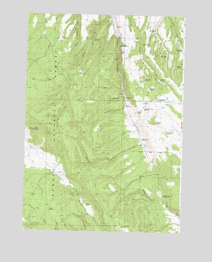
Holmes Canyon, OR USGS Topographic Map
Click on map above to begin viewing in our Map Viewer.

This topographic map contains these locations and features:
Feature Name Type Latitude Longitude GNIS ID View Map
Bald ButteSummitN43.6821°W119.3713°1137435View Map
Boulder SpringSpringN43.7205°W119.2521°1156963View Map
Dead End ReservoirReservoirN43.7126°W119.2693°1156989View Map
Deer Camp ReservoirReservoirN43.7130°W119.2813°1156988View Map
Dry Gulch ReservoirReservoirN43.7412°W119.2739°1156959View Map
East Horton Basin ReservoirReservoirN43.6966°W119.2811°1156994View Map
Four Deer ReservoirReservoirN43.7267°W119.2640°1156961View Map
Holmes CanyonValleyN43.7482°W119.3077°1143676View Map
Horse SpringSpringN43.7332°W119.2830°1156960View Map
Horse Spring ReservoirReservoirN43.7014°W119.2695°1156993View Map
Horton CanyonValleyN43.6610°W119.2774°1153263View Map
Horton Mill ReservoirReservoirN43.6786°W119.2827°1157002View Map
Lumsden SpringSpringN43.7362°W119.3213°1156964View Map
Old Horton MillLocaleN43.7024°W119.2963°1156991View Map
Panel Spring ReservoirReservoirN43.6834°W119.2630°1156996View Map
Pine Spring BasinBasinN43.6376°W119.3263°1147729View Map
Rock Creek DamDamN43.6865°W119.3061°1131351View Map
Rocky Road ReservoirReservoirN43.7077°W119.2775°1156990View Map
Sagadore SpringSpringN43.6877°W119.2712°1156995View Map
Silver ReservoirReservoirN43.6992°W119.2775°1156992View Map
Skull Creek ReservoirReservoirN43.7302°W119.2513°1116627View Map
West Bassout ReservoirReservoirN43.7324°W119.2962°1156965View Map
Winslow CanyonValleyN43.6763°W119.2844°1157003View Map

Note: Coordinates in the location and feature list above are referenced to NAD83 datum.


Copyright (C) 2008-2025 Ryan Niemi / Sunset Dynamics ... All Rights Reserved