TopoQuest Logo
Do you find TopoQuest useful?
Help keep TopoQuest running and adding new maps/features by donating!
Bitcoin:  19c7KJd3qBynnjoSw5npx9KScwjBe4ifkT
Litecoin:  LXs6TkuXGGXo1vDsWCkWVdjQX94eUKd6ui
Home View Maps Find Maps Find Places Resources & Links


Hughet Valley, Oregon Topographic Map

USGS Map Title: Hughet Valley, OR
USGS Map MRC: 43119G3
DRG (GeoTIFF) Download: o43119g3.tif


Neighboring USGS Topographic Map Quads:


  Whiskey Mountain, OR  
43119H4
 

  Alsup Mountain, OR  
43119H3
 

  West Myrtle Butte, OR  
43119H2
 

  Bear Canyon Butte, OR  
43119G4
 

  Hughet Valley, OR  
43119G3
 

  Landing Creek, OR  
43119G2
 

  Egypt Canyon, OR  
43119F4
 

  Holmes Canyon, OR  
43119F3
 

  Burns NW, OR  
43119F2


Map MRC Location:

N44°
W120°
N44°
W119°
H8 H7 H6 H5 H4 H3 H2 H1
G8 G7 G6 G5 G4 G3 G2 G1
F8 F7 F6 F5 F4 F3 F2 F1
E8 E7 E6 E5 E4 E3 E2 E1
D8 D7 D6 D5 D4 D3 D2 D1
C8 C7 C6 C5 C4 C3 C2 C1
B8 B7 B6 B5 B4 B3 B2 B1
A8 A7 A6 A5 A4 A3 A2 A1
N43°
W120°
N43°
W119°

Hughet Valley, OR USGS 1:24K Topographic Map Preview:
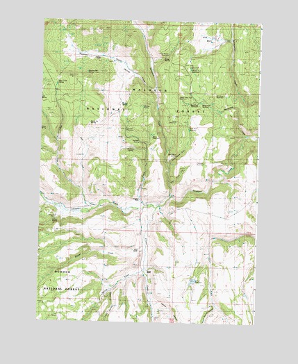
Hughet Valley, OR USGS Topographic Map
Click on map above to begin viewing in our Map Viewer.

This topographic map contains these locations and features:
Feature Name Type Latitude Longitude GNIS ID View Map
Basin ReservoirReservoirN43.8267°W119.3114°1133910View Map
Beaverdam CreekStreamN43.8271°W119.2566°1137852View Map
Beaverdam ReservoirReservoirN43.8410°W119.2830°1137858View Map
Beaverdam TrailTrailN43.8301°W119.2736°1137860View Map
Blue CreekStreamN43.7965°W119.3441°1138292View Map
Blue Creek SpringSpringN43.8488°W119.3665°1154198View Map
Blue Creek Work CenterLocaleN43.8465°W119.3658°1138298View Map
Calon RanchLocaleN43.7929°W119.3644°1639294View Map
Campbell RanchLocaleN43.8010°W119.3169°1139286View Map
Carlon SpringSpringN43.7920°W119.3659°1139376View Map
Carlson CanyonValleyN43.7576°W119.3083°1133909View Map
Cricket CreekStreamN43.7974°W119.3072°1140446View Map
Dead Mule CanyonValleyN43.8154°W119.3013°1140708View Map
Dead Mule ReservoirReservoirN43.8304°W119.2906°1140709View Map
Dead Mule SpringSpringN43.8187°W119.2976°1140710View Map
Deer Cave CanyonValleyN43.8071°W119.2997°1140817View Map
Dicks ReservoirReservoirN43.8334°W119.2977°1141021View Map
Dunn RanchLocaleN43.7799°W119.3169°1141413View Map
East Fork Blue CreekStreamN43.8051°W119.3505°1141533View Map
East Fork ReservoirReservoirN43.8551°W119.2897°1141597View Map
Emigrant ReservoirReservoirN43.8161°W119.2815°1141861View Map
Finke SpringSpringN43.8591°W119.3057°1142099View Map
Gunther CreekStreamN43.7982°W119.3152°1143160View Map
Gunther ReservoirReservoirN43.8298°W119.3264°1133911View Map
Gunther SpringSpringN43.8250°W119.3189°1143161View Map
Hughet CreekStreamN43.8457°W119.3097°1143896View Map
Hughet ValleyValleyN43.8501°W119.3227°1143897View Map
Hunter SpringSpringN43.8393°W119.3166°1143938View Map
J L SpringSpringN43.8186°W119.3554°1144152View Map
Lower Buttes ReservoirReservoirN43.8607°W119.3019°1145607View Map
Middle Fork ReservoirReservoirN43.8535°W119.2908°1124115View Map
Mosier SpringSpringN43.8305°W119.3736°1146486View Map
No Name ReservoirReservoirN43.8446°W119.2699°1146857View Map
Pine Knoll BasinBasinN43.8654°W119.2833°1147716View Map
Professor SpringSpringN43.8224°W119.3239°1148010View Map
Ramsey RanchLocaleN43.8604°W119.3433°1148196View Map
Ramsey SpringSpringN43.8396°W119.3275°1148197View Map
Rocking Bar SpringSpringN43.8536°W119.3489°1148643View Map
Sawtooth CreekStreamN43.8024°W119.2991°1149098View Map
Seven Up SpringSpringN43.8325°W119.3469°1149253View Map
Smith ReservoirReservoirN43.7963°W119.3263°1149759View Map
Spring CreekStreamN43.7721°W119.3136°1150175View Map
Spring Creek SpringSpringN43.7558°W119.3422°1154205View Map
Stinger CreekStreamN43.7799°W119.3127°1150437View Map
Turner RanchLocaleN43.7715°W119.3119°1151535View Map
Upper West Fork ReservoirReservoirN43.8426°W119.2949°1151709View Map
West Fork ReservoirReservoirN43.8411°W119.2853°1152107View Map
Willow ReservoirReservoirN43.7672°W119.2865°1133908View Map
Yellowjacket TrailTrailN43.8415°W119.2661°1152726View Map

Note: Coordinates in the location and feature list above are referenced to NAD83 datum.


Copyright (C) 2008-2024 Ryan Niemi / Sunset Dynamics ... All Rights Reserved