TopoQuest Logo
Do you find TopoQuest useful?
Help keep TopoQuest running and adding new maps/features by donating!
Bitcoin:  19c7KJd3qBynnjoSw5npx9KScwjBe4ifkT
Litecoin:  LXs6TkuXGGXo1vDsWCkWVdjQX94eUKd6ui
Home View Maps Find Maps Find Places Resources & Links


Burns NW, Oregon Topographic Map

USGS Map Title: Burns NW, OR
USGS Map MRC: 43119F2
DRG (GeoTIFF) Download: o43119f2.tif


Neighboring USGS Topographic Map Quads:


  Hughet Valley, OR  
43119G3
 

  Landing Creek, OR  
43119G2
 

  Mosquito Flat, OR  
43119G1
 

  Holmes Canyon, OR  
43119F3
 

  Burns NW, OR  
43119F2
 

  Poison Creek, OR  
43119F1
 

  Sage Hen Hill, OR  
43119E3
 

  Burns Butte, OR  
43119E2
 

  Burns, OR  
43119E1


Map MRC Location:

N44°
W120°
N44°
W119°
H8 H7 H6 H5 H4 H3 H2 H1
G8 G7 G6 G5 G4 G3 G2 G1
F8 F7 F6 F5 F4 F3 F2 F1
E8 E7 E6 E5 E4 E3 E2 E1
D8 D7 D6 D5 D4 D3 D2 D1
C8 C7 C6 C5 C4 C3 C2 C1
B8 B7 B6 B5 B4 B3 B2 B1
A8 A7 A6 A5 A4 A3 A2 A1
N43°
W120°
N43°
W119°

Burns NW, OR USGS 1:24K Topographic Map Preview:
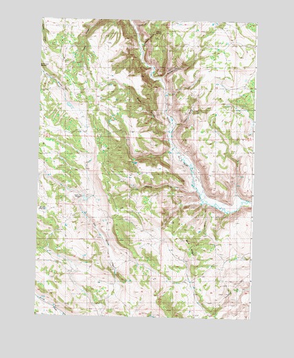
Burns NW, OR USGS Topographic Map
Click on map above to begin viewing in our Map Viewer.

This topographic map contains these locations and features:
Feature Name Type Latitude Longitude GNIS ID View Map
Big BasinBasinN43.7082°W119.2288°1160683View Map
Boone CanyonValleyN43.7040°W119.1749°1117937View Map
Boulder CanyonValleyN43.7249°W119.1816°1117967View Map
Brown FlatFlatN43.6665°W119.1677°1638521View Map
Cave GulchValleyN43.7068°W119.1733°1132042View Map
Charlie CreekStreamN43.6790°W119.1594°1132048View Map
Charlie Creek ReservoirReservoirN43.6776°W119.1941°1834799View Map
Cherry CreekStreamN43.7407°W119.1941°1118849View Map
Cherry SpringSpringN43.7438°W119.1844°1118862View Map
Clemens Spring ReservoirReservoirN43.6898°W119.1953°1638515View Map
Gravel SpringSpringN43.7287°W119.1776°1121334View Map
Green FlatFlatN43.6763°W119.2302°1160684View Map
Green Flat ReservoirReservoirN43.6740°W119.2222°1121375View Map
Jumbo SpringSpringN43.7318°W119.2027°1638512View Map
Juniper ReservoirReservoirN43.7045°W119.2237°1638513View Map
Lower Thissel PlaceLocaleN43.6807°W119.1552°1638517View Map
Mayes CabinLocaleN43.6776°W119.1363°1123870View Map
Mayes CabinLocaleN43.6782°W119.1352°1638518View Map
Mud RidgeRidgeN43.6443°W119.1552°1132047View Map
Old Cushman RanchLocaleN43.6471°W119.2066°1638523View Map
Parker SpringsSpringN43.6820°W119.1364°1132050View Map
Shoeffer ReservoirReservoirN43.6689°W119.2448°1126900View Map
Silvies CanyonValleyN43.7249°W119.1830°1154192View Map
Thissel RanchLocaleN43.6957°W119.1730°1638514View Map
Thomas Spring ReservoirReservoirN43.6685°W119.2072°1638520View Map
Tipi-Tehaga CreekStreamN43.7471°W119.1969°1150249View Map
Triple SpringsSpringN43.6547°W119.1795°1638522View Map

Note: Coordinates in the location and feature list above are referenced to NAD83 datum.


Copyright (C) 2008-2025 Ryan Niemi / Sunset Dynamics ... All Rights Reserved