TopoQuest Logo
Do you find TopoQuest useful?
Help keep TopoQuest running and adding new maps/features by donating!
Bitcoin:  19c7KJd3qBynnjoSw5npx9KScwjBe4ifkT
Litecoin:  LXs6TkuXGGXo1vDsWCkWVdjQX94eUKd6ui
Home View Maps Find Maps Find Places Resources & Links


Bear Canyon Butte, Oregon Topographic Map

USGS Map Title: Bear Canyon Butte, OR
USGS Map MRC: 43119G4
DRG (GeoTIFF) Download: o43119g4.tif


Neighboring USGS Topographic Map Quads:


  Big Mowich Mountain, OR  
43119H5
 

  Whiskey Mountain, OR  
43119H4
 

  Alsup Mountain, OR  
43119H3
 

  Donnelly Butte, OR  
43119G5
 

  Bear Canyon Butte, OR  
43119G4
 

  Hughet Valley, OR  
43119G3
 

  Dry Mountain, OR  
43119F5
 

  Egypt Canyon, OR  
43119F4
 

  Holmes Canyon, OR  
43119F3


Map MRC Location:

N44°
W120°
N44°
W119°
H8 H7 H6 H5 H4 H3 H2 H1
G8 G7 G6 G5 G4 G3 G2 G1
F8 F7 F6 F5 F4 F3 F2 F1
E8 E7 E6 E5 E4 E3 E2 E1
D8 D7 D6 D5 D4 D3 D2 D1
C8 C7 C6 C5 C4 C3 C2 C1
B8 B7 B6 B5 B4 B3 B2 B1
A8 A7 A6 A5 A4 A3 A2 A1
N43°
W120°
N43°
W119°

Bear Canyon Butte, OR USGS 1:24K Topographic Map Preview:
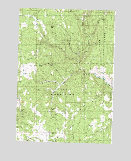
Bear Canyon Butte, OR USGS Topographic Map
Click on map above to begin viewing in our Map Viewer.

This topographic map contains these locations and features:
Feature Name Type Latitude Longitude GNIS ID View Map
Alder CreekStreamN43.8138°W119.4108°1154204View Map
Alder Creek SpringSpringN43.8026°W119.4179°1137085View Map
Bear Canyon ButteSummitN43.8590°W119.4616°1137642View Map
Bear Canyon CreekStreamN43.8243°W119.4202°1137644View Map
Beaver Rock SpringSpringN43.7792°W119.4951°1137844View Map
Buck Spring ReservoirReservoirN43.7668°W119.4003°1138832View Map
Buckboard CreekStreamN43.8082°W119.4363°1138841View Map
Buckboard SpringSpringN43.8225°W119.4701°1138842View Map
Corbett CabinLocaleN43.8151°W119.4113°1140117View Map
Cow CanyonValleyN43.8043°W119.3816°1140274View Map
Cow HollowValleyN43.7621°W119.4291°1140288View Map
Cow Hollow SpringSpringN43.7635°W119.4275°1140289View Map
Coyote SpringSpringN43.8731°W119.4346°1140339View Map
Dipping Vat SpringSpringN43.8668°W119.4827°1141046View Map
Emigrant ButteSummitN43.7582°W119.4544°1141853View Map
Emigrant Recreation SiteLocaleN43.8501°W119.4108°1156376View Map
Falls Recreation SiteLocaleN43.8499°W119.4108°1167121View Map
Foundation CreekStreamN43.8479°W119.4063°1142348View Map
Foundation SpringSpringN43.8660°W119.3931°1142349View Map
Garrett Basin SpringSpringN43.8203°W119.3970°1142581View Map
Horsehead SpringSpringN43.8583°W119.3870°1143797View Map
Little Emigrant CreekStreamN43.8182°W119.4172°1145161View Map
Little Emigrant SpringSpringN43.7810°W119.4541°1145162View Map
Lost Guard CreekStreamN43.8035°W119.4436°1145536View Map
Lost Guard SpringSpringN43.8149°W119.4954°1145537View Map
Lost SpringSpringN43.7516°W119.4043°1145559View Map
Lost SpringSpringN43.8423°W119.3755°1145560View Map
Parker CreekStreamN43.7976°W119.4516°1147447View Map
Rainbow CampgroundLocaleN43.8646°W119.4186°1156375View Map
Roaring SpringSpringN43.7935°W119.3764°1148525View Map
Rock SpringSpringN43.8434°W119.4017°1148626View Map
Spring Canyon CreekStreamN43.8271°W119.4183°1150156View Map

Note: Coordinates in the location and feature list above are referenced to NAD83 datum.


Copyright (C) 2008-2025 Ryan Niemi / Sunset Dynamics ... All Rights Reserved