TopoQuest Logo
Do you find TopoQuest useful?
Help keep TopoQuest running and adding new maps/features by donating!
Bitcoin:  19c7KJd3qBynnjoSw5npx9KScwjBe4ifkT
Litecoin:  LXs6TkuXGGXo1vDsWCkWVdjQX94eUKd6ui
Home View Maps Find Maps Find Places Resources & Links


Hunter, Texas Topographic Map

USGS Map Title: Hunter, TX
USGS Map MRC: 29098G1
DRG (GeoTIFF) Download: o29098g1.tif


Neighboring USGS Topographic Map Quads:


  Devils Backbone, TX  
29098H2
 

  Wimberley, TX  
29098H1
 

  San Marcos North, TX  
29097H8
 

  Sattler, TX  
29098G2
 

  Hunter, TX  
29098G1
 

  San Marcos South, TX  
29097G8
 

  New Braunfels West, TX  
29098F2
 

  New Braunfels East, TX  
29098F1
 

  Geronimo, TX  
29097F8


Map MRC Location:

N30°
W99°
N30°
W98°
H8 H7 H6 H5 H4 H3 H2 H1
G8 G7 G6 G5 G4 G3 G2 G1
F8 F7 F6 F5 F4 F3 F2 F1
E8 E7 E6 E5 E4 E3 E2 E1
D8 D7 D6 D5 D4 D3 D2 D1
C8 C7 C6 C5 C4 C3 C2 C1
B8 B7 B6 B5 B4 B3 B2 B1
A8 A7 A6 A5 A4 A3 A2 A1
N29°
W99°
N29°
W98°

Hunter, TX USGS 1:24K Topographic Map Preview:
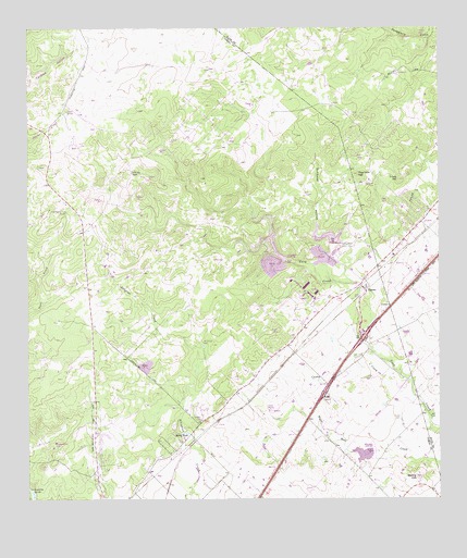
Hunter, TX USGS Topographic Map
Click on map above to begin viewing in our Map Viewer.

This topographic map contains these locations and features:
Feature Name Type Latitude Longitude GNIS ID View Map
Bading HillSummitN29.7558°W98.0070°1351397View Map
Bullhead HollowValleyN29.8077°W98.0320°1353284View Map
Caney CreekStreamN29.7741°W98.0045°1353727View Map
Circle Dot RanchLocaleN29.8372°W98.0931°1354508View Map
Coal Kiln HillSummitN29.8363°W98.0245°1354700View Map
Conrads CemeteryCemeteryN29.7716°W98.0725°1354887View Map
Flying R Ranch AirportAirportN29.7994°W98.0850°2675872View Map
Haley TankReservoirN29.7679°W98.0775°1358645View Map
HunterPopulated PlaceN29.8072°W98.0236°1359837View Map
Kellermann CemeteryCemeteryN29.7652°W98.1172°1360523View Map
Nail HillSummitN29.7769°W98.0345°1363575View Map
Rosenthal CemeteryCemeteryN29.7916°W98.0720°1366879View Map
Royal ForestPopulated PlaceN29.8480°W98.0872°2034585View Map
Soil Conservation Service Site 1 DamDamN29.8136°W98.0486°1857296View Map
Soil Conservation Service Site 1 ReservoirReservoirN29.8136°W98.0486°1857297View Map
Soil Conservation Service Site 2 DamDamN29.8186°W98.0336°1857286View Map
Soil Conservation Service Site 2 ReservoirReservoirN29.8186°W98.0336°1857287View Map
Soil Conservation Service Site 3 DamDamN29.7619°W98.0203°1857298View Map
Soil Conservation Service Site 3 ReservoirReservoirN29.7620°W98.0233°1857299View Map
Trunk HillSummitN29.8347°W98.0125°1370169View Map
Wegner RanchLocaleN29.8536°W98.0492°1370990View Map
York Creek CemeteryCemeteryN29.7874°W98.0258°1372052View Map

Note: Coordinates in the location and feature list above are referenced to NAD83 datum.


Copyright (C) 2008-2024 Ryan Niemi / Sunset Dynamics ... All Rights Reserved