TopoQuest Logo
Do you find TopoQuest useful?
Help keep TopoQuest running and adding new maps/features by donating!
Bitcoin:  19c7KJd3qBynnjoSw5npx9KScwjBe4ifkT
Litecoin:  LXs6TkuXGGXo1vDsWCkWVdjQX94eUKd6ui
Home View Maps Find Maps Find Places Resources & Links


Janesville, Minnesota Topographic Map

USGS Map Title: Janesville, MN
USGS Map MRC: 44093A6
DRG (GeoTIFF) Download: o44093a6.tif


Neighboring USGS Topographic Map Quads:


  Madison Lake, MN  
44093B7
 

  Elysian, MN  
44093B6
 

  Waterville, MN  
44093B5
 

  Saint Clair, MN  
44093A7
 

  Janesville, MN  
44093A6
 

  Waseca, MN  
44093A5
 

  Mapleton NE, MN  
43093H7
 

  Waldorf, MN  
43093H6
 

  Otisco, MN  
43093H5


Map MRC Location:

N45°
W94°
N45°
W93°
H8 H7 H6 H5 H4 H3 H2 H1
G8 G7 G6 G5 G4 G3 G2 G1
F8 F7 F6 F5 F4 F3 F2 F1
E8 E7 E6 E5 E4 E3 E2 E1
D8 D7 D6 D5 D4 D3 D2 D1
C8 C7 C6 C5 C4 C3 C2 C1
B8 B7 B6 B5 B4 B3 B2 B1
A8 A7 A6 A5 A4 A3 A2 A1
N44°
W94°
N44°
W93°

Janesville, MN USGS 1:24K Topographic Map Preview:
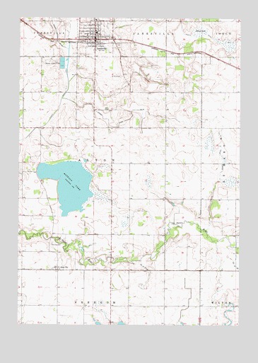
Janesville, MN USGS Topographic Map
Click on map above to begin viewing in our Map Viewer.

This topographic map contains these locations and features:
Feature Name Type Latitude Longitude GNIS ID View Map
Alma CityPopulated PlaceN44.0225°W93.7280°639297View Map
Alma City CemeteryCemeteryN44.0330°W93.7313°639298View Map
Alma City Post Office (historical)Post OfficeN44.0225°W93.7280°2051134View Map
Buffalo LakeReservoirN44.0666°W93.7152°1776128View Map
Buffalo LakeLakeN44.0572°W93.7218°640610View Map
Buffalo Lake DamDamN44.0666°W93.7152°1776127View Map
City of JanesvilleCivilN44.1214°W93.7106°2395455View Map
County Ditch Number NineteenCanalN44.0689°W93.6361°641757View Map
County Ditch Number SixCanalN44.0775°W93.7438°642221View Map
County Ditch Number TenCanalN44.1241°W93.7322°641575View Map
County Ditch Number ThreeCanalN44.1216°W93.6588°641930View Map
County Ditch Number TwentyeightCanalN44.0233°W93.6788°641897View Map
County Ditch Number TwentynineCanalN44.0833°W93.6899°641910View Map
Faith Lutheran ChurchChurchN44.1172°W93.7055°2051210View Map
Helena LakeSwampN44.1202°W93.6483°644848View Map
JanesvilleLocaleN44.1150°W93.7049°2051203View Map
JanesvillePopulated PlaceN44.1161°W93.7080°645580View Map
Janesville CemeteryCemeteryN44.1139°W93.6944°2051227View Map
Janesville ClinicHospitalN44.1180°W93.7083°2051216View Map
Janesville Elementary SchoolSchoolN44.1189°W93.7066°2051214View Map
Janesville Fire DepartmentBuildingN44.1176°W93.7072°2051208View Map
Janesville Nursing HomeHospitalN44.1241°W93.7072°2051217View Map
Janesville Police DepartmentBuildingN44.1158°W93.7086°2051207View Map
Janesville Post OfficePost OfficeN44.1153°W93.7072°2051206View Map
Janesville Public LibraryBuildingN44.1175°W93.7088°2051209View Map
Janesville United Methodist ChurchChurchN44.1186°W93.7155°2051212View Map
North Street ParkParkN44.1230°W93.7136°2051219View Map
Peddler's Grove CemeteryCemeteryN44.0216°W93.6969°2051228View Map
Saint Ann's ParishChurchN44.1169°W93.7113°2051211View Map
Saint Anns CemeteryCemeteryN44.1011°W93.6930°650505View Map
Township of AltonCivilN44.0656°W93.7077°663420View Map
Trinity Lutheran ChurchChurchN44.1191°W93.7083°2051213View Map
Trinity Lutheran SchoolSchoolN44.1197°W93.7072°2051215View Map
Veterans Memorial ParkParkN44.1158°W93.7097°2051220View Map

Note: Coordinates in the location and feature list above are referenced to NAD83 datum.


Copyright (C) 2008-2025 Ryan Niemi / Sunset Dynamics ... All Rights Reserved