TopoQuest Logo
Do you find TopoQuest useful?
Help keep TopoQuest running and adding new maps/features by donating!
Bitcoin:  19c7KJd3qBynnjoSw5npx9KScwjBe4ifkT
Litecoin:  LXs6TkuXGGXo1vDsWCkWVdjQX94eUKd6ui
Home View Maps Find Maps Find Places Resources & Links


Waterville, Minnesota Topographic Map

USGS Map Title: Waterville, MN
USGS Map MRC: 44093B5
DRG (GeoTIFF) Download: o44093b5.tif


Neighboring USGS Topographic Map Quads:


  Cordova, MN  
44093C6
 

  Kilkenny, MN  
44093C5
 

  Shieldsville, MN  
44093C4
 

  Elysian, MN  
44093B6
 

  Waterville, MN  
44093B5
 

  Morristown, MN  
44093B4
 

  Janesville, MN  
44093A6
 

  Waseca, MN  
44093A5
 

  Meriden, MN  
44093A4


Map MRC Location:

N45°
W94°
N45°
W93°
H8 H7 H6 H5 H4 H3 H2 H1
G8 G7 G6 G5 G4 G3 G2 G1
F8 F7 F6 F5 F4 F3 F2 F1
E8 E7 E6 E5 E4 E3 E2 E1
D8 D7 D6 D5 D4 D3 D2 D1
C8 C7 C6 C5 C4 C3 C2 C1
B8 B7 B6 B5 B4 B3 B2 B1
A8 A7 A6 A5 A4 A3 A2 A1
N44°
W94°
N44°
W93°

Waterville, MN USGS 1:24K Topographic Map Preview:
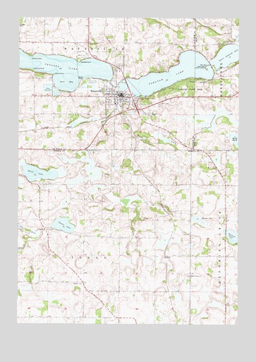
Waterville, MN USGS Topographic Map
Click on map above to begin viewing in our Map Viewer.

This topographic map contains these locations and features:
Feature Name Type Latitude Longitude GNIS ID View Map
Antl BayBayN44.2236°W93.5983°639402View Map
Calvary CemeteryCemeteryN44.2144°W93.5455°640739View Map
Cannon Gate ParkParkN44.2214°W93.5689°2063401View Map
City of WatervilleCivilN44.2235°W93.5746°2397212View Map
County Line CemeteryCemeteryN44.1961°W93.5869°642393View Map
Crams PointCapeN44.2333°W93.6180°642411View Map
Ebenezer CemeteryCemeteryN44.1416°W93.5880°643132View Map
Everson LakeLakeN44.1614°W93.5036°643475View Map
First Baptist ChurchChurchN44.2189°W93.5678°2063407View Map
Hobans PointCapeN44.2289°W93.6172°645042View Map
Holy Trinity Catholic ChurchChurchN44.2156°W93.5625°2063412View Map
Iosco CemeteryCemeteryN44.1616°W93.5274°645441View Map
Kamp DellsLocaleN44.2261°W93.5625°2063416View Map
Knutsen LakeLakeN44.1676°W93.5225°646220View Map
McPete PointCapeN44.2319°W93.5913°647707View Map
North Waseca CemeteryCemeteryN44.1450°W93.5266°2051242View Map
North Waseca ChurchChurchN44.1447°W93.5266°648711View Map
PalmerPopulated PlaceN44.1530°W93.5419°654869View Map
Palmer Post Office (historical)Post OfficeN44.1530°W93.5419°2051121View Map
Pommerans CemeteryCemeteryN44.1816°W93.5524°2051241View Map
Reeds LakeLakeN44.1864°W93.6141°649911View Map
Rocky PointCapeN44.2247°W93.5902°650213View Map
Saint Andrews Episcopal ChurchChurchN44.2203°W93.5708°2063410View Map
Saint Jarlath CemeteryCemeteryN44.1636°W93.6088°2051240View Map
Saint Jarlath ChurchChurchN44.1636°W93.6083°650625View Map
Sakatah CemeteryCemeteryN44.2108°W93.5510°651090View Map
Sakatah LakeLakeN44.2295°W93.5287°651091View Map
Sakatah State ParkParkN44.2211°W93.5358°651092View Map
Scott's CampgroundLocaleN44.2194°W93.5592°2063402View Map
Silver CreekStreamN44.1577°W93.6205°652033View Map
Tetonka DamDamN44.2244°W93.5736°1776145View Map
Tetonka LakeReservoirN44.2305°W93.6074°653103View Map
The NarrowsGapN44.2308°W93.5161°653114View Map
Toners LakeLakeN44.1652°W93.5992°653232View Map
Township of IoscoCivilN44.1527°W93.5872°664553View Map
Township of WatervilleCivilN44.2406°W93.5865°665933View Map
Trinity Lutheran ChurchChurchN44.2197°W93.5736°2063409View Map
United Methodist ChurchChurchN44.2192°W93.5653°2063411View Map
Van Blaracom CemeteryCemeteryN44.2397°W93.5858°644157View Map
Waseca Area Medical CenterHospitalN44.2197°W93.5678°2063414View Map
WatervillePopulated PlaceN44.2189°W93.5680°653836View Map
Waterville - Elysian - Morristown Senior High SchoolSchoolN44.2171°W93.5626°2433289View Map
Waterville (historical)LocaleN44.2147°W93.5703°2063408View Map
Waterville City HallBuildingN44.2175°W93.5664°2063405View Map
Waterville CreekStreamN44.2069°W93.5002°653837View Map
Waterville Elementary SchoolSchoolN44.2174°W93.5628°2433180View Map
Waterville Fire DepartmentBuildingN44.2192°W93.5689°2666309View Map
Waterville Good Samaritan CenterHospitalN44.2206°W93.5689°2063413View Map
Waterville High SchoolSchoolN44.2175°W93.5619°2063415View Map
Waterville Police DepartmentBuildingN44.2170°W93.5705°2063404View Map
Waterville Post OfficePost OfficeN44.2198°W93.5665°2063403View Map
Waterville Public LibraryBuildingN44.2175°W93.5664°2063406View Map
White Water CreekStreamN44.2189°W93.5599°654096View Map
Willow PointCapeN44.2269°W93.6055°654202View Map

Note: Coordinates in the location and feature list above are referenced to NAD83 datum.


Copyright (C) 2008-2025 Ryan Niemi / Sunset Dynamics ... All Rights Reserved