TopoQuest Logo
Do you find TopoQuest useful?
Help keep TopoQuest running and adding new maps/features by donating!
Bitcoin:  19c7KJd3qBynnjoSw5npx9KScwjBe4ifkT
Litecoin:  LXs6TkuXGGXo1vDsWCkWVdjQX94eUKd6ui
Home View Maps Find Maps Find Places Resources & Links


Waseca, Minnesota Topographic Map

USGS Map Title: Waseca, MN
USGS Map MRC: 44093A5
DRG (GeoTIFF) Download: o44093a5.tif


Neighboring USGS Topographic Map Quads:


  Elysian, MN  
44093B6
 

  Waterville, MN  
44093B5
 

  Morristown, MN  
44093B4
 

  Janesville, MN  
44093A6
 

  Waseca, MN  
44093A5
 

  Meriden, MN  
44093A4
 

  Waldorf, MN  
43093H6
 

  Otisco, MN  
43093H5
 

  New Richland, MN  
43093H4


Map MRC Location:

N45°
W94°
N45°
W93°
H8 H7 H6 H5 H4 H3 H2 H1
G8 G7 G6 G5 G4 G3 G2 G1
F8 F7 F6 F5 F4 F3 F2 F1
E8 E7 E6 E5 E4 E3 E2 E1
D8 D7 D6 D5 D4 D3 D2 D1
C8 C7 C6 C5 C4 C3 C2 C1
B8 B7 B6 B5 B4 B3 B2 B1
A8 A7 A6 A5 A4 A3 A2 A1
N44°
W94°
N44°
W93°

Waseca, MN USGS 1:24K Topographic Map Preview:
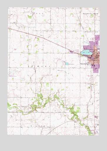
Waseca, MN USGS Topographic Map
Click on map above to begin viewing in our Map Viewer.

This topographic map contains these locations and features:
Feature Name Type Latitude Longitude GNIS ID View Map
Abundant Life Tabernacle ChurchChurchN44.0805°W93.5077°2051144View Map
Calvary CemeteryCemeteryN44.0469°W93.5124°640749View Map
City of WasecaCivilN44.0826°W93.5026°2397203View Map
Colony CourtPopulated PlaceN44.0980°W93.5063°2051135View Map
County Ditch Number Fifteen-twoCanalN44.0327°W93.5091°641708View Map
County Ditch Number ThirtyeightCanalN44.0914°W93.5899°642026View Map
County Ditch Number ThirtyfiveCanalN44.0150°W93.6113°641995View Map
County Ditch Number TwelveCanalN44.0630°W93.5602°641627View Map
Evangelical Free ChurchChurchN44.0855°W93.5183°2051151View Map
Evangelical United Methodist ChurchChurchN44.0802°W93.5005°2051154View Map
Faith Baptist ChurchChurchN44.0830°W93.5036°2051152View Map
Federal Correctional Institution WasecaBuildingN44.0700°W93.5169°2756212View Map
First Congregational ChurchChurchN44.0786°W93.5016°2051148View Map
Grace Lutheran ChurchChurchN44.0772°W93.5044°2051149View Map
Kanne State Wildlife Management AreaParkN44.0583°W93.6247°2051237View Map
Krassin CemeteryCemeteryN44.0338°W93.5822°2051238View Map
Lake Shore Inn Nursing HomeHospitalN44.0786°W93.5174°2051157View Map
Little Le Sueur RiverStreamN44.0044°W93.5133°646842View Map
Loon LakeLakeN44.0800°W93.5184°647164View Map
Loon Lake ParkParkN44.0839°W93.5036°2051170View Map
Mayo Clinic Health System WasecaHospitalN44.0816°W93.5081°2051158View Map
Minske CemeteryCemeteryN44.1180°W93.5922°2051239View Map
North Memorial Ambulance WasecaBuildingN44.0933°W93.5027°2721331View Map
Northridge PlazaLocaleN44.0941°W93.5055°2051165View Map
Northwest ParkParkN44.0902°W93.5133°2051177View Map
Orthopedic Surgical Consultants CenterHospitalN44.0819°W93.5080°2051159View Map
Sacred Heart ChurchChurchN44.0777°W93.5124°2051153View Map
Sacred Heart SchoolSchoolN44.0782°W93.5114°2051161View Map
Saint John Lutheran ChurchChurchN44.0797°W93.5030°2051147View Map
Saint Johns CemeteryCemeteryN44.1094°W93.6177°650661View Map
Saint MaryPopulated PlaceN44.0283°W93.6019°654928View Map
Saint Mary CemeteryCemeteryN44.0266°W93.5924°650828View Map
Saint Marys Post Office (historical)Post OfficeN44.0283°W93.6019°2051120View Map
Saint Paul Lutheran ChurchChurchN44.0797°W93.5036°2051146View Map
Senn MarshSwampN44.0108°W93.5047°651853View Map
Senn-Rich State Wildlife management AreaParkN44.0027°W93.5008°2051235View Map
South Side SchoolSchoolN44.0733°W93.5080°652343View Map
Township of Saint MaryCivilN44.0656°W93.5872°665524View Map
Trinity Lutheran ChurchChurchN44.0005°W93.5008°2051156View Map
Trowbridge ParkParkN44.0816°W93.5063°2051176View Map
University of MinnesotaSchoolN44.0697°W93.5161°653528View Map
University ParkParkN44.0700°W93.5127°2051169View Map
Vista-Villa Mobilehome CommunityPopulated PlaceN44.0825°W93.5308°2051136View Map
WasecaPopulated PlaceN44.0777°W93.5074°653793View Map
WasecaLocaleN44.0758°W93.5094°2051143View Map
Waseca Area Learning CenterSchoolN44.0780°W93.5019°2051160View Map
Waseca Christian Assembly of God ChurchChurchN44.0777°W93.5069°2051145View Map
Waseca City HallBuildingN44.0750°W93.5083°2051166View Map
Waseca CountyCivilN44.0221°W93.5873°659525View Map
Waseca County CourthouseBuildingN44.0800°W93.5077°2051167View Map
Waseca County FairgroundsLocaleN44.0866°W93.5013°2051168View Map
Waseca County Historical Society MuseumBuildingN44.0789°W93.5036°2051142View Map
Waseca County JailBuildingN44.0798°W93.5084°2758699View Map
Waseca County Sheriff's OfficeBuildingN44.0798°W93.5080°2051137View Map
Waseca Fire DepartmentBuildingN44.0762°W93.5063°2051138View Map
Waseca High SchoolSchoolN44.0946°W93.5097°2051163View Map
Waseca Junior High SchoolSchoolN44.0942°W93.5099°2051164View Map
Waseca La Sueur LibraryBuildingN44.0811°W93.5069°2051140View Map
Waseca Municipal AirportAirportN44.0735°W93.5529°660461View Map
Waseca Police DepartmentBuildingN44.0751°W93.5080°2051141View Map
Waseca Post OfficePost OfficeN44.0782°W93.5056°2051139View Map
WiltonPopulated PlaceN44.0139°W93.5344°655016View Map
Wilton CemeteryCemeteryN44.0011°W93.5341°2051236View Map
Wilton Post Office (historical)Post OfficeN44.0139°W93.5344°2051116View Map

Note: Coordinates in the location and feature list above are referenced to NAD83 datum.


Copyright (C) 2008-2025 Ryan Niemi / Sunset Dynamics ... All Rights Reserved