TopoQuest Logo
Do you find TopoQuest useful?
Help keep TopoQuest running and adding new maps/features by donating!
Bitcoin:  19c7KJd3qBynnjoSw5npx9KScwjBe4ifkT
Litecoin:  LXs6TkuXGGXo1vDsWCkWVdjQX94eUKd6ui
Home View Maps Find Maps Find Places Resources & Links


Jefferson, Mississippi Topographic Map

USGS Map Title: Jefferson, MS
USGS Map MRC: 33089F8
DRG (GeoTIFF) Download: o33089f8.tif


Neighboring USGS Topographic Map Quads:


  Cascilla, MS  
33090G1
 

  Holcomb, MS  
33089G8
 

  Grenada, MS  
33089G7
 

  Avalon, MS  
33090F1
 

  Jefferson, MS  
33089F8
 

  Tie Plant, MS  
33089F7
 

  Browning, MS  
33090E1
 

  North Carrollton, MS  
33089E8
 

  McCarley, MS  
33089E7


Map MRC Location:

N34°
W90°
N34°
W89°
H8 H7 H6 H5 H4 H3 H2 H1
G8 G7 G6 G5 G4 G3 G2 G1
F8 F7 F6 F5 F4 F3 F2 F1
E8 E7 E6 E5 E4 E3 E2 E1
D8 D7 D6 D5 D4 D3 D2 D1
C8 C7 C6 C5 C4 C3 C2 C1
B8 B7 B6 B5 B4 B3 B2 B1
A8 A7 A6 A5 A4 A3 A2 A1
N33°
W90°
N33°
W89°

Jefferson, MS USGS 1:24K Topographic Map Preview:
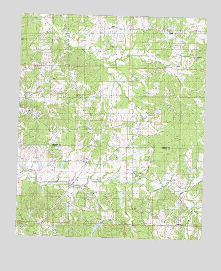
Jefferson, MS USGS Topographic Map
Click on map above to begin viewing in our Map Viewer.

This topographic map contains these locations and features:
Feature Name Type Latitude Longitude GNIS ID View Map
Beard CemeteryCemeteryN33.7401°W89.9829°666665View Map
Beck CemeteryCemeteryN33.6596°W89.9159°666736View Map
Beck CemeteryCemeteryN33.6479°W89.8901°684880View Map
Beckville (historical)LocaleN33.6382°W89.9054°684881View Map
Big Spring ChurchChurchN33.7090°W89.9612°667145View Map
Big Spring SchoolSchoolN33.7098°W89.9615°667147View Map
Billups CreekStreamN33.6432°W89.8837°667169View Map
Bledsoe CemeteryCemeteryN33.6618°W89.9167°667269View Map
Bunion CemeteryCemeteryN33.6426°W89.8887°667788View Map
Bunion ChurchChurchN33.6396°W89.8906°667789View Map
Coon CreekStreamN33.7254°W89.9509°668798View Map
Dubard BranchStreamN33.6554°W89.9229°669463View Map
Ebenezer CemeteryCemeteryN33.6618°W89.9242°669639View Map
Ebenezer ChurchChurchN33.6626°W89.9248°669653View Map
Eliot (historical)LocaleN33.7418°W89.9618°705789View Map
Emmons CemeteryCemeteryN33.6471°W89.9542°669770View Map
Franklin CemeteryCemeteryN33.6668°W89.9548°670158View Map
Franklin ChurchChurchN33.6668°W89.9545°670162View Map
Franklin SchoolSchoolN33.6673°W89.9534°670166View Map
Goza BranchStreamN33.6485°W89.8948°670559View Map
Grays BranchStreamN33.7023°W89.9962°670636View Map
Grays CemeteryCemeteryN33.6418°W89.9234°670637View Map
Grays CreekStreamN33.6576°W89.9387°670638View Map
Greasy CreekStreamN33.6546°W89.9554°670642View Map
Hillside ChurchChurchN33.7040°W89.9593°671227View Map
Hood ChapelChurchN33.7062°W89.9404°671388View Map
JeffersonPopulated PlaceN33.6326°W89.8951°671823View Map
Jefferson CemeteryCemeteryN33.6354°W89.8926°1959796View Map
Liberty Baptist ChurchChurchN33.6354°W89.8923°684901View Map
Loden CreekStreamN33.6371°W89.8787°672761View Map
Mormon BranchStreamN33.6523°W89.8884°673816View Map
Mount Carmel CemeteryCemeteryN33.6904°W89.8781°673950View Map
Mount Carmel ChurchChurchN33.6896°W89.8762°673963View Map
Mount Carmel SchoolSchoolN33.6887°W89.8776°673968View Map
NasonPopulated PlaceN33.7232°W89.8987°674513View Map
O'Neal BranchStreamN33.6535°W89.9040°674999View Map
Potacocowa Creek Watershed Y-31a-26 DamDamN33.6685°W89.9951°682285View Map
Potacocowa Watershed Y-31a-10 DamDamN33.6451°W89.8901°682265View Map
Potacocowa Watershed Y-31a-11 DamDamN33.6251°W89.8834°682251View Map
Potacocowa Watershed Y-31a-15 DamDamN33.6635°W89.8834°682282View Map
Potacocowa Watershed Y-31a-19 DamDamN33.6468°W89.9468°682266View Map
Potacocowa Watershed Y-31a-20 DamDamN33.6635°W89.9968°682283View Map
Potacocowa Watershed Y-31a-3 DamDamN33.6518°W89.9818°682269View Map
Potacocowa Watershed Y-31a-4 DamDamN33.6418°W89.9651°682264View Map
Potacocowa Watershed Y-31a-5 DamDamN33.6618°W89.9701°682279View Map
Potacocowa Watershed Y-31a-6 DamDamN33.6335°W89.9418°682257View Map
Potacocowa Watershed Y-31a-7 DamDamN33.6518°W89.9334°682268View Map
Potacocowa Watershed Y-31a-9 DamDamN33.6601°W89.8984°682278View Map
Prospect Baptist ChurchChurchN33.7437°W89.9423°676360View Map
Prospect CemeteryCemeteryN33.7329°W89.9384°676354View Map
Prospect SchoolSchoolN33.7437°W89.9418°676366View Map
Purnell CreekStreamN33.6429°W89.8834°676423View Map
Sanctified ChurchChurchN33.7412°W89.9006°683105View Map
Smiths Mill (historical)LocaleN33.6512°W89.9823°690947View Map
Sparta CemeteryCemeteryN33.6946°W89.9929°678039View Map
Sparta ChurchChurchN33.6943°W89.9923°678040View Map
Spring Hill CemeteryCemeteryN33.7287°W89.8856°678102View Map
Spring Hill ChurchChurchN33.7296°W89.8854°678131View Map
Swange Chapel CemeteryCemeteryN33.7362°W89.9992°678187View Map
Sweet Home CemeteryCemeteryN33.7304°W89.8948°678469View Map
Sweet Home ChurchChurchN33.7290°W89.8956°678477View Map

Note: Coordinates in the location and feature list above are referenced to NAD83 datum.


Copyright (C) 2008-2025 Ryan Niemi / Sunset Dynamics ... All Rights Reserved