TopoQuest Logo
Do you find TopoQuest useful?
Help keep TopoQuest running and adding new maps/features by donating!
Bitcoin:  19c7KJd3qBynnjoSw5npx9KScwjBe4ifkT
Litecoin:  LXs6TkuXGGXo1vDsWCkWVdjQX94eUKd6ui
Home View Maps Find Maps Find Places Resources & Links


North Carrollton, Mississippi Topographic Map

USGS Map Title: North Carrollton, MS
USGS Map MRC: 33089E8
DRG (GeoTIFF) Download: o33089e8.tif


Neighboring USGS Topographic Map Quads:


  Avalon, MS  
33090F1
 

  Jefferson, MS  
33089F8
 

  Tie Plant, MS  
33089F7
 

  Browning, MS  
33090E1
 

  North Carrollton, MS  
33089E8
 

  McCarley, MS  
33089E7
 

  Gravel Hill, MS  
33090D1
 

  Coila, MS  
33089D8
 

  Bailey Lake, MS  
33089D7


Map MRC Location:

N34°
W90°
N34°
W89°
H8 H7 H6 H5 H4 H3 H2 H1
G8 G7 G6 G5 G4 G3 G2 G1
F8 F7 F6 F5 F4 F3 F2 F1
E8 E7 E6 E5 E4 E3 E2 E1
D8 D7 D6 D5 D4 D3 D2 D1
C8 C7 C6 C5 C4 C3 C2 C1
B8 B7 B6 B5 B4 B3 B2 B1
A8 A7 A6 A5 A4 A3 A2 A1
N33°
W90°
N33°
W89°

North Carrollton, MS USGS 1:24K Topographic Map Preview:
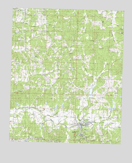
North Carrollton, MS USGS Topographic Map
Click on map above to begin viewing in our Map Viewer.

This topographic map contains these locations and features:
Feature Name Type Latitude Longitude GNIS ID View Map
Beasley CreekStreamN33.5168°W89.9242°666674View Map
Beck SchoolSchoolN33.6068°W89.8779°666737View Map
Bethlehem ChurchChurchN33.6079°W89.8793°667014View Map
Big Sand Creek Structure Y-32-31 DamDamN33.5335°W89.9884°682179View Map
Big Sand Creek Structure Y-32-32 DamDamN33.5401°W89.9534°682186View Map
Big Sand Creek Structure Y-32-33 DamDamN33.5235°W89.9034°682167View Map
Big Sand Creek Structure Y-32-49 DamDamN33.5285°W89.9718°682170View Map
Big Sand Watershed Y-32-1 DamDamN33.5168°W89.9617°682161View Map
Big Sand Watershed Y-32-12 DamDamN33.5435°W89.9084°682191View Map
Big Sand Watershed Y-32-2 DamDamN33.5318°W89.8851°682174View Map
Big Sand Watershed Y-32-3 DamDamN33.5418°W89.9368°682189View Map
Big Sand Watershed Y-32-4 DamDamN33.5301°W89.9484°682172View Map
Billups BranchStreamN33.5232°W89.9615°667167View Map
Browns CemeteryCemeteryN33.6123°W89.8920°667642View Map
Browns ChurchChurchN33.6132°W89.9009°667645View Map
Carpenter CreekStreamN33.5562°W89.9059°668084View Map
Carroll AcademySchoolN33.5110°W89.9248°684885View Map
Carroll County Sheriff's OfficeBuildingN33.5083°W89.9196°2754283View Map
Carroll LakeReservoirN33.5324°W89.8858°684886View Map
CarrolltonPopulated PlaceN33.5082°W89.9204°668097View Map
Carrollton Baptist ChurchChurchN33.5079°W89.9215°684887View Map
Carrollton Post OfficePost OfficeN33.5079°W89.9202°2768835View Map
Carrollton Presbyterian ChurchChurchN33.5082°W89.9187°684888View Map
Evergreen CemeteryCemeteryN33.5237°W89.9098°684892View Map
Fox CemeteryCemeteryN33.5248°W89.8987°670146View Map
Gee BranchStreamN33.5140°W89.9315°670346View Map
Greater Helm ChurchChurchN33.5043°W89.9148°1959795View Map
J Z George High SchoolSchoolN33.5210°W89.9206°711702View Map
Jones ChurchChurchN33.5035°W89.9779°671982View Map
Little Rock CreekStreamN33.5185°W89.8998°672674View Map
Little Sand CreekStreamN33.5165°W89.8776°672684View Map
Longview CemeteryCemeteryN33.5804°W89.9748°672859View Map
Longview ChurchChurchN33.5798°W89.9754°672861View Map
Lott CemeteryCemeteryN33.5746°W89.8934°672887View Map
Marshall Elementary SchoolSchoolN33.5176°W89.9131°711703View Map
Monday CemeteryCemeteryN33.5893°W89.9401°673727View Map
Moores Memorial CemeteryCemeteryN33.6223°W89.9926°684913View Map
Morehead ChurchChurchN33.5960°W89.9093°673800View Map
Morehead SchoolSchoolN33.5962°W89.9095°673801View Map
Moss Springs CemeteryCemeteryN33.5473°W89.9865°673879View Map
Moss Springs ChurchChurchN33.5471°W89.9865°673880View Map
Mount Elam CemeteryCemeteryN33.6026°W89.8784°673981View Map
Mount Elam ChurchChurchN33.6043°W89.8779°673983View Map
Mount Pisgah ChurchChurchN33.6221°W89.9929°674204View Map
New Bethel CemeteryCemeteryN33.5840°W89.9370°674569View Map
New Bethel ChurchChurchN33.5837°W89.9365°674582View Map
New Jerusalem ChurchChurchN33.5721°W89.9915°674762View Map
North CarrolltonPopulated PlaceN33.5182°W89.9206°674946View Map
North Carrollton Post OfficePost OfficeN33.5153°W89.9197°2768574View Map
Old Union CemeteryCemeteryN33.6118°W89.9620°675269View Map
Old Union ChurchChurchN33.6104°W89.9595°675271View Map
Pleasant Grove ChurchChurchN33.5960°W89.9079°684918View Map
Providence ChurchChurchN33.5026°W89.9484°684921View Map
Silvenhall CemeteryCemeteryN33.5068°W89.9784°677787View Map
Tanyard BranchStreamN33.5123°W89.9159°678565View Map
Tilman ChapelChurchN33.5446°W89.9545°678764View Map
Town of CarrolltonCivilN33.5061°W89.9218°2406225View Map
Town of North CarrolltonCivilN33.5186°W89.9194°2407003View Map

Note: Coordinates in the location and feature list above are referenced to NAD83 datum.


Copyright (C) 2008-2025 Ryan Niemi / Sunset Dynamics ... All Rights Reserved