TopoQuest Logo
Do you find TopoQuest useful?
Help keep TopoQuest running and adding new maps/features by donating!
Bitcoin:  19c7KJd3qBynnjoSw5npx9KScwjBe4ifkT
Litecoin:  LXs6TkuXGGXo1vDsWCkWVdjQX94eUKd6ui
Home View Maps Find Maps Find Places Resources & Links


McCarley, Mississippi Topographic Map

USGS Map Title: McCarley, MS
USGS Map MRC: 33089E7
DRG (GeoTIFF) Download: o33089e7.tif


Neighboring USGS Topographic Map Quads:


  Jefferson, MS  
33089F8
 

  Tie Plant, MS  
33089F7
 

  Duck Hill, MS  
33089F6
 

  North Carrollton, MS  
33089E8
 

  McCarley, MS  
33089E7
 

  Eskridge, MS  
33089E6
 

  Coila, MS  
33089D8
 

  Bailey Lake, MS  
33089D7
 

  Winona, MS  
33089D6


Map MRC Location:

N34°
W90°
N34°
W89°
H8 H7 H6 H5 H4 H3 H2 H1
G8 G7 G6 G5 G4 G3 G2 G1
F8 F7 F6 F5 F4 F3 F2 F1
E8 E7 E6 E5 E4 E3 E2 E1
D8 D7 D6 D5 D4 D3 D2 D1
C8 C7 C6 C5 C4 C3 C2 C1
B8 B7 B6 B5 B4 B3 B2 B1
A8 A7 A6 A5 A4 A3 A2 A1
N33°
W90°
N33°
W89°

McCarley, MS USGS 1:24K Topographic Map Preview:
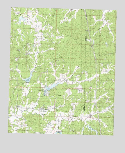
McCarley, MS USGS Topographic Map
Click on map above to begin viewing in our Map Viewer.

This topographic map contains these locations and features:
Feature Name Type Latitude Longitude GNIS ID View Map
Allen CemeteryCemeteryN33.5137°W89.8576°666207View Map
Allen CemeteryCemeteryN33.5268°W89.8631°666208View Map
Ambrose ChurchChurchN33.5735°W89.8179°1959758View Map
American Legion LakeReservoirN33.5064°W89.7773°666244View Map
American Legion Lake DamDamN33.5085°W89.7801°682155View Map
Barrentine LakeReservoirN33.5021°W89.8151°666080View Map
Bear Den CreekStreamN33.5507°W89.8537°666651View Map
Beat 1 - Carroll County Volunteer Fire DepartmentBuildingN33.6005°W89.8423°2666053View Map
Big Sand Watershed Y-32-10 DamDamN33.5418°W89.8301°682188View Map
Big Sand Watershed Y-32-11 DamDamN33.5518°W89.8501°682198View Map
Big Sand Watershed Y-32-22 DamDamN33.5068°W89.7884°682153View Map
Big Sand Watershed Y-32-8 DamDamN33.5018°W89.8067°682147View Map
Church of GodChurchN33.5135°W89.8295°668469View Map
Eden CemeteryCemeteryN33.5451°W89.8709°669665View Map
Eden Methodist ChurchChurchN33.5451°W89.8670°669666View Map
Eden SchoolSchoolN33.5473°W89.8665°669667View Map
Ellis Lake DamDamN33.5068°W89.7884°682152View Map
Hickory Grove Baptist ChurchChurchN33.5823°W89.8659°671166View Map
Hickory Grove CemeteryCemeteryN33.5823°W89.8656°671158View Map
Magic CreekStreamN33.5226°W89.8540°673063View Map
McAnerney (historical)LocaleN33.5240°W89.8129°684906View Map
McCarleyPopulated PlaceN33.5232°W89.8340°673294View Map
McCarley Community CenterBuildingN33.5435°W89.8342°684908View Map
McCarley Post OfficePost OfficeN33.5244°W89.8355°2768804View Map
Mission CemeteryCemeteryN33.5348°W89.7831°673688View Map
Mission ChurchChurchN33.5343°W89.7826°673689View Map
Mount Olive ChurchChurchN33.5029°W89.7962°674150View Map
Mullen BranchStreamN33.5168°W89.8670°674463View Map
Pink Flower CemeteryCemeteryN33.5396°W89.8167°675915View Map
Pink Flower ChurchChurchN33.5385°W89.8162°675916View Map
Pleasant Green Baptist ChurchChurchN33.5007°W89.8351°675973View Map
Pleasant Green CemeteryCemeteryN33.5012°W89.8348°675963View Map
Potacocowa Structure Y-31a-5 DamDamN33.5985°W89.8601°682233View Map
Potacocowa Watershed Y-31a-12 DamDamN33.6168°W89.8651°682244View Map
Primitive CemeteryCemeteryN33.5940°W89.8348°684920View Map
Prospect CemeteryCemeteryN33.6043°W89.7845°676353View Map
Prospect ChurchChurchN33.6035°W89.7848°676359View Map
Supervisor District 1CivilN33.5852°W89.8549°711793View Map
Supervisor District 2CivilN33.5548°W89.7520°711993View Map
Thompson CreekStreamN33.5198°W89.8484°678706View Map
Wall CemeteryCemeteryN33.5493°W89.8598°684934View Map
Whitehead CreekStreamN33.5240°W89.8195°679624View Map
WONA-FM (Winona)TowerN33.5093°W89.7548°680244View Map
Zion ChurchChurchN33.5187°W89.8331°679988View Map

Note: Coordinates in the location and feature list above are referenced to NAD83 datum.


Copyright (C) 2008-2025 Ryan Niemi / Sunset Dynamics ... All Rights Reserved