TopoQuest Logo
Do you find TopoQuest useful?
Help keep TopoQuest running and adding new maps/features by donating!
Bitcoin:  19c7KJd3qBynnjoSw5npx9KScwjBe4ifkT
Litecoin:  LXs6TkuXGGXo1vDsWCkWVdjQX94eUKd6ui
Home View Maps Find Maps Find Places Resources & Links


Liberty, Georgia Topographic Map

USGS Map Title: Liberty, GA
USGS Map MRC: 33083D2
DRG (GeoTIFF) Download: o33083d2.tif


Neighboring USGS Topographic Map Quads:


  Buckhead, GA  
33083E3
 

  Greensboro, GA  
33083E2
 

  Union Point, GA  
33083E1
 

  Harmony, GA  
33083D3
 

  Liberty, GA  
33083D2
 

  White Plains, GA  
33083D1
 

  Meda, GA  
33083C3
 

  Rockville, GA  
33083C2
 

  Shoulderbone, GA  
33083C1


Map MRC Location:

N34°
W84°
N34°
W83°
H8 H7 H6 H5 H4 H3 H2 H1
G8 G7 G6 G5 G4 G3 G2 G1
F8 F7 F6 F5 F4 F3 F2 F1
E8 E7 E6 E5 E4 E3 E2 E1
D8 D7 D6 D5 D4 D3 D2 D1
C8 C7 C6 C5 C4 C3 C2 C1
B8 B7 B6 B5 B4 B3 B2 B1
A8 A7 A6 A5 A4 A3 A2 A1
N33°
W84°
N33°
W83°

Liberty, GA USGS 1:24K Topographic Map Preview:
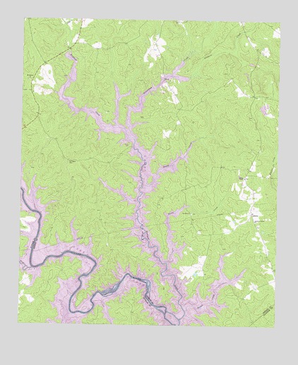
Liberty, GA USGS Topographic Map
Click on map above to begin viewing in our Map Viewer.

This topographic map contains these locations and features:
Feature Name Type Latitude Longitude GNIS ID View Map
Beaverdam CreekStreamN33.4512°W83.1952°354517View Map
Beulah School (historical)SchoolN33.4729°W83.1785°348649View Map
Cawthon School (historical)SchoolN33.3985°W83.1263°348653View Map
Comfort (historical)Populated PlaceN33.3865°W83.1413°348657View Map
Copelan-Credille CemeteryCemeteryN33.4607°W83.1379°1705399View Map
Double CreekStreamN33.3810°W83.1685°313573View Map
Flat Rock (historical)Populated PlaceN33.4646°W83.1318°348668View Map
Flat Rock ChurchChurchN33.4212°W83.1668°314196View Map
Fuller BridgeBridgeN33.4879°W83.2277°348669View Map
Hendricks CemeteryCemeteryN33.4218°W83.2107°348684View Map
Kimbrough CemeteryCemeteryN33.4143°W83.1627°1705414View Map
Lake Oconee Charter SchoolSchoolN33.4674°W83.2432°2545760View Map
Lawrence Center ChurchChurchN33.4182°W83.1357°316694View Map
LibertyPopulated PlaceN33.4215°W83.1371°332210View Map
Liberty CemeteryCemeteryN33.4357°W83.1415°1705417View Map
Liberty ChapelChurchN33.4354°W83.1410°316798View Map
Liberty Volunteer Fire DepartmentBuildingN33.4398°W83.1389°2604411View Map
Lick CreekStreamN33.3979°W83.2438°328508View Map
Linger Longer Bridge (historical)BridgeN33.4054°W83.1832°348687View Map
Little CreekStreamN33.4985°W83.2293°328536View Map
Long ShoalsRapidsN33.3887°W83.2213°348689View Map
Minnish CemeteryCemeteryN33.4271°W83.1810°1705420View Map
Mount Calvary ChurchChurchN33.4754°W83.2463°318585View Map
Mount Olive Church (historical)ChurchN33.4607°W83.1379°348695View Map
Old Salem CemeteryCemeteryN33.4415°W83.2268°1705425View Map
Old Salem Volunteer Fire DepartmentBuildingN33.4923°W83.2455°2604991View Map
Old Salem Volunteer Fire DepartmentBuildingN33.4245°W83.2138°2604225View Map
Old Salem Volunteer Fire Department Station 2BuildingN33.4104°W83.2174°2604010View Map
Pine Grove Church (historical)ChurchN33.4199°W83.2110°348706View Map
Red Oak School (historical)SchoolN33.4343°W83.1696°348707View Map
Reeves Church (historical)ChurchN33.3893°W83.1449°348708View Map
Richland CreekStreamN33.3779°W83.1713°329427View Map
Riley ShoalsRapidsN33.3896°W83.1868°347255View Map
Rocky CreekStreamN33.4007°W83.1782°321806View Map
Rowland CemeteryCemeteryN33.4785°W83.1502°1705431View Map
Ruth (historical)Populated PlaceN33.4479°W83.1338°348711View Map
Salem Church (historical)ChurchN33.4415°W83.2268°348713View Map
Salem School (historical)SchoolN33.4529°W83.2318°348714View Map
Sandy CreekStreamN33.4312°W83.1915°322465View Map
Stewarts CreekStreamN33.4801°W83.1652°329835View Map
Walker - Church Volunteer Fire DepartmentBuildingN33.4683°W83.1739°2604226View Map
Ward Hill CemeteryCemeteryN33.4804°W83.1382°1705441View Map
WDDK-FM (Greensboro)TowerN33.4749°W83.2460°352703View Map
Weaver BranchStreamN33.4257°W83.2488°347269View Map

Note: Coordinates in the location and feature list above are referenced to NAD83 datum.


Copyright (C) 2008-2024 Ryan Niemi / Sunset Dynamics ... All Rights Reserved