TopoQuest Logo
Do you find TopoQuest useful?
Help keep TopoQuest running and adding new maps/features by donating!
Bitcoin:  19c7KJd3qBynnjoSw5npx9KScwjBe4ifkT
Litecoin:  LXs6TkuXGGXo1vDsWCkWVdjQX94eUKd6ui
Home View Maps Find Maps Find Places Resources & Links


Greensburg, Louisiana Topographic Map

USGS Map Title: Greensburg, LA
USGS Map MRC: 30090G6
DRG (GeoTIFF) Download: o30090g6.tif


Neighboring USGS Topographic Map Quads:


  Chipola, LA  
30090H7
 

  Liverpool, LA  
30090H6
 

  Kentwood, LA  
30090H5
 

  Hatchersville, LA  
30090G7
 

  Greensburg, LA  
30090G6
 

  Roseland, LA  
30090G5
 

  Pine Grove, LA  
30090F7
 

  Montpelier, LA  
30090F6
 

  Amite, LA  
30090F5


Map MRC Location:

N31°
W91°
N31°
W90°
H8 H7 H6 H5 H4 H3 H2 H1
G8 G7 G6 G5 G4 G3 G2 G1
F8 F7 F6 F5 F4 F3 F2 F1
E8 E7 E6 E5 E4 E3 E2 E1
D8 D7 D6 D5 D4 D3 D2 D1
C8 C7 C6 C5 C4 C3 C2 C1
B8 B7 B6 B5 B4 B3 B2 B1
A8 A7 A6 A5 A4 A3 A2 A1
N30°
W91°
N30°
W90°

Greensburg, LA USGS 1:24K Topographic Map Preview:
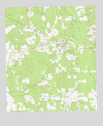
Greensburg, LA USGS Topographic Map
Click on map above to begin viewing in our Map Viewer.

This topographic map contains these locations and features:
Feature Name Type Latitude Longitude GNIS ID View Map
Arbuthnot CemeteryCemeteryN30.7813°W90.7201°1628680View Map
Audubon Regional Library Saint Helena BranchBuildingN30.8294°W90.6672°2603026View Map
Beaver BranchStreamN30.8210°W90.6359°560122View Map
Bell BranchStreamN30.7532°W90.6345°560134View Map
Bickham CemeteryCemeteryN30.8455°W90.7301°560162View Map
Bracheen BranchStreamN30.7882°W90.6437°560261View Map
Bridge BranchStreamN30.7888°W90.6440°560271View Map
Brumfield CemeteryCemeteryN30.8699°W90.6343°560282View Map
Butler School (historical)SchoolN30.7941°W90.7309°560308View Map
Chandler BranchStreamN30.7816°W90.7343°560398View Map
Chapman CemeteryCemeteryN30.7827°W90.6973°1628681View Map
Choctaw CreekStreamN30.7974°W90.7409°560426View Map
Corkern CemeteryCemeteryN30.8638°W90.6581°560467View Map
Crossroads ChurchChurchN30.8302°W90.6937°560548View Map
Distillery BranchStreamN30.7707°W90.6337°560630View Map
Dry BranchStreamN30.8610°W90.7012°560658View Map
First Baptist ChurchChurchN30.8308°W90.6704°2601732View Map
Foster CemeteryCemeteryN30.8718°W90.7187°560785View Map
Glass BranchStreamN30.7874°W90.6909°560832View Map
GreensburgPopulated PlaceN30.8307°W90.6718°1629953View Map
Greensburg Oil FieldOilfieldN30.8474°W90.6626°1629284View Map
Greensburg Volunteer Fire DepartmentBuildingN30.8197°W90.6750°2332519View Map
Hoffman CreekStreamN30.7513°W90.6826°560969View Map
Hollands PondReservoirN30.8302°W90.6634°1628767View Map
Hutchinson CemeteryCemeteryN30.8677°W90.6401°1628684View Map
Hutchison CreekStreamN30.8613°W90.6512°1627314View Map
Jackson CemeteryCemeteryN30.7571°W90.7104°1628685View Map
Jackson ChurchChurchN30.7591°W90.7057°1628686View Map
Jackson SchoolSchoolN30.7585°W90.7057°1627347View Map
Jones BranchStreamN30.8452°W90.6404°1627374View Map
Jones BranchStreamN30.7646°W90.6365°1627375View Map
Joseph BranchStreamN30.8049°W90.6362°1627377View Map
Joseph Branch Oil FieldOilfieldN30.8705°W90.7237°1629286View Map
Kemp BranchStreamN30.8591°W90.6490°1627392View Map
Kemp CemeteryCemeteryN30.7593°W90.6481°1628688View Map
Kendrick CemeteryCemeteryN30.8199°W90.6570°1627395View Map
Lazzard ChurchChurchN30.8174°W90.6612°1627459View Map
Little RiverStreamN30.8657°W90.6562°1627538View Map
Louisiana Noname 104 DamDamN30.8435°W90.7268°1628765View Map
Louisiana Noname 105 DamDamN30.8302°W90.6634°1628766View Map
McGehee CemeteryCemeteryN30.7924°W90.7331°1627631View Map
McKinney BranchStreamN30.8446°W90.6398°1627632View Map
Nettles CemeteryCemeteryN30.8227°W90.6601°1628689View Map
North Helena Volunteer Fire DepartmentBuildingN30.8310°W90.6722°2691667View Map
Northshore Technical Community College Florida Parish CampusSchoolN30.8334°W90.6882°2434864View Map
Parish Governing Authority District 2CivilN30.8328°W90.7484°1929912View Map
Parish Governing Authority District 3CivilN30.7593°W90.7303°1929972View Map
Raby BranchStreamN30.7993°W90.6351°1628017View Map
Raymond BranchStreamN30.7624°W90.6784°1628026View Map
Roberts CemeteryCemeteryN30.7668°W90.6251°1628064View Map
Sabe BranchStreamN30.8305°W90.6348°1628087View Map
Saint Helena Arts and Technology AcademySchoolN30.8290°W90.7018°1629773View Map
Saint Helena Central Middle SchoolSchoolN30.8296°W90.6978°2434823View Map
Saint Helena College and Career AcademySchoolN30.8274°W90.6713°1629291View Map
Saint Helena Fire District 4 Station 1BuildingN30.7744°W90.7405°2691725View Map
Saint Helena Head Start SchoolSchoolN30.8218°W90.6661°2600260View Map
Saint Helena ParishCivilN30.8220°W90.7103°1629457View Map
Saint Helena Parish HospitalHospitalN30.8313°W90.6663°1629292View Map
Saint Helena Parish Hospital HeliportAirportN30.8318°W90.6662°1632732View Map
Saint Helena Parish JailBuildingN30.8290°W90.6673°2755275View Map
Saint Helena Parish OfficeBuildingN30.8299°W90.6705°2603352View Map
Saint Helena Parish Police JuryBuildingN30.8281°W90.6673°2334208View Map
Saint Helena Parish Sheriff's OfficeBuildingN30.8291°W90.6670°2334017View Map
Saint Helena Police JuryBuildingN30.8434°W90.6687°2333913View Map
Saint Mary ChurchChurchN30.7799°W90.6509°1628692View Map
Sheridan ChurchChurchN30.8457°W90.6276°1628222View Map
Sorman CemeteryCemeteryN30.8052°W90.7395°1628251View Map
South Second Ward Fire DistrictBuildingN30.8319°W90.6936°2691845View Map
Spring BranchStreamN30.7757°W90.6357°1628282View Map
Spring CreekStreamN30.7888°W90.7004°1628287View Map
Strickland CemeteryCemeteryN30.8360°W90.6270°1628301View Map
Tidwell CemeteryCemeteryN30.8199°W90.6345°1628364View Map
Town of GreensburgCivilN30.8300°W90.6698°2406615View Map
Turner Chapel African Methodist Episcopal ChurchChurchN30.8304°W90.6943°2602911View Map
Ward ThreeCivilN30.7841°W90.7159°1628587View Map
Ward TwoCivilN30.8621°W90.7290°1628586View Map
Womack BranchStreamN30.7899°W90.7404°1628521View Map
Womack CemeteryCemeteryN30.8357°W90.7101°1628522View Map
Womack ChapelChurchN30.8096°W90.7295°1628523View Map
Womack-Brickham CemeteryCemeteryN30.8249°W90.7287°1628524View Map
Womack-Muse CemeteryCemeteryN30.8655°W90.7465°1628695View Map

Note: Coordinates in the location and feature list above are referenced to NAD83 datum.


Copyright (C) 2008-2025 Ryan Niemi / Sunset Dynamics ... All Rights Reserved