TopoQuest Logo
Do you find TopoQuest useful?
Help keep TopoQuest running and adding new maps/features by donating!
Bitcoin:  19c7KJd3qBynnjoSw5npx9KScwjBe4ifkT
Litecoin:  LXs6TkuXGGXo1vDsWCkWVdjQX94eUKd6ui
Home View Maps Find Maps Find Places Resources & Links


Murdock, Pennsylvania Topographic Map

USGS Map Title: Murdock, PA
USGS Map MRC: 39079H1
DRG (GeoTIFF) Download: o39079h1.tif


Neighboring USGS Topographic Map Quads:


  Bakersville, PA  
40079A2
 

  Somerset, PA  
40079A1
 

  Stoystown, PA  
40078A8
 

  Rockwood, PA  
39079H2
 

  Murdock, PA  
39079H1
 

  Berlin, PA  
39078H8
 

  Markleton, PA  
39079G2
 

  Meyersdale, PA  
39079G1
 

  Wittenberg, PA  
39078G8


Map MRC Location:

N40°
W80°
N40°
W79°
H8 H7 H6 H5 H4 H3 H2 H1
G8 G7 G6 G5 G4 G3 G2 G1
F8 F7 F6 F5 F4 F3 F2 F1
E8 E7 E6 E5 E4 E3 E2 E1
D8 D7 D6 D5 D4 D3 D2 D1
C8 C7 C6 C5 C4 C3 C2 C1
B8 B7 B6 B5 B4 B3 B2 B1
A8 A7 A6 A5 A4 A3 A2 A1
N39°
W80°
N39°
W79°

Murdock, PA USGS 1:24K Topographic Map Preview:
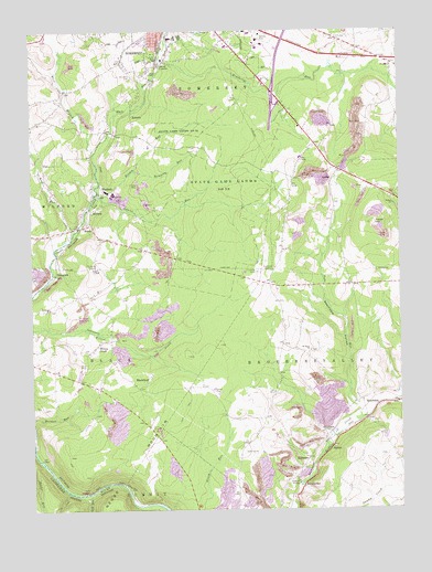
Murdock, PA USGS Topographic Map
Click on map above to begin viewing in our Map Viewer.

This topographic map contains these locations and features:
Feature Name Type Latitude Longitude GNIS ID View Map
Allegheny MinesMineN39.8945°W79.0248°1206105View Map
AlthousePopulated PlaceN39.8881°W79.0309°1168227View Map
Ankeny School (historical)SchoolN39.9851°W79.1089°1206113View Map
Base Rock QuarryMineN39.9492°W79.0597°1206054View Map
BeachdalePopulated PlaceN39.9037°W79.0122°1198366View Map
Beachdale HollowValleyN39.9005°W79.0140°1168835View Map
Beachley MineMineN39.9667°W79.0186°1206108View Map
Best LookoutLocaleN39.8859°W79.0970°1205111View Map
BlackfieldPopulated PlaceN39.9067°W79.0881°1169756View Map
Bromm RunStreamN39.9567°W79.1014°1198045View Map
Bromm School (historical)SchoolN39.9742°W79.0889°1206110View Map
Bromm School (historical)SchoolN39.9734°W79.0881°1206053View Map
Buffalo StationLocaleN39.9034°W79.0009°1206857View Map
BurkhelderPopulated PlaceN39.8809°W79.0331°1170722View Map
Coleman SchoolSchoolN39.9701°W79.0256°1213447View Map
Cover HillSummitN39.9492°W79.0084°1172535View Map
Dempsey RunStreamN39.9567°W79.1011°1173146View Map
Dovan FarmsLocaleN39.9172°W79.0464°2585731View Map
East Branch Coxes CreekStreamN39.9681°W79.1034°1192397View Map
Edgewood Grove StationLocaleN39.9923°W79.0803°1212263View Map
FairviewPopulated PlaceN39.9901°W79.0020°1201947View Map
Flickinger SchoolSchoolN39.9437°W79.0181°1206107View Map
Garrett Slope StationLocaleN39.8823°W79.0325°1212264View Map
Kimberly RunStreamN39.9931°W79.0797°1178461View Map
Laurel RunStreamN39.9573°W79.1031°1178972View Map
Lick RunStreamN39.8798°W79.1053°1179306View Map
Long School (historical)SchoolN39.8954°W79.0411°1206104View Map
McGregor MinesMineN39.9412°W79.1011°1206102View Map
MilfordPopulated PlaceN39.9531°W79.1042°1181105View Map
Milford StationLocaleN39.9526°W79.1048°1206859View Map
Millers RunStreamN39.9037°W79.0011°1199170View Map
Mount Calvary ChurchChurchN39.9776°W79.1189°1206112View Map
MurdockPopulated PlaceN39.9581°W79.0989°1182101View Map
Parson RunStreamN39.9987°W79.0772°1183346View Map
Pennsylvania State Police Troop T Somerset StationBuildingN39.9928°W79.0196°2777276View Map
Pines Church (historical)ChurchN39.9659°W79.1206°1206111View Map
Piney Run Golf CourseLocaleN39.8901°W79.0511°1205602View Map
Plank Road School (historical)SchoolN39.9917°W79.0514°1206109View Map
Rice RunStreamN39.9456°W79.1139°1184989View Map
RobertsPopulated PlaceN39.9790°W79.0895°1185205View Map
Saint Johns CemeteryCemeteryN39.9887°W79.0897°1186055View Map
Saint Johns ChurchChurchN39.9279°W79.1186°1186091View Map
Saint Marks Church (historical)ChurchN39.9551°W79.0472°1213595View Map
Saint Pauls ChurchChurchN39.9170°W79.0300°1186570View Map
Salem ChurchChurchN39.9545°W79.0011°1186814View Map
Shafer RunStreamN39.8909°W79.1248°1187320View Map
ShamrockPopulated PlaceN39.9373°W79.1145°1204622View Map
ShoberPopulated PlaceN39.8915°W79.0225°1187570View Map
Somerset CountyCivilN39.9724°W79.0283°1209188View Map
State Correctional Institution SomersetBuildingN39.9642°W79.0390°2757203View Map
State Game Lands Number 50ParkN39.9740°W79.0731°1193457View Map
Summit SchoolSchoolN39.9254°W79.0406°1206106View Map
Tubs RunStreamN39.9012°W79.0134°1198134View Map
Vogel MineMineN39.8773°W79.0411°1201641View Map
WADJ-AM (Somerset)TowerN39.9926°W79.0945°1200350View Map
West Branch Coxes CreekStreamN39.9681°W79.1028°1193626View Map
Wills ChurchChurchN39.9906°W79.0020°1191516View Map
Wilson CreekPopulated PlaceN39.9176°W79.1034°1191531View Map
Wilson Creek MinesMineN39.9181°W79.0934°1206103View Map

Note: Coordinates in the location and feature list above are referenced to NAD83 datum.


Copyright (C) 2008-2025 Ryan Niemi / Sunset Dynamics ... All Rights Reserved