TopoQuest Logo
Do you find TopoQuest useful?
Help keep TopoQuest running and adding new maps/features by donating!
Bitcoin:  19c7KJd3qBynnjoSw5npx9KScwjBe4ifkT
Litecoin:  LXs6TkuXGGXo1vDsWCkWVdjQX94eUKd6ui
Home View Maps Find Maps Find Places Resources & Links


Olive Branch, North Carolina Topographic Map

USGS Map Title: Olive Branch, NC
USGS Map MRC: 35080A3
DRG (GeoTIFF) Download: o35080a3.tif


Neighboring USGS Topographic Map Quads:


  Stanfield, NC  
35080B4
 

  Oakboro, NC  
35080B3
 

  Aquadale, NC  
35080B2
 

  Watson, NC  
35080A4
 

  Olive Branch, NC  
35080A3
 

  Polkton, NC  
35080A2
 

  Wingate, NC  
34080H4
 

  Marshville, NC  
34080H3
 

  Russellville, NC  
34080H2


Map MRC Location:

N36°
W81°
N36°
W80°
H8 H7 H6 H5 H4 H3 H2 H1
G8 G7 G6 G5 G4 G3 G2 G1
F8 F7 F6 F5 F4 F3 F2 F1
E8 E7 E6 E5 E4 E3 E2 E1
D8 D7 D6 D5 D4 D3 D2 D1
C8 C7 C6 C5 C4 C3 C2 C1
B8 B7 B6 B5 B4 B3 B2 B1
A8 A7 A6 A5 A4 A3 A2 A1
N35°
W81°
N35°
W80°

Olive Branch, NC USGS 1:24K Topographic Map Preview:
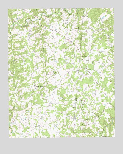
Olive Branch, NC USGS Topographic Map
Click on map above to begin viewing in our Map Viewer.

This topographic map contains these locations and features:
Feature Name Type Latitude Longitude GNIS ID View Map
Baucom Family CemeteryCemeteryN35.1223°W80.3496°2778847View Map
Baucoms CemeteryCemeteryN35.1024°W80.3222°980636View Map
Becky BranchStreamN35.0307°W80.3676°980879View Map
Blackwell BranchStreamN35.0110°W80.2598°981564View Map
Cappadocia ChurchChurchN35.0940°W80.2562°982636View Map
Carpenter CemeteryCemeteryN35.0467°W80.3209°2778901View Map
Caudle BranchStreamN35.0240°W80.2887°982779View Map
Davis CemeteryCemeteryN35.0890°W80.3290°983992View Map
Deep Spring ChurchChurchN35.0304°W80.2767°984101View Map
Fountain HillPopulated PlaceN35.0777°W80.2884°1020338View Map
Fountain Hill United Methodist CemeteryCemeteryN35.0787°W80.2891°2778982View Map
Godwin Family CemeteryCemeteryN35.1067°W80.3549°2778848View Map
Gold BranchStreamN35.0574°W80.3287°985765View Map
Gourdvine CreekStreamN35.1143°W80.3403°985873View Map
Hamilton CrossroadsPopulated PlaceN35.0496°W80.3445°1006227View Map
Hamilton Crossroads Baptist Church CemeteryCemeteryN35.0509°W80.3437°2778899View Map
Harmony Community ChurchChurchN35.0182°W80.2976°986423View Map
Jacks BranchStreamN35.0610°W80.3684°987478View Map
Jerusalem ChurchChurchN35.1174°W80.2845°987583View Map
Jerusalem Church CemeteryCemeteryN35.1169°W80.2837°2778906View Map
Jones PondReservoirN35.1158°W80.2632°998406View Map
Jones Pond DamDamN35.1135°W80.2648°998407View Map
Lacey BranchStreamN35.0010°W80.2731°988069View Map
Little Water BranchStreamN35.1174°W80.2926°988798View Map
Lockhart BranchStreamN35.0657°W80.2753°988828View Map
Maness BranchStreamN35.0240°W80.2887°989270View Map
Mile BranchStreamN35.0213°W80.2759°989845View Map
New Home ChurchChurchN35.0749°W80.2803°990977View Map
New Home Church CemeteryCemeteryN35.0750°W80.2788°2778981View Map
Olive BranchPopulated PlaceN35.1040°W80.3212°991633View Map
Olive Branch Baptist CemeteryCemeteryN35.1031°W80.3174°2778849View Map
Olive Branch Missionary Baptist Church CemeteryCemeteryN35.0985°W80.3227°2778850View Map
Rebel HillSummitN35.0790°W80.2851°1022180View Map
Salem CreekStreamN35.1057°W80.3731°990898View Map
Smith BranchStreamN35.0740°W80.3309°994929View Map
Stegall BranchStreamN35.1190°W80.3359°995461View Map
Township of New SalemCivilN35.1162°W80.3552°1027247View Map
Union Emergency Medical ServicesBuildingN35.1063°W80.3282°2720453View Map
Union Grove ChurchChurchN35.0115°W80.3401°996476View Map
Union Grove Church CemeteryCemeteryN35.0121°W80.3394°2778898View Map
Water BranchStreamN35.1232°W80.2928°996839View Map
Zion Crossroad ChurchChurchN35.0318°W80.3267°997791View Map
Zion Crossroad Church CemeteryCemeteryN35.0317°W80.3268°2778900View Map

Note: Coordinates in the location and feature list above are referenced to NAD83 datum.


Copyright (C) 2008-2025 Ryan Niemi / Sunset Dynamics ... All Rights Reserved