TopoQuest Logo
Do you find TopoQuest useful?
Help keep TopoQuest running and adding new maps/features by donating!
Bitcoin:  19c7KJd3qBynnjoSw5npx9KScwjBe4ifkT
Litecoin:  LXs6TkuXGGXo1vDsWCkWVdjQX94eUKd6ui
Home View Maps Find Maps Find Places Resources & Links


Parrott, Georgia Topographic Map

USGS Map Title: Parrott, GA
USGS Map MRC: 31084H5
DRG (GeoTIFF) Download: o31084h5.tif


Neighboring USGS Topographic Map Quads:


  Richland, GA  
32084A6
 

  Preston, GA  
32084A5
 

  Plains, GA  
32084A4
 

  Benevolence, GA  
31084H6
 

  Parrott, GA  
31084H5
 

  Bottsford, GA  
31084H4
 

  Brooksville, GA  
31084G6
 

  Shellman, GA  
31084G5
 

  Dawson, GA  
31084G4


Map MRC Location:

N32°
W85°
N32°
W84°
H8 H7 H6 H5 H4 H3 H2 H1
G8 G7 G6 G5 G4 G3 G2 G1
F8 F7 F6 F5 F4 F3 F2 F1
E8 E7 E6 E5 E4 E3 E2 E1
D8 D7 D6 D5 D4 D3 D2 D1
C8 C7 C6 C5 C4 C3 C2 C1
B8 B7 B6 B5 B4 B3 B2 B1
A8 A7 A6 A5 A4 A3 A2 A1
N31°
W85°
N31°
W84°

Parrott, GA USGS 1:24K Topographic Map Preview:
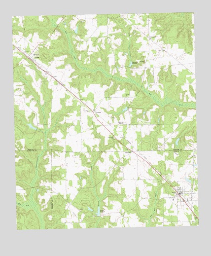
Parrott, GA USGS Topographic Map
Click on map above to begin viewing in our Map Viewer.

This topographic map contains these locations and features:
Feature Name Type Latitude Longitude GNIS ID View Map
Ballingtine LakeReservoirN31.9019°W84.5063°342229View Map
Ballingtine Lake DamDamN31.9002°W84.5049°342228View Map
CenterpointPopulated PlaceN31.9852°W84.5302°326214View Map
ChamblissPopulated PlaceN31.9196°W84.5441°355105View Map
Davenports MillpondReservoirN31.9705°W84.5441°313324View Map
Davenports Millpond DamDamN31.9707°W84.5433°340804View Map
Foremans CemeteryCemeteryN31.9324°W84.5438°314264View Map
Green Point ChurchChurchN31.9435°W84.5730°314850View Map
Greenfield AcademySchoolN31.9774°W84.6102°314862View Map
Holoka LakeReservoirN31.9248°W84.5132°340749View Map
Holoka Lake DamDamN31.9268°W84.5132°340748View Map
Jackson Grove ChurchChurchN31.9157°W84.5019°316013View Map
Kennedy LakeReservoirN31.9443°W84.5486°340747View Map
Kennedy Lake DamDamN31.9435°W84.5483°340746View Map
Lee Mill (historical)LocaleN31.8913°W84.5285°344669View Map
LeverettsPopulated PlaceN31.9429°W84.5699°326365View Map
Long BranchStreamN31.9607°W84.5433°317306View Map
Macedonia CemeteryCemeteryN31.9727°W84.5338°345027View Map
Macedonia ChurchChurchN31.8899°W84.5071°317535View Map
Macedonia ChurchChurchN31.9718°W84.5335°317537View Map
Mount Olive ChurchChurchN31.9207°W84.5460°318740View Map
Mulkey LakeReservoirN31.9353°W84.6129°340743View Map
Mulkey Lake DamDamN31.9352°W84.6099°340742View Map
ParrottPopulated PlaceN31.8935°W84.5132°320249View Map
Parrott Baptist ChurchChurchN31.8957°W84.5302°344682View Map
Parrott CemeteryCemeteryN31.8979°W84.5130°344683View Map
Parrott School (historical)SchoolN31.8907°W84.5169°344684View Map
Parrott Volunteer Fire DepartmentBuildingN31.8940°W84.5098°2604207View Map
Perry LakeReservoirN31.8861°W84.5741°342231View Map
Perry Lake DamDamN31.8852°W84.5733°342230View Map
Red Hill CemeteryCemeteryN31.8857°W84.5477°344692View Map
Saint Mark Baptist ChurchChurchN31.9815°W84.6230°345033View Map
Stapleton LakeReservoirN31.9910°W84.5807°340745View Map
Stapleton Lake DamDamN31.9902°W84.5816°340744View Map
Town of ParrottCivilN31.8944°W84.5118°2407077View Map
Town of Weston (historical)CivilN31.9769°W84.6116°2406870View Map
Turkey Creek CemeteryCemeteryN31.9274°W84.5563°345034View Map
Turkey Creek ChurchChurchN31.9274°W84.5563°324388View Map
Turner ChapelChurchN31.8857°W84.5813°324405View Map
Veneys Mill (historical)LocaleN31.8821°W84.5677°344707View Map
Veneys MillpondReservoirN31.8847°W84.5686°324680View Map
Veneys Millpond DamDamN31.8849°W84.5685°338506View Map
WACS-TV (Dawson)TowerN31.9377°W84.5541°352855View Map
West Fork Ichawaynochaway CreekStreamN31.8888°W84.6130°325047View Map
WestonPopulated PlaceN31.9760°W84.6149°333396View Map
Weston Baptist ChurchChurchN31.9743°W84.6096°345037View Map
Weston CemeteryCemeteryN31.9746°W84.6096°345038View Map
Weston CemeteryCemeteryN31.9785°W84.6169°345039View Map
Weston DivisionCivilN31.9892°W84.5643°1936641View Map
Weston Volunteer Fire DepartmentBuildingN31.9785°W84.6163°2604789View Map

Note: Coordinates in the location and feature list above are referenced to NAD83 datum.


Copyright (C) 2008-2025 Ryan Niemi / Sunset Dynamics ... All Rights Reserved