TopoQuest Logo
Do you find TopoQuest useful?
Help keep TopoQuest running and adding new maps/features by donating!
Bitcoin:  19c7KJd3qBynnjoSw5npx9KScwjBe4ifkT
Litecoin:  LXs6TkuXGGXo1vDsWCkWVdjQX94eUKd6ui
Home View Maps Find Maps Find Places Resources & Links


Benevolence, Georgia Topographic Map

USGS Map Title: Benevolence, GA
USGS Map MRC: 31084H6
DRG (GeoTIFF) Download: o31084h6.tif


Neighboring USGS Topographic Map Quads:


  Lumpkin, GA  
32084A7
 

  Richland, GA  
32084A6
 

  Preston, GA  
32084A5
 

  County Line, GA  
31084H7
 

  Benevolence, GA  
31084H6
 

  Parrott, GA  
31084H5
 

  Cuthbert, GA  
31084G7
 

  Brooksville, GA  
31084G6
 

  Shellman, GA  
31084G5


Map MRC Location:

N32°
W85°
N32°
W84°
H8 H7 H6 H5 H4 H3 H2 H1
G8 G7 G6 G5 G4 G3 G2 G1
F8 F7 F6 F5 F4 F3 F2 F1
E8 E7 E6 E5 E4 E3 E2 E1
D8 D7 D6 D5 D4 D3 D2 D1
C8 C7 C6 C5 C4 C3 C2 C1
B8 B7 B6 B5 B4 B3 B2 B1
A8 A7 A6 A5 A4 A3 A2 A1
N31°
W85°
N31°
W84°

Benevolence, GA USGS 1:24K Topographic Map Preview:
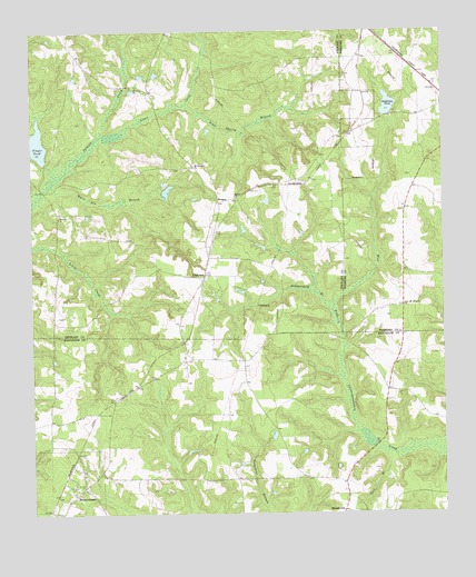
Benevolence, GA USGS Topographic Map
Click on map above to begin viewing in our Map Viewer.

This topographic map contains these locations and features:
Feature Name Type Latitude Longitude GNIS ID View Map
BargesLocaleN31.9565°W84.6924°310796View Map
Barges Mill (historical)LocaleN31.9202°W84.6555°344716View Map
BenevolencePopulated PlaceN31.8818°W84.7346°331134View Map
Benevolence Baptist ChurchChurchN31.8865°W84.7349°2585262View Map
Benevolence Baptist Church CemeteryCemeteryN31.8871°W84.7348°2585263View Map
Clear CreekStreamN31.9738°W84.7241°312719View Map
Goodwins PondReservoirN31.9808°W84.6414°314696View Map
Goodwins Pond DamDamN31.9802°W84.6405°337331View Map
GorePopulated PlaceN31.9013°W84.7263°344738View Map
Lime Spring BranchStreamN31.9810°W84.7016°316872View Map
Mount Airy ChurchChurchN31.9518°W84.7413°318548View Map
Mount Olive ChurchChurchN31.9857°W84.7169°318742View Map
Mount Pleasant ChurchChurchN31.9652°W84.6996°318836View Map
New Mount Lebanon ChurchChurchN31.9290°W84.6369°319483View Map
Overbys Mill (historical)LocaleN31.9946°W84.6971°347330View Map
Pataula School (historical)SchoolN31.9865°W84.7177°347331View Map
Pisgah Church (historical)ChurchN31.9732°W84.6563°347336View Map
Pool BranchStreamN31.8904°W84.6419°321002View Map
Randolph County Fire Department Benevolence StationBuildingN31.8805°W84.7382°2604428View Map
Sardis CemeteryCemeteryN31.9568°W84.6880°347349View Map
Sardis ChurchChurchN31.9571°W84.6869°322537View Map
Singer BridgeBridgeN31.9590°W84.7463°347354View Map
Singer PondLakeN31.9712°W84.7481°323030View Map
Singers Pond DamDamN31.9715°W84.7480°337481View Map
Summerford BranchStreamN31.9271°W84.6583°323740View Map
TroutmanPopulated PlaceN31.9368°W84.6969°326561View Map
Wards Mill (historical)LocaleN31.9154°W84.7438°344779View Map
Watts Gin BranchStreamN31.9602°W84.7435°324925View Map

Note: Coordinates in the location and feature list above are referenced to NAD83 datum.


Copyright (C) 2008-2025 Ryan Niemi / Sunset Dynamics ... All Rights Reserved