TopoQuest Logo
Do you find TopoQuest useful?
Help keep TopoQuest running and adding new maps/features by donating!
Bitcoin:  19c7KJd3qBynnjoSw5npx9KScwjBe4ifkT
Litecoin:  LXs6TkuXGGXo1vDsWCkWVdjQX94eUKd6ui
Home View Maps Find Maps Find Places Resources & Links


Mount Sterling, Iowa Topographic Map

USGS Map Title: Mount Sterling, IA
USGS Map MRC: 40091E8
DRG (GeoTIFF) Download: o40091e8.tif


Neighboring USGS Topographic Map Quads:


  Cantril, IA  
40092F1
 

  Keosauqua, IA  
40091F8
 

  Bonaparte, IA  
40091F7
 

  Azen, MO  
40092E1
 

  Mount Sterling, IA  
40091E8
 

  Anson, MO  
40091E7
 

  Arbela, MO  
40092D1
 

  Wyaconda, MO  
40091D8
 

  Medill, MO  
40091D7


Map MRC Location:

N41°
W92°
N41°
W91°
H8 H7 H6 H5 H4 H3 H2 H1
G8 G7 G6 G5 G4 G3 G2 G1
F8 F7 F6 F5 F4 F3 F2 F1
E8 E7 E6 E5 E4 E3 E2 E1
D8 D7 D6 D5 D4 D3 D2 D1
C8 C7 C6 C5 C4 C3 C2 C1
B8 B7 B6 B5 B4 B3 B2 B1
A8 A7 A6 A5 A4 A3 A2 A1
N40°
W92°
N40°
W91°

Mount Sterling, IA USGS 1:24K Topographic Map Preview:
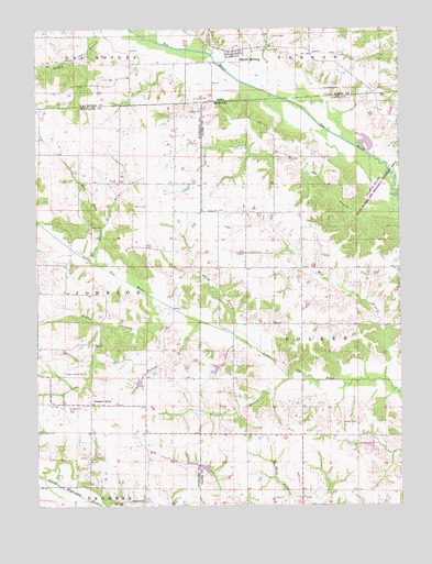
Mount Sterling, IA USGS Topographic Map
Click on map above to begin viewing in our Map Viewer.

This topographic map contains these locations and features:
Feature Name Type Latitude Longitude GNIS ID View Map
Allphin CemeteryCemeteryN40.5786°W91.9666°713240View Map
Asbury ChurchChurchN40.5775°W91.9380°735489View Map
Bibb CemeteryCemeteryN40.5678°W91.9624°714121View Map
Black Oak CemeteryCemeteryN40.5015°W91.9667°2777531View Map
Black Oak ChurchChurchN40.5011°W91.9685°714300View Map
Black Oak School (historical)SchoolN40.5011°W91.9730°733027View Map
Blackledge CemeteryCemeteryN40.6095°W91.8955°454668View Map
Brookhart CemeteryCemeteryN40.5197°W91.9999°714741View Map
Canaan SchoolSchoolN40.5498°W91.9277°731694View Map
Charlie Heath State Forest and Memorial Wildlife AreaParkN40.5781°W91.8782°742933View Map
City of Mount SterlingCivilN40.6181°W91.9367°2395126View Map
Cochenour Lake DamDamN40.5100°W91.9418°762254View Map
Conkle CemeteryCemeteryN40.5214°W91.8907°716190View Map
Davis CemeteryCemeteryN40.5736°W91.9785°716721View Map
East Fork Jordan BranchStreamN40.5736°W91.9768°717289View Map
Fairplay SchoolSchoolN40.5773°W91.9193°731693View Map
Fox RiverStreamN40.6114°W91.9299°456714View Map
Gorgas CemeteryCemeteryN40.5256°W91.9893°718622View Map
Harness CemeteryCemeteryN40.6232°W91.9192°457272View Map
Heald CemeteryCemeteryN40.6034°W91.9477°719316View Map
Hughes BranchStreamN40.5517°W91.9532°719968View Map
Jordan BranchStreamN40.5636°W91.9802°720430View Map
Jordan School (historical)SchoolN40.5853°W91.9718°733025View Map
Miller CemeteryCemeteryN40.6210°W91.9313°1981017View Map
Mount SterlingPopulated PlaceN40.6178°W91.9321°459338View Map
Mount Sterling (historical)LocaleN40.6178°W91.9321°1980873View Map
Mount Sterling Census Designated PlaceCensusN40.6198°W91.9326°2746618View Map
Mount Sterling Post Office (historical)Post OfficeN40.6178°W91.9321°1980872View Map
Pilcher BranchStreamN40.5339°W91.9141°724339View Map
Prospect GrovePopulated PlaceN40.5264°W91.9821°741173View Map
Prospect Grove CemeteryCemeteryN40.5347°W91.9843°724955View Map
Prospect Grove School (historical)SchoolN40.5375°W91.9732°733026View Map
Seaver Lake DamDamN40.5367°W91.9385°762255View Map
Smith BranchStreamN40.5450°W91.9330°726579View Map
Township of FolkerCivilN40.5410°W91.8882°766493View Map
Township of JohnsonCivilN40.5547°W91.9991°767377View Map
Turkey BranchStreamN40.5484°W91.9438°727840View Map
Union School (historical)SchoolN40.5175°W91.9104°731695View Map
West Fork Jordan BranchStreamN40.5736°W91.9768°728567View Map
Wolf BranchStreamN40.5323°W91.8793°729030View Map

Note: Coordinates in the location and feature list above are referenced to NAD83 datum.


Copyright (C) 2008-2024 Ryan Niemi / Sunset Dynamics ... All Rights Reserved