TopoQuest Logo
Do you find TopoQuest useful?
Help keep TopoQuest running and adding new maps/features by donating!
Bitcoin:  19c7KJd3qBynnjoSw5npx9KScwjBe4ifkT
Litecoin:  LXs6TkuXGGXo1vDsWCkWVdjQX94eUKd6ui
Home View Maps Find Maps Find Places Resources & Links


Rogillioville, Louisiana Topographic Map

USGS Map Title: Rogillioville, LA
USGS Map MRC: 30091H2
DRG (GeoTIFF) Download: o30091h2.tif


Neighboring USGS Topographic Map Quads:


  Woodville, MS  
31091A3
 

  Newtonia, MS  
31091A2
 

  Centreville, MS  
31091A1
 

  Laurel Hill, LA  
30091H3
 

  Rogillioville, LA  
30091H2
 

  Wilson, LA  
30091H1
 

  Elm Park, LA  
30091G3
 

  Jackson, LA  
30091G2
 

  Clinton, LA  
30091G1


Map MRC Location:

N31°
W92°
N31°
W91°
H8 H7 H6 H5 H4 H3 H2 H1
G8 G7 G6 G5 G4 G3 G2 G1
F8 F7 F6 F5 F4 F3 F2 F1
E8 E7 E6 E5 E4 E3 E2 E1
D8 D7 D6 D5 D4 D3 D2 D1
C8 C7 C6 C5 C4 C3 C2 C1
B8 B7 B6 B5 B4 B3 B2 B1
A8 A7 A6 A5 A4 A3 A2 A1
N30°
W92°
N30°
W91°

Rogillioville, LA USGS 1:24K Topographic Map Preview:
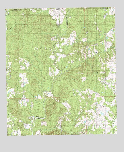
Rogillioville, LA USGS Topographic Map
Click on map above to begin viewing in our Map Viewer.

This topographic map contains these locations and features:
Feature Name Type Latitude Longitude GNIS ID View Map
Beaver CreekStreamN30.8768°W91.2209°532856View Map
Cason CreekStreamN30.9180°W91.2082°533804View Map
Cockerham Lake DamDamN30.8952°W91.1418°556779View Map
Concord ChurchChurchN30.9055°W91.2371°534073View Map
Dawson BranchStreamN30.8763°W91.1765°534416View Map
East Fork Beaver Dam CreekStreamN30.8777°W91.1787°550112View Map
Gin BranchStreamN30.9596°W91.1287°535232View Map
Hickman BottomValleyN30.9478°W91.1593°535644View Map
Hickory Grove ChurchChurchN30.9218°W91.2415°535648View Map
Hickory Hill PlantationLocaleN30.9085°W91.1807°550118View Map
Hurricane CreekStreamN30.9574°W91.1957°535874View Map
Jews CreekStreamN30.9730°W91.1898°536042View Map
Lost CreekStreamN30.9352°W91.1876°536740View Map
McQueen CemeteryCemeteryN30.8977°W91.1818°537018View Map
Mount Common ChurchChurchN30.9618°W91.1582°537314View Map
Mount Common Church Gas FieldOilfieldN30.9738°W91.1484°1629528View Map
Oakgrove ChurchChurchN30.9027°W91.1829°537800View Map
Parish Governing Authority District 3CivilN30.8825°W91.1399°1929950View Map
Pilgrim Rest Baptist ChurchChurchN30.9254°W91.1433°2602584View Map
Pilgrims Rest ChurchChurchN30.9291°W91.1565°538147View Map
Pisgah CemeteryCemeteryN30.9627°W91.1537°538217View Map
Rilgrims Rest CemeteryCemeteryN30.9243°W91.1429°538611View Map
RogilliovillePopulated PlaceN30.9252°W91.2312°541178View Map
Saint Johns CemeteryCemeteryN30.9380°W91.1373°538889View Map
Saint Paul Missionary Baptist ChurchChurchN30.9199°W91.1582°2602735View Map
Sandel CemeteryCemeteryN30.9343°W91.1354°539141View Map
Santle BranchStreamN30.9307°W91.1943°539173View Map
Scott CemeteryCemeteryN30.9005°W91.1529°539229View Map
Shady Grove BranchStreamN30.9602°W91.1304°539269View Map
Shothole BranchStreamN30.8924°W91.2071°539358View Map
Singletar CemeteryCemeteryN30.9080°W91.1279°539396View Map
Smith CemeteryCemeteryN30.9010°W91.1351°539433View Map
South Fork Beaver CreekStreamN30.8774°W91.1784°539494View Map
Spring BranchStreamN30.9049°W91.2090°539564View Map
Sydal Acres AirportAirportN30.9196°W91.1650°1633009View Map
The Shades PlantationLocaleN30.9027°W91.1426°550144View Map
Thom CreekStreamN30.9307°W91.2484°539871View Map
Thompson Creek Oil FieldOilfieldN30.9182°W91.2321°550197View Map
Trinity Baptist ChurchChurchN30.8865°W91.1908°2602879View Map
Ward FiveCivilN30.9168°W91.2426°545282View Map
Wayside (historical)Populated PlaceN30.9718°W91.1946°550202View Map
Westerfield Lake DamDamN30.8852°W91.1618°556780View Map

Note: Coordinates in the location and feature list above are referenced to NAD83 datum.


Copyright (C) 2008-2024 Ryan Niemi / Sunset Dynamics ... All Rights Reserved