TopoQuest Logo
Do you find TopoQuest useful?
Help keep TopoQuest running and adding new maps/features by donating!
Bitcoin:  19c7KJd3qBynnjoSw5npx9KScwjBe4ifkT
Litecoin:  LXs6TkuXGGXo1vDsWCkWVdjQX94eUKd6ui
Home View Maps Find Maps Find Places Resources & Links


Camp Wood, Arizona Topographic Map

USGS Map Title: Camp Wood, AZ
USGS Map MRC: 34112G8
DRG (GeoTIFF) Download: o34112g8.tif


Neighboring USGS Topographic Map Quads:


  Mount Hope, AZ  
34113H1
 

  Juniper Mountains, AZ  
34112H8
 

  Indian Peak, AZ  
34112H7
 

  Scratch Canyon, AZ  
34113G1
 

  Camp Wood, AZ  
34112G8
 

  Seepage Mountain, AZ  
34112G7
 

  Behm Mesa, AZ  
34113F1
 

  Sheridan Mountain, AZ  
34112F8
 

  Smith Mesa, AZ  
34112F7


Map MRC Location:

N35°
W113°
N35°
W112°
H8 H7 H6 H5 H4 H3 H2 H1
G8 G7 G6 G5 G4 G3 G2 G1
F8 F7 F6 F5 F4 F3 F2 F1
E8 E7 E6 E5 E4 E3 E2 E1
D8 D7 D6 D5 D4 D3 D2 D1
C8 C7 C6 C5 C4 C3 C2 C1
B8 B7 B6 B5 B4 B3 B2 B1
A8 A7 A6 A5 A4 A3 A2 A1
N34°
W113°
N34°
W112°

Camp Wood, AZ USGS 1:24K Topographic Map Preview:
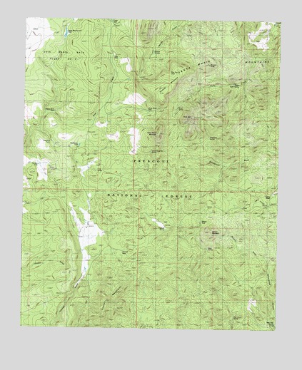
Camp Wood, AZ USGS Topographic Map
Click on map above to begin viewing in our Map Viewer.

This topographic map contains these locations and features:
Feature Name Type Latitude Longitude GNIS ID View Map
Apache SpringsSpringN34.8623°W112.9375°38219View Map
Bar Thirtyseven RanchLocaleN34.7947°W112.9982°25955View Map
Bear Trap SpringSpringN34.7530°W112.8766°38248View Map
Brown SpringSpringN34.8393°W112.9255°38274View Map
Camp WoodLocaleN34.8006°W112.8794°27218View Map
Camp Wood Corner DamDamN34.8675°W112.9813°38312View Map
Camp Wood Corner TankReservoirN34.8690°W112.9809°41046View Map
Camp Wood MountainSummitN34.8284°W112.9341°27219View Map
Camp Wood Mountain SpringSpringN34.8217°W112.9382°38313View Map
Camp Wood Ranger Guard StationLocaleN34.8059°W112.8805°38314View Map
Camp Wood TankReservoirN34.8380°W112.9399°38315View Map
Carter TankReservoirN34.8743°W112.9586°38318View Map
Connell GulchValleyN34.7764°W112.9691°27853View Map
Connell MountainsRangeN34.7528°W112.9613°27854View Map
Connell SeepSpringN34.7809°W112.9538°38358View Map
Granite KnobSummitN34.8567°W112.9094°29478View Map
Grapevine SpringSpringN34.8273°W112.9096°38480View Map
Harmon TankReservoirN34.8160°W112.9932°38494View Map
Hunt TankReservoirN34.8602°W112.9573°38525View Map
Hyde Creek MountainSummitN34.8353°W112.9185°29956View Map
Hyde Mountain Lookout TowerTowerN34.8350°W112.9185°43532View Map
L O SpringSpringN34.8236°W112.9230°38557View Map
Live Oak WellWellN34.7689°W112.8888°38583View Map
McElhaney TankReservoirN34.8241°W112.9735°38614View Map
Merritt SpringSpringN34.8001°W112.8793°24267View Map
Paddock RanchLocaleN34.7914°W112.9307°32620View Map
Paddock SpringSpringN34.7906°W112.9308°38681View Map
Panther SpringSpringN34.8728°W112.9257°38682View Map
Pasture B TankReservoirN34.8254°W112.9869°41049View Map
Pasture Number Three TankReservoirN34.8374°W112.9858°38685View Map
Pine FlatsFlatN34.8009°W112.8891°32942View Map
Pine SpringSpringN34.7551°W112.8966°41066View Map
Pinetop MountainSummitN34.8450°W112.9341°32992View Map
Pinetop TankReservoirN34.8550°W112.9313°38700View Map
Pinetop Trick TankReservoirN34.8484°W112.9296°41047View Map
Ranger Guard StationLocaleN34.8045°W112.8860°33372View Map
Rock House SpringSpringN34.8008°W112.8875°38758View Map
Rock SpringSpringN34.8667°W112.9080°38760View Map
Ruins TankReservoirN34.8741°W112.8784°38769View Map
Santa Maria MountainsRangeN34.8417°W112.8755°40986View Map
Seven Up RanchLocaleN34.8178°W112.9671°34282View Map
Seven Up SpringSpringN34.8139°W112.9646°38800View Map
Shivers Trap SpringSpringN34.7625°W112.9202°38808View Map
Snag SpringSpringN34.7827°W112.9096°38819View Map
Stinson MountainSummitN34.7889°W112.9082°34855View Map
Stinson TankReservoirN34.7935°W112.9130°21454View Map
Stinson WashStreamN34.7753°W112.8791°34856View Map
Triangle HC RanchLocaleN34.8006°W112.9677°35467View Map
Upper Hyde SpringSpringN34.8491°W112.8956°21477View Map
Williamson Valley SchoolSchoolN34.8039°W112.8791°38955View Map
Yolo RanchLocaleN34.7928°W112.9682°36482View Map
Yolo Ranch AirportAirportN34.7910°W112.9735°45318View Map

Note: Coordinates in the location and feature list above are referenced to NAD83 datum.


Copyright (C) 2008-2024 Ryan Niemi / Sunset Dynamics ... All Rights Reserved